Ban Phraek District
| Ban Phraek บ้านแพรก | |
|---|---|
| Amphoe | |
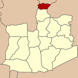 Amphoe location in Ayutthaya Province | |
| Coordinates: 14°38′52″N 100°34′57″E / 14.64778°N 100.58250°ECoordinates: 14°38′52″N 100°34′57″E / 14.64778°N 100.58250°E | |
| Country |
|
| Province | Ayutthaya |
| Seat | Ban Phraek |
| Tambon | 5 |
| Area | |
| • Total | 39.1 km2 (15.1 sq mi) |
| Population (2005) | |
| • Total | 9,250 |
| • Density | 236.6/km2 (613/sq mi) |
| Time zone | THA (UTC+7) |
| Postal code | 13240 |
| Geocode | 1416 |
Ban Phraek (Thai: บ้านแพรก; IPA: [bâːn pʰrɛ̂ːk]) is the northernmost district of Ayutthaya Province.
History
Tambon Phraek was separated from Maha Rat district to become a minor district (King Amphoe) in 1937. It was upgraded to a full district on December 10, 1959.
Geography
Neighboring districts are (from the north clockwise) Mueang Lopburi of Lopburi Province, Don Phut of Saraburi Province, Maha Rat of Ayutthaya Province, and Chaiyo of Ang Thong Province.
Administration
The district is subdivided into 5 subdistricts (tambon), which are further subdivided into 27 villages (muban). Ban Phraek has township (thesaban tambon) status and covers parts of tambon Ban Phraek and Sam Phaniang. There are 2 Tambon administrative organizations (TAO).
|
This article is issued from Wikipedia - version of the 2/27/2013. The text is available under the Creative Commons Attribution/Share Alike but additional terms may apply for the media files.