Sena District
| Sena เสนา | |
|---|---|
| Amphoe | |
 Amphoe location in Ayutthaya Province | |
| Coordinates: 14°19′38″N 100°24′16″E / 14.32722°N 100.40444°ECoordinates: 14°19′38″N 100°24′16″E / 14.32722°N 100.40444°E | |
| Country |
|
| Province | Ayutthaya |
| Seat | Sena |
| Tambon | 17 |
| Muban | 132 |
| Area | |
| • Total | 205.6 km2 (79.4 sq mi) |
| Population (2012) | |
| • Total | 66,670 |
| • Density | 313.4/km2 (812/sq mi) |
| Time zone | THA (UTC+7) |
| Postal code | 13110 |
| Geocode | 1412 |
Sena (Thai: เสนา, IPA: [sěːnāː]) is a district (amphoe) in Ayutthaya Province, central Thailand.
Local people typically know Sena and call it Ban Phaen (บ้านแพน). Its city boasts a clocktower in the center of town, which has a clock on all four sides. Also, there is a weekly temple market on Tuesday nights, where countless vendors can be seen selling everything from puppies to mobile phone accessories to movie and music posters at a discount price. There was an historical coconut shop across the street from the temple market, which was formerly known as Mukda Shop. Mukda Shop sold fresh coconut juice, jelly and whole fresh coconuts, to both individuals and to businesses in the greater Ayutthaya area, as well as within the ancient capital. The former family who owned the coconut shop sold it to a young couple. However, ultimately the coconut shop was torn down and the adjoining road was expanded into more lanes.
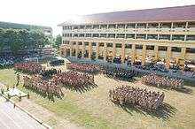
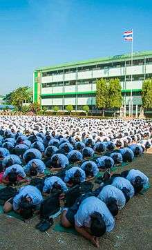
There is also a secondary school known as Senaprasit School that features yearly Sports Days − three days that fall between Christmas and New Year's. The students dress in various themes that represent Thailand and walk around the school grounds. There is also a march from the center of town to the school. For three days the students rally and play competitive Thai sports.
Geography
Neighboring districts are (from the north clockwise) Phak Hai, Bang Ban, Bang Sai (บางไทร), Lat Bua Luang and Bang Sai (บางซ้าย) of Ayutthaya Province.
Administration
The district is subdivided into 17 subdistricts (tambon), which are further subdivided into 132 administrative villages (muban). Sena is a town covering the whole Sena subdistrict. There are four subdistrict municipalities (thesaban tambon) − Sam Ko and Bang Nom Kho cover the whole same-named subdistrict, Hua Wiang the whole subdistrict Hua Wiang and ban Krathum, and Chao Chet the whole subdistrict Chao Sadet and parts of the subdistrict Chao Chet and Ban Thaeo. There are further 9 Tambon administrative organizations as the local government for the subdistricts not part of a municipality.
| No. | Name | Thai | Inh.[1] |
|---|---|---|---|
| 1. | Sena | เสนา | 4,103 |
| 2. | Ban Phaen | บ้านแพน | 3,370 |
| 3. | Chao Chet | เจ้าเจ็ด | 4,729 |
| 4. | Sam Ko | สามกอ | 7,003 |
| 5. | Bang Nom Kho | บางนมโค | 7,127 |
| 6. | Hua Wiang | หัวเวียง | 4,236 |
| 7. | Manwichai | มารวิชัย | 2,556 |
| 8. | Ban Pho | บ้านโพธิ์ | 3,456 |
| 9. | Rang Chorakhe | รางจรเข้ | 2,753 |
| 10. | Ban Krathum | บ้านกระทุ่ม | 2,122 |
| 11. | Ban Thaeo | บ้านแถว | 4,084 |
| 12. | Chai Na | ชายนา | 4,880 |
| 13. | Sam Tum | สามตุ่ม | 4,692 |
| 14. | Lat Nga | ลาดงา | 3,437 |
| 15. | Don Thong | ดอนทอง | 2,444 |
| 16. | Ban Luang | บ้านหลวง | 2,844 |
| 17. | Chao Sadet | เจ้าเสด็จ | 2,834 |
References
- ↑ "Population statistics 2012". Department of Provincial Administration.