Amesville, Ohio
| Amesville, Ohio | |
|---|---|
| Village | |
 Location of Amesville, Ohio | |
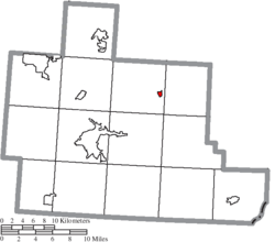 Location of Amesville in Athens County | |
| Coordinates: 39°24′5″N 81°57′18″W / 39.40139°N 81.95500°WCoordinates: 39°24′5″N 81°57′18″W / 39.40139°N 81.95500°W | |
| Country | United States |
| State | Ohio |
| County | Athens |
| Township | Ames |
| GovernmentTownship | |
| • Type | Town Council |
| Area[1] | |
| • Total | 0.22 sq mi (0.57 km2) |
| • Land | 0.22 sq mi (0.57 km2) |
| • Water | 0 sq mi (0 km2) |
| Elevation[2] | 633 ft (193 m) |
| Population (2010)[3] | |
| • Total | 154 |
| • Estimate (2012[4]) | 153 |
| • Density | 700.0/sq mi (270.3/km2) |
| Time zone | Eastern (EST) (UTC-5) |
| • Summer (DST) | EDT (UTC-4) |
| ZIP codes | 45711, 45777 |
| Area code(s) | 740 |
| FIPS code | 39-01784[5] |
| GNIS feature ID | 1075260[2] |
Amesville /ˈeɪmzvɪl/[6] is a village in Athens County, Ohio, United States, located on Federal Creek. The population was 154 at the 2010 census.
History
Amesville was laid out in 1837.[7] The village derives its name from Sylvanus and Nabby Lee Ames, pioneer landowners.[8] A post office called Amesville has been in operation since 1820.[9]
Geography
Amesville is located at 39°24′5″N 81°57′18″W / 39.40139°N 81.95500°W (39.401497, -81.955134).[10]
Amesville is situated in the foothills of the Appalachian Mountains, approximately 45 miles south by southeast of the terminal moraine, a topographical feature often associated with the boundaries of glaciers, and is surrounded by wooded hills, narrow valleys, and numerous creeks flanked by lowland pastures and farmland.
These features are largely indicative of the areas in the State of Ohio that fall to the south of the terminal moraine. The terminal moraine in the State of Ohio, and to the north of Amesville, effectively serves to bisect the state along a line running on a west to east axis across the south by southeastern third of Ohio thereby contributing to certain distinctive topographical, socio-economic, and cultural attributes on either side of this feature.
According to the United States Census Bureau, the village has a total area of 0.22 square miles (0.57 km2), all land.[1]
Demographics
| Historical population | |||
|---|---|---|---|
| Census | Pop. | %± | |
| 1880 | 159 | — | |
| 1910 | 267 | — | |
| 1920 | 273 | 2.2% | |
| 1930 | 298 | 9.2% | |
| 1940 | 286 | −4.0% | |
| 1950 | 269 | −5.9% | |
| 1960 | 255 | −5.2% | |
| 1970 | 295 | 15.7% | |
| 1980 | 247 | −16.3% | |
| 1990 | 250 | 1.2% | |
| 2000 | 184 | −26.4% | |
| 2010 | 154 | −16.3% | |
| Est. 2015 | 158 | [11] | 2.6% |
2010 census
As of the census[3] of 2010, there were 154 people, 63 households, and 38 families residing in the village of Amesville, Ohio. The population density was 700.0 inhabitants per square mile (270.3/km2). There were 70 housing units at an average density of 318.2 per square mile (122.9/km2). The racial makeup of the village was 88.3% White, 3.2% African American, 0.6% Native American, 4.5% Asian, and 3.2% from two or more races. Hispanic or Latino of any race were 2.6% of the population.
There were 63 households of which 27.0% had children under the age of 18 living with them, 46.0% were married couples living together, 9.5% had a female householder with no husband present, 4.8% had a male householder with no wife present, 39.7% were households composed of non-geanologically related persons, 31.7% of all households were made up of sole individuals, and 11.1% had someone living alone who was 65 years of age or older. The average household size was 2.44 and the average family size was 3.03.
The median age in the village was 36.5 years. 25.3% of residents were under the age of 18; 9.7% of redidents were between the ages of 18 and 24; 19.3% were from between the ages of 25 to 44; 31.1% were from 45 to 64; and 14.3% were 65 years of age or older. Gender distribution of the village was 48.7% male and 51.3% female.
2000 census
As of the census[5] of 2000, there were 184 people, 70 households, and 52 families residing in the village. The population density was 829.8 people per square mile (322.9/km²). There were 82 housing units at an average density of 369.8 per square mile (143.9/km²). The racial makeup of the village was 95.65% White, 1.09% African American, 1.63% Native American, and 1.63% from two or more races. Hispanic or Latino of any race were 2.17% of the population.
There were 70 households out of which 44.3% had children under the age of 18 living with them, 50.0% were married couples living together, 22.9% had a female householder with no husband present, and 25.7% were non-families. 22.9% of all households were made up of individuals and 7.1% had someone living alone who was 65 years of age or older. The average household size was 2.63 and the average family size was 2.90.
In the village the population was spread out with 33.2% under the age of 18, 6.0% from 18 to 24, 30.4% from 25 to 44, 20.7% from 45 to 64, and 9.8% who were 65 years of age or older. The median age was 36 years. For every 100 females there were 91.7 males. For every 100 females age 18 and over, there were 73.2 males.
The median income for a household in the village was $35,000, and the median income for a family was $44,000. Males had a median income of $29,583 versus $24,063 for females. The per capita income for the village was $16,554. About 8.3% of families and 8.0% of the population were below the poverty line, including 11.5% of those under the age of eighteen and none of those sixty five or over.
Notable people
- Edward Raymond Ames, born in Amesville, bishop of the Methodist Episcopal Church[13]
- Arthur Gish, activist, author and farmer[14]
Climate
The climate in this area is characterized by hot, humid summers and generally mild to cool winters. According to the Köppen Climate Classification system, Amesville has a humid subtropical climate, abbreviated "Cfa" on climate maps.[15]
References
- 1 2 "US Gazetteer files 2010". United States Census Bureau. Archived from the original on 2012-01-24. Retrieved 2013-01-06.
- 1 2 "US Board on Geographic Names". United States Geological Survey. 2007-10-25. Retrieved 2008-01-31.
- 1 2 "American FactFinder". United States Census Bureau. Retrieved 2013-01-06.
- ↑ "Population Estimates". United States Census Bureau. Archived from the original on 2013-06-17. Retrieved 2013-06-17.
- 1 2 "American FactFinder". United States Census Bureau. Archived from the original on 2013-09-11. Retrieved 2008-01-31.
- ↑ http://scrippsjschool.org/pronunciation/
- ↑ History of Hocking Valley, Ohio. Inter-State Publishing Co. 1883. p. 507.
- ↑ "Variety's the spice of life in scenic Ames Twp.". The Athens News. Jan 5, 2004. Retrieved 31 December 2015.
- ↑ "Athens County". Jim Forte Postal History. Retrieved 31 December 2015.
- ↑ "US Gazetteer files: 2010, 2000, and 1990". United States Census Bureau. 2011-02-12. Retrieved 2011-04-23.
- ↑ "Annual Estimates of the Resident Population for Incorporated Places: April 1, 2010 to July 1, 2015". Retrieved July 2, 2016.
- ↑ "Census of Population and Housing". Census.gov. Archived from the original on May 11, 2015. Retrieved June 4, 2015.
- ↑ Who Was Who in America, Historical Volume, 1607-1896. Marquis Who's Who. 1967.
- ↑ Phillips, Jim (2010-07-28). "Prominent local activist dies in farming accident". The Athens News (Ohio). Retrieved 2010-08-07.
- ↑ Climate Summary for Amesville, Ohio
External links
Municipalities and communities of Athens County, Ohio, United States | ||
|---|---|---|
| Cities | 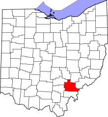 | |
| Villages | ||
| Townships | ||
| CDPs | ||
| Unincorporated communities | ||
| Footnotes | ‡This populated place also has portions in an adjacent county or counties | |