Alton, Utah
| Alton, Utah | |
|---|---|
| Town | |
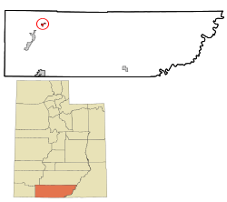 Location in Kane County and the state of Utah | |
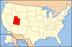 Location of Utah in the United States | |
| Coordinates: 37°26′24″N 112°28′55″W / 37.44000°N 112.48194°WCoordinates: 37°26′24″N 112°28′55″W / 37.44000°N 112.48194°W | |
| Country | United States |
| State | Utah |
| County | Kane |
| Founded | 1907 |
| Incorporated | 1935 |
| Named for | Alton Fjord |
| Area | |
| • Total | 0.4 sq mi (1.0 km2) |
| • Land | 0.4 sq mi (1.0 km2) |
| • Water | 0.0 sq mi (0.0 km2) |
| Elevation | 7,041 ft (2,146 m) |
| Population (2012) | |
| • Total | 118 |
| • Density | 300/sq mi (120/km2) |
| Time zone | MST (UTC-7) |
| • Summer (DST) | MDT (UTC-6) |
| ZIP code | 84710 |
| Area code(s) | 435 |
| FIPS code | 49-00870[1] |
| GNIS feature ID | 1438182[2] |
Alton is a town in Kane County, Utah, United States. The population was 119 at the 2010 census,[3] a decrease from the 2000 figure of 134.
History
Alton was first settled by Lorenzo Wesley Roundy in 1865 and was originally called Roundys Station.[4][5] Roundy's family was forced to leave due to conflicts with the local American Indians. The community was later called Graham, after Graham Duncan McDonald, a local pioneer. Over the years, many names had been discussed, but a consensus could not be reached. In 1912, a drawing was held at a community event to determine the name of the community. Charles R. Pugh, who had been reading about the Alton Fjord in Norway suggested the name, and it was pulled from the hat by a two-year-old child.
Geography
According to the United States Census Bureau, the town has a total area of 0.4 square miles (1.0 km²), all of it land.
Climate
The Köppen Climate Classification subtype for this climate is "Csb" (Mediterranean climate).
| Climate data for Alton, Utah | |||||||||||||
|---|---|---|---|---|---|---|---|---|---|---|---|---|---|
| Month | Jan | Feb | Mar | Apr | May | Jun | Jul | Aug | Sep | Oct | Nov | Dec | Year |
| Average high °C (°F) | 4 (39) |
6 (42) |
9 (48) |
14 (57) |
19 (67) |
25 (77) |
28 (82) |
27 (80) |
23 (73) |
17 (63) |
10 (50) |
5 (41) |
16 (60) |
| Average low °C (°F) | −9 (15) |
−8 (18) |
−6 (22) |
−2 (28) |
2 (35) |
6 (42) |
10 (50) |
9 (49) |
6 (42) |
1 (33) |
−5 (23) |
−8 (17) |
−1 (31) |
| Average precipitation mm (inches) | 48 (1.9) |
46 (1.8) |
41 (1.6) |
28 (1.1) |
20 (0.8) |
13 (0.5) |
36 (1.4) |
43 (1.7) |
38 (1.5) |
38 (1.5) |
30 (1.2) |
43 (1.7) |
424 (16.7) |
| Source: Weatherbase [6] | |||||||||||||
Demographics
| Historical population | |||
|---|---|---|---|
| Census | Pop. | %± | |
| 1900 | 106 | — | |
| 1910 | 98 | −7.5% | |
| 1920 | 169 | 72.4% | |
| 1930 | 193 | 14.2% | |
| 1940 | 239 | 23.8% | |
| 1950 | 154 | −35.6% | |
| 1960 | 116 | −24.7% | |
| 1970 | 62 | −46.6% | |
| 1980 | 75 | 21.0% | |
| 1990 | 93 | 24.0% | |
| 2000 | 134 | 44.1% | |
| 2010 | 119 | −11.2% | |
| Est. 2015 | 116 | [7] | −2.5% |
As of the census of 2010, there were 119 people in 39 households in the town. The racial makeup of the town was 89% white, 5% Hispanic or Latino, and 2.5% Native American.
The population was 45 percent male and 55 percent female. The population was 38.7 percent under the age of 18 and 20 percent 65 or over.
References
- ↑ "American FactFinder". United States Census Bureau. Archived from the original on 2013-09-11. Retrieved 2008-01-31.
- ↑ "US Board on Geographic Names". United States Geological Survey. 2007-10-25. Retrieved 2008-01-31.
- ↑ 2010 US Census
- ↑ Andrew Jenson. Encyclopedic History of the Church. (Salt Lake City: Deseret Book, 1941) p. 17
- ↑ John W. Van Cott Utah Place Names. (University of Utah Press, 2000) p. 5
- ↑ "Weatherbase.com". Weatherbase. 2013. Retrieved on August 14, 2013.
- ↑ "Annual Estimates of the Resident Population for Incorporated Places: April 1, 2010 to July 1, 2015". Retrieved July 2, 2016.
- ↑ "Census of Population and Housing". Census.gov. Archived from the original on May 11, 2015. Retrieved June 4, 2015.
Municipalities and communities of Kane County, Utah, United States | ||
|---|---|---|
| City | 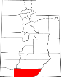 | |
| Towns | ||
| Unincorporated communities | ||
| Ghost town | ||