Altamont, Maryland
| Altamont | |
|---|---|
| Unincorporated community | |
  Location within the state of Maryland | |
| Coordinates: 39°25′39″N 79°16′55″W / 39.42750°N 79.28194°WCoordinates: 39°25′39″N 79°16′55″W / 39.42750°N 79.28194°W | |
| Country | United States |
| State | Maryland |
| County | Garrett |
| Time zone | Eastern (EST) (UTC-5) |
| • Summer (DST) | EDT (UTC-4) |
Altamont is an unincorporated community in Garrett County, Maryland, United States.[1] Altamont sits on the Eastern Continental Divide between the watershed of Crabtree Creek, which flows into the Savage River and eventually into the Atlantic Ocean, and the watershed of the Little Youghiogheny River, which flows into the Youghiogheny River and eventually into the Gulf of Mexico. Altamont is notable as the spot at which the B&O Railroad crossed the divide. Today, that same spot is crossed by CSX's Mountain Subdivision. Altamont also features the intersection of Maryland Route 135 (MD 135) and MD 495.
References
- ↑ "Geographic Names Information System". Altamont. U.S. Geological Survey. 2010-03-01.
Municipalities and communities of Garrett County, Maryland, United States | ||
|---|---|---|
| Towns | 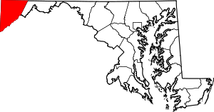 | |
| CDPs | ||
| Unincorporated communities | ||
| Ghost town | ||
| Footnotes | ‡This populated place also has portions in an adjacent county or counties | |
This article is issued from Wikipedia - version of the 7/29/2016. The text is available under the Creative Commons Attribution/Share Alike but additional terms may apply for the media files.