Alsey, Illinois
| Alsey | |
| Village | |
| Country | United States |
|---|---|
| State | Illinois |
| County | Scott |
| Coordinates | 39°33′37″N 90°26′1″W / 39.56028°N 90.43361°WCoordinates: 39°33′37″N 90°26′1″W / 39.56028°N 90.43361°W |
| Area | 0.56 sq mi (1 km2) |
| - land | 0.55 sq mi (1 km2) |
| - water | 0.01 sq mi (0 km2) |
| Density | 441.7/sq mi (171/km2) |
| Timezone | CST (UTC-6) |
| - summer (DST) | CDT (UTC-5) |
| Postal code | 62610 |
| Area code | 217 |
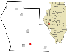 Location in Scott County and the state of Illinois.
| |
.svg.png) Location of Illinois in the United States
| |
Alsey is a village in Scott County, Illinois, USA. The population was 246 at the 2000 census.[1] It is part of the Jacksonville Micropolitan Statistical Area.
History
Alsey was originally called Smithfield, and under the latter name was laid out in 1870 by Alsey R. Smith, and named for him.[2] A post office called Alsey has been in operation since 1872.[3]
Geography
Alsey is located at 39°33′37″N 90°26′1″W / 39.56028°N 90.43361°W (39.560288, -90.433730).[4]
According to the 2010 census, Alsey has a total area of 0.56 square miles (1.45 km2), of which 0.55 square miles (1.42 km2) (or 98.21%) is land and 0.01 square miles (0.03 km2) (or 1.79%) is water.[5]
Demographics
| Historical population | |||
|---|---|---|---|
| Census | Pop. | %± | |
| 1940 | 290 | — | |
| 1950 | 294 | 1.4% | |
| 1960 | 248 | −15.6% | |
| 1970 | 242 | −2.4% | |
| 1980 | 318 | 31.4% | |
| 1990 | 253 | −20.4% | |
| 2000 | 246 | −2.8% | |
| 2010 | 227 | −7.7% | |
| Est. 2015 | 217 | [6] | −4.4% |
As of the census[8] of 2000, there were 246 people, 97 households, and 67 families residing in the village. The population density was 441.7 people per square mile (169.6/km²). There were 102 housing units at an average density of 183.1 per square mile (70.3/km²). The racial makeup of the village was 98.78% White and 1.22% Native American.
There were 97 households out of which 36.1% had children under the age of 18 living with them, 55.7% were married couples living together, 10.3% had a female householder with no husband present, and 29.9% were non-families. 25.8% of all households were made up of individuals and 14.4% had someone living alone who was 65 years of age or older. The average household size was 2.54 and the average family size was 3.04.
In the village the population was spread out with 26.4% under the age of 18, 6.1% from 18 to 24, 32.9% from 25 to 44, 23.6% from 45 to 64, and 11.0% who were 65 years of age or older. The median age was 36 years. For every 100 females there were 92.2 males. For every 100 females age 18 and over, there were 88.5 males.
The median income for a household in the village was $33,750, and the median income for a family was $40,833. Males had a median income of $29,844 versus $18,214 for females. The per capita income for the village was $15,652. About 4.2% of families and 8.1% of the population were below the poverty line, including 14.0% of those under the age of eighteen and 6.4% of those sixty five or over.
References
- ↑ City data. 2000 census information Retrieved on May 16, 2007
- ↑ Callary, Edward (29 September 2008). Place Names of Illinois. University of Illinois Press. p. 7. ISBN 978-0-252-09070-7.
- ↑ "Scott County". Jim Forte Postal History. Retrieved 27 November 2015.
- ↑ "US Gazetteer files: 2010, 2000, and 1990". United States Census Bureau. 2011-02-12. Retrieved 2011-04-23.
- ↑ "G001 - Geographic Identifiers - 2010 Census Summary File 1". United States Census Bureau. Retrieved 2015-08-01.
- ↑ "Annual Estimates of the Resident Population for Incorporated Places: April 1, 2010 to July 1, 2015". Retrieved July 2, 2016.
- ↑ "Census of Population and Housing". Census.gov. Archived from the original on May 11, 2015. Retrieved June 4, 2015.
- ↑ "American FactFinder". United States Census Bureau. Archived from the original on 2013-09-11. Retrieved 2008-01-31.
Municipalities and communities of Scott County, Illinois, United States | ||
|---|---|---|
| City | ||
| Town | ||
| Villages | ||
| Precincts |
| |
| Unincorporated communities | ||