Pre-1970 Southern Hemisphere tropical cyclone seasons
The Pre-1970 Southern Hemisphere tropical cyclone seasons ran year-round from July 1 to June 30, reaching their peaks mid-February to early March. For storms in the South-West Indian Ocean, see here.
| Southern Hemisphere Cyclone Seasons |
|---|
|
Pre-1910 storms
Unnamed tropical cyclone (1778)
The Banda Islands were hit in March. The cyclone blew the roof off of almost every house and killed 85% of nutmeg trees.[1]
Unnamed tropical cyclone (1811)
A tropical cyclone hit the Banda Islands.[1]
Unnamed tropical cyclone (1841)
A cyclone hit the island of Roti in April, killing 75 and destroying many homes.[1]
Unnamed tropical cyclone (Circa 1855)
Around this time, a tropical cyclone hit the Kei Islands, uprooting many trees.[1]
Unnamed tropical cyclone (1872)
On 20 April 1872, a cyclone struck Roebourne in the Pilbara of Western Australia effectively destroying the town.[2]
Unnamed tropical cyclone (1875)
On 24 December 1875, a total of 59 lives were lost at sea when the eye of a cyclone passed over Exmouth Gulf. Several schooners were driven ashore and wrecked.[3]
Unnamed tropical cyclone (1880)
On 9 January 1880 a cyclone passed near Yammadery Creek, between Onslow, Western Australia and Fortescue River, where the tidal surge was eight metres over the high-water mark. The Adalia was wrecked near Robe River and some of the crew drowned.[4]
Unnamed tropical cyclone (1882)
On 7 March 1882 a severe cyclone passed Roebourne and Cossack in the evening causing damage to every building in the settlements. Cossack recorded a minimum pressure of 942 hPa. Despite the extensive loss of sheep from surrounding stations it was considered fortunate that only one person suffered an injury.[5]
Unnamed tropical cyclone (1884)
On 30 January 1884 a severe cyclone hit Bowen in Queensland causing damage to every building in the settlement and loss of the jetty and all boats and all communication.[6][7][8]
Unnamed tropical cyclone (1887)
On 22 April 1887, a cyclone struck the pearling fleet at Ninety Mile Beach near Broome claiming 140 lives. The storm was unexpected, since it was so late in the season.[3]
Unnamed tropical cyclone (1889)
On 1 March 1889 flooding was considerable at Cossack where a cyclone coincided with high tide. All crew aboard the Waratah were lost off Cape Preston and one man drowned in the river at Roebourne.[5]
1889 Apia Cyclone
A strong cyclone struck Samoa sinking several ships and caused 147+ Fatalities.
Unnamed tropical cyclones (1894)
On 4 January 1894 and 9 January 1894 – Within the space of five days two cyclones crossed the Pilbara coast. The first caused damage to many buildings at Roebourne and Cossack. The second cyclone caused more significant damage to the area completely washing away the previously damaged sea wall at Cossack. Over forty lives were believed to have been lost as twelve luggers and the steamer Anne were destroyed. Altogether the damage was estimated at 15000 pounds and the loss of some 15000 sheep. Flooding was also substantial.[5]
Unnamed tropical cyclone (1898)
On 2 April 1898 a cyclone was described as causing more damage at Cossack than had ever been experienced before. Tramway, rails, road and bridges were destroyed and telegraph line downed. Houses collapsed and all boats slipped their moorings. The damage was estimated at over 30000 pounds. Whim Creek registered 747 mm of rain in 24 hours, the highest daily rainfall ever recorded in Western Australia.[5]
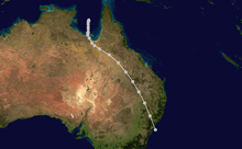
Cyclone Mahina (1899)
Upon making landfall in Queensland, Australia on March 4, 1899, Cyclone Mahina produced a 40 foot storm surge, the highest ever recorded. The flooding killed 400–410 people, making it the deadliest cyclone in Australian history.
Unnamed tropical cyclone near Ninety Mile Beach(1908)
On 27 April 1908, the pearling fleet (again) at Ninety Mile Beach experienced the full force of a storm. The loss of life exceeded 50 persons.[3]
Unnamed tropical cyclone (1909)
Following a cyclone at Onslow, Western Australia in January 1909 a second storm hit the town on 5 to 6 April 1909 causing damage to most boats and some buildings. Four luggers with all 24 of their crew were lost.[4]
Cyclone 1 (1910)
A cyclone hit Queensland, Australia near the city of Cairns.[9]
Unnamed tropical cyclone (1910)
On 19 November 1910 the eye of a cyclone passed directly over Broome, where there was much damage. Twenty six boats of the pearling fleet were sunk and 40 lives were lost.[3]
1920–21 to 1930–31 cyclone seasons
Unnamed tropical cyclone (1923)
This cyclone developed on 21 March 1923 east of Cape York and then devastated the normally cyclone free Torres Strait Islands. It then moved over the Gulf of Carpentaria where 20 lives were lost after the Douglas Mawson sank. The cyclone decayed around 2 April.[10]
Unnamed tropical cyclone near Roebourne (1925)
After this cyclone on 21 January 1925 near Roebourne, Western Australia only a very small portion of the land end of the Point Samson jetty was left intact. Almost 5 km of the tramline was washed away and the Pope's Nose Creek bridge was badly damaged. At Cossack the sea in the creek rose 7.2 m, covering the road and surrounding country for about a mile (1.6 km). Seven luggers and a schooner which had sheltered in Cossack Creek were lifted 100 m into the mangroves by the storm surge. Not a building was left unscathed in Roebourne. Residents sheltered in more substantial stone buildings as the timber houses were razed. The Jubilee Hotel was unroofed and the other two hotels badly damaged.[5]
Unnamed tropical cyclone near Yamdena (1925)
In April, a tropical cyclone destroyed most houses in Yamdena. 10 people were killed on the island of Selaru, along with destruction of plantations, damage to houses, and palm trees being blown over.[1]
1930–31 to 1940–41 cyclone seasons
Unnamed tropical cyclone near Cairns (1934)
On March 12, 1934, a powerful cyclone crossed the coast of Far North Queensland at Cape Tribulation. A pearling fleet was decimated by the system, resulting in the loss of 75 lives. The towns of Daintree and Mossman suffered extensive damage, with damage to vegetation reported in Cairns.
Unnamed tropical cyclone near Broome (1935)
This is Australia's second deadliest cyclone in the 20th century. The Lacepede Islands near Broome were struck sinking 21 pearling luggers with 141 lives lost.
Unnamed tropical cyclone near Roebourne (1939)
Nine people died on 11 January 1939 with the loss of the Nicol Bay, on a holiday cruise to the Ashburton River. Some properties in Roebourne, Western Australia sustained damage.[5]
1940–41 to 1950–51 cyclone seasons
Unnamed tropical cyclone near Port Hedland (1942)
On 24 March 1942 a storm hit Port Hedland causing a pile driver to be blown off the jetty and nine pearling luggers blown out to sea. One was wrecked with the loss of two lives. All houses suffered some degree of damage, and the Pier and the Esplanade Hotels were again badly damaged. Fortunately the tide was low at the time so there was little foreshore damage. The maximum gust was estimated to be 230 km/h.[11]
Unnamed tropical cyclone near Roebourne (1945)
On 6 March 1945 severe damage was done to Roebourne and Point Samson. The Harding River broke its banks and flooded back yards. The maximum gust was 117 km/h.[5]
1949 Central Queensland cyclone
On 2 March a cyclone passed over Gladstone and Rockhampton. Fifteen towns suffered extensive damage from the storm – in Rockhampton, 1000 homes were damaged or destroyed. Seven people died, including a young child killed by a falling gum tree in Bundaberg. During the height of the cyclone, Rockhampton recorded barometric pressure of 960 hPa and a maximum wind gust of 160 km/h. 635mm of rain fell in a 24 hour period at Yeppoon.[12]
1950–51 to 1960–61 cyclone seasons
Sydney cyclone (1950)
In January, this tropical cyclone tracked from the Gulf of Carpentaria to Sydney. Three horseman were drowned on the 18th when Washpool Creek (80 km from Grafton) rose rapidly. Another four lives were lost in NSW from the cyclone including a girl swept off the Esplanade at Cronulla by the storm surge and waves, a boy electrocuted by fallen power lines at Gordon in Sydney, a man drowned near Goulburn and another man drowned in the Macleay River at Kempsey. Seven yachts were completely wrecked in Sydney Harbour. The record low pressure reading of 988 hPa was recorded in Sydney. Ten lives were lost in total.[13]
Unnamed tropical cyclone near Onslow (1953)
On 22 March 1953 a cyclone made landfall west of Onslow. Buildings were unroofed and the jetty was destroyed. The damage was estimated at 50,000 pounds. The estimated maximum gust in Onslow was 184 km/h.[4]
Unnamed tropical cyclone near Roebourne (1954)
On 31 December 1954 every building was damaged in Roebourne, Western Australia. The Point Samson jetty was wrecked and a locomotive shed and workshop demolished. Damage was conservatively estimated at 50,000 pounds. The eye passed over Lewis Island driving ashore the Dulverton then moved over Roebourne from 3:20 to 4:30 pm. Damage was extensive at Coolwanyah and Pyramid stations.[5]
Gold Coast cyclone (1954)
The Gold Coast cyclone passed within 100 km of Brisbane and then towards Sydney. Gales whipped up large waves on the swollen Richmond River and 26 people died.
Unnamed tropical cyclone (1956)
This cyclone affected the Australian mainland for 17 days, traversing virtually the whole Western Australian coastline. It passed directly over Perth, causing damage to buildings in and around the Western Australian capital.
Unnamed tropical cyclone near Broome (1957)
On 14 February 1957, the eye of this cyclone passed directly over Broome between 6:30 and 7:00 and gale force winds were experienced from 11 pm on the 13th to 5 pm on the 15th. Two people were killed and four injured by a collapsing house. Many buildings were wrecked and damage was estimated at 80,000 pounds.[14]
Two tropical cyclones in Onslow (1958)
In March 1958, two cyclones crossed near Onslow within two weeks. On 4 March 1958 wind gusts to 172 km/h unroofed some houses and communications were cut during the first cyclone, but overall damage was not considered serious. The second cyclone on 15 March 1958 caused extensive damage. Half the Onslow jetty was washed away and the storm surge broke through the foreshore wall flooding the town. Onslow recorded a gust of 202 km/h and 283 mm of rain.[4]
Bowen Cyclone (1958)
On 1 April 1958, a small but intense cyclone hit the town of Bowen in north Queensland. Wind gusts of 98 knots (182 km/h) were recorded before the anemometer was blown away.[15] A storm surge of 2 metres caused some destruction of beachside buildings, including the Hotel Ozone.[16] A scrap of newsreel film about the 1958 cyclone that flattened Bowen is stored in ScreenSound, Australia's film and sound archive in Canberra.[17][18] Among other damage to the town, the local cinema's roof was blown off.[19]
Unnamed tropical cyclone (April 1960)
A ship called the Straat Jahore encountered a tropical cyclone.[1]
1960–61 to 1968–69 cyclone seasons
Unnamed tropical cyclone (December 1960)
A cyclone hit Saumlaki, killing three people and almost completely destroying the settlement. Thousands of palm trees were uprooted.[1]
Unnamed tropical cyclone near Onslow (1963)
On 7 February 1963 a severe cyclone with gusts recorded to 231 km/h made landfall at Onslow damaging all but six buildings in the town. Telephone poles were bent parallel to the ground. Even the weather instrument enclosure was destroyed. Heavy rain also caused flooding in the area, the town recording 356 mm of rain.[4]
Cyclone Audrey (1964)
This occurred from 7 January to 14 January 1964 causing damage over the eastern Gulf of Carpentaria, followed by heavy rains and wind damage over large areas of southern Queensland.[10]
Cyclone Shirley (1966)
On 2 April 1966 Shirley passed crossed the coast at King Bay where a ship recorded winds to 204 km/h. In Roebourne, Western Australia, winds destroyed some buildings. Sherlock station recorded 404 mm and subsequent floodwaters damaged the Mount Goldsworthy and Hamersley iron-ore railways under construction, roads and other facilities along the Pilbara coast. However, considering the intensity, the cyclone caused only minor damage.[5]
Cyclone Giselle (1968)
This storm merged with a non-tropical storm and led to the sinking of the TEV Wahine.
1969–70 Southern Hemisphere tropical cyclone season
Cyclone Blossom
- Blossom, 8 to 9 November 1969 very weak to northwest of Cocos Island
Severe Tropical Cyclone Ada
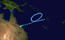
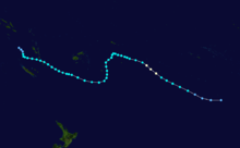
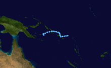
Tropical Cyclone Ada was a Category 4 cyclone that killed 14 people when it hit Queensland's Whitsunday Island Resorts and the adjacent Whitsunday Coast mainland on January 17, 1970.
Resorts and boats were destroyed or severely damaged at Hayman, Daydream and South Molle Islands, as well as the two resorts – Happy Bay and Palm Bay – on Long Island. About 80% of buildings in the mainland centres of Shute Harbour, Airlie Beach and Cannonvale were severely damaged. Some damage occurred also inland at Proserpine where, following 24-hours of heavy rain that accompanied the storm, the Proserpine River peaked at 11.16 metres: its highest recorded flood. Fourteen people died and property damage was estimated at A$390 million (1997 values).
Like Tropical Cyclone Tracy that devastated Darwin on Christmas Eve 1974, Ada was small in diameter (estimated width 30 km) and damage from her path was limited to a comparatively small geographical area. The wind from Tropical Cyclone Ada was not felt in Bowen (60 km to the north) or Mackay (120 km to the south). However the heavy rains did cause flooding in the Pioneer River (Mackay) and the Don River (Bowen). Before degenerating into a rainstorm Cyclone Ada travelled further inland to the Cathu State Forest (83 km north-west of Mackay behind the small Bruce Highway township of Calen) and caused extensive damage to the eucalypts, rainforest and pine plantations in that area.
It was as a result of complaints about lack of timely warning about the 1970 cyclone that the Bureau of Meteorology introduced the cyclone warning siren that now accompanies all media broadcasts and telecasts of cyclone warnings in Queensland.
Cyclone Diane
- Diane, 2 to 15 January 1970 in central Indian Ocean
Cyclone Genevieve
Genevieve, January 1970 in Indian Ocean
Cyclone Glynis
- Glynis, 27 January to 7 February 1970 crossed coast near Mandurah, Western Australia but no major damage
Cyclone Harriet-Iseult
- Harriet/Iseult, 30 January to 4 February 1970 in central to western Indian Ocean
Cyclone Ingrid
- Ingrid, 9 to 17 February 1970 crossed coast near Carnarvon, Western Australia causing severe agricultural damage.
Cyclone Judy
- Judy, 9 to 24 February 1970 in central Indian Ocean
Cyclone Dawn
- Dawn, 10 to 19 February 1970 in Coral Sea with heavy rain
Cyclone Florence
- Florence, 10 to 12 February 1970 a weak cyclone in the Coral Sea and merged with Dolly
Cyclone Dolly
- Dolly, February 1970 also in the Coral Sea
Cyclone Cindy
- Cindy, 11 to 22 March 1970 in Gulf of Carpentaria
Cyclone Kathy
- Kathy, 19 to 28 March 1970 in central Indian Ocean
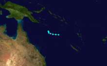
Cyclone Helen
On January 17th, 1970, Apollo 13 was making its final decent over the splashdown zone when they spotted Cyclone Helen as they were re-entering the earths atmosphere. Mission control had been tracking the storm to make sure it did not interfere with the missions re-entry.
Cyclone Isa
- Isa, 13 to 18 April 1970 in Solomon Islands area with no major damage
Cyclone Lulu
- Lulu, 4 to 9 May caused flooding around the Pilbara region of Western Australia
See also
References
- 1 2 3 4 5 6 7 Gary Padgett (2002-04-22). "Monthly Global Tropical Cyclone Summary December 2001". Retrieved 2007-10-21.
- ↑ "Distastrous Cyclone at Roebourne". The Herald. Fremantle, Western Australia: National Library of Australia. 18 May 1872. p. 2. Retrieved 19 October 2013.
- 1 2 3 4 Bureau of Meteorology (1998). Tropical Cyclones (A Guide for Mariners in Northwest Australia), Pamphlet, Commonwealth of Australia
- 1 2 3 4 5 BoM – Tropical Cyclones affecting Onslow
- 1 2 3 4 5 6 7 8 9 BoM – Tropical Cyclones affecting Karratha/Dampier
- ↑ "THE TORNADO IN THE NORTH.". The Brisbane Courier (Qld. : 1864 - 1933). Qld.: National Library of Australia. 4 February 1884. p. 5. Retrieved 10 January 2016.
- ↑ "THE RECENT CYCLONE AT BOWEN.". The Brisbane Courier (Qld. : 1864 - 1933). Qld.: National Library of Australia. 6 February 1884. p. 5. Retrieved 10 January 2016.
- ↑ "THE CYCLONE AT BOWEN.". The Brisbane Courier (Qld. : 1864 - 1933). Qld.: National Library of Australia. 9 February 1884. p. 5. Retrieved 10 January 2016.
- ↑ ftp://eclipse.ncdc.noaa.gov/pub/ibtracs/v03r02/maps/by_center/bom.ds824_au/
- 1 2 Bureau of Meteorology (1992). Climate of Queensland, Commonwealth of Australia ISBN 0-644-24331-7
- ↑ BoM – Tropical Cyclones affecting Port Hedland
- ↑ Callaghan, J. "Australian Severe Weather: Tropical cyclone impacts along the East Coast 1858–2000". Page 19.
- ↑ http://www.bom.gov.au/cyclone/history/nsw.shtml
- ↑ BoM – Tropical Cyclones affecting Broome
- ↑ BoM – Royal Geographical Society of Queensland
- ↑ http://www.windworker.com.au/qldcyclones.htm
- ↑ http://www.qhatlas.com.au/content/tropical-cyclones
- ↑ http://www.townsvillebulletin.com.au/article/2007/06/16/3852_print.html
- ↑ http://www.tourismbowen.com.au/things_do_see/summergarden.htm