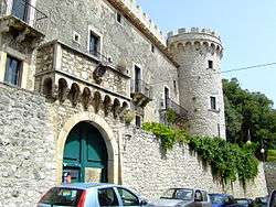
Monteroduni
| Monteroduni | ||
|---|---|---|
| Comune | ||
| Comune di Monteroduni | ||
 | ||
| ||
 Monteroduni Location of Monteroduni in Italy | ||
| Coordinates: 41°31′N 14°10′E / 41.517°N 14.167°E | ||
| Country | Italy | |
| Region | Molise | |
| Province / Metropolitan city | Isernia (IS) | |
| Frazioni | Campo Fiorito, Campo la Fontana, Carpinete, Guado Largo, Limate, Pagliara, San Nazzaro, Sant'Eusanio, Selvotta, Socce, Starze | |
| Government | ||
| • Mayor | Custode Russo | |
| Area | ||
| • Total | 37.0 km2 (14.3 sq mi) | |
| Elevation | 476 m (1,562 ft) | |
| Population (1 Maggio 2013[1]) | ||
| • Total | 2,195 | |
| • Density | 59/km2 (150/sq mi) | |
| Demonym(s) | Monterodunesi | |
| Time zone | CET (UTC+1) | |
| • Summer (DST) | CEST (UTC+2) | |
| Postal code | 86075 | |
| Dialing code | 0865 | |
| Patron saint | St. Michael Archangel | |
| Saint day | 29 September | |

Monteroduni is a comune (municipality) in the Province of Isernia in the Italian region Molise,[2] located about 40 kilometres (25 mi) west of Campobasso and about 11 kilometres (7 mi) southwest of Isernia.
The town's name derives from the ancient one of the river Volturno, Olotrunus.
Monteroduni borders the following municipalities: Capriati a Volturno, Colli a Volturno, Gallo Matese, Longano, Macchia d'Isernia, Montaquila, Pozzilli, Sant'Agapito.
References
- ↑ All demographics and other statistics: Italian statistical institute Istat.
- ↑ "Il Molise: panorami e sapori di una regione da scoprire ". Gambero Rosso, January 21, 2014 Massimiliano Rella
External links
This article is issued from Wikipedia - version of the 11/21/2016. The text is available under the Creative Commons Attribution/Share Alike but additional terms may apply for the media files.