List of cultural property of national significance in Switzerland: Bern N-Z
This list contains about half of the cultural property of national significance (class A) in the canton of Bern from the 2009 Swiss Inventory of Cultural Property of National and Regional Significance. It is sorted by municipality and contains 345 individual buildings, 43 collections, 30 archaeological finds and 4 other, special sites or objects.
The geographic coordinates provided are in the Swiss coordinate system as given in the Inventory.
Nidau
| KGS No.? |
Picture | Name | Street Address | CH1903 X coordinate | CH1903 Y coordinate | Location |
|---|---|---|---|---|---|---|
| 8982 |  |
Rathaus (Town council house) | Hauptstrasse 32 | 584.940 | 219.426 | 47°07′32″N 7°14′25″E / 47.125648°N 7.240163°E |
| 1119 |  |
Nidau Castle | Hauptstrasse 2–8 | 584.943 | 219.663 | 47°07′40″N 7°14′25″E / 47.12778°N 7.240195°E |
| 9034 |  |
Strandbad Biel (Beach along Lake Biel) | Uferweg 40 | 584.596 | 219.893 | 47°07′47″N 7°14′08″E / 47.12984°N 7.235614°E |
| Unknown | ISOS Town / Region: Nidau |
Nods
| KGS No.? |
Picture | Name | Street Address | CH1903 X coordinate | CH1903 Y coordinate | Location |
|---|---|---|---|---|---|---|
| Unknown | ISOS village: Nods |
Oberbalm
| KGS No.? |
Picture | Name | Street Address | CH1903 X coordinate | CH1903 Y coordinate | Location |
|---|---|---|---|---|---|---|
| 9231 |  |
Farm House | Stöckli 203 | 597.453 | 189.700 | 46°51′30″N 7°24′19″E / 46.858425°N 7.405237°E |
| 9210 |  |
Granary | Horbermatt 114 | 598.883 | 191.515 | 46°52′29″N 7°25′26″E / 46.874755°N 7.423985°E |
| 9232 |  |
Granary | Oberbalmstrasse 209 A | 597.156 | 191.378 | 46°52′25″N 7°24′05″E / 46.873518°N 7.401332°E |
Oberbipp
| KGS No.? |
Picture | Name | Street Address | CH1903 X coordinate | CH1903 Y coordinate | Location |
|---|---|---|---|---|---|---|
| Unknown | ISOS Village: Oberbipp |
Oberburg
| KGS No.? |
Picture | Name | Street Address | CH1903 X coordinate | CH1903 Y coordinate | Location |
|---|---|---|---|---|---|---|
| 9769 |  |
Staldenhof | Untere Oschwandstrasse 38 | 614.170 | 208.653 | 47°01′44″N 7°37′30″E / 47.028765°N 7.625045°E |
| Unknown | ISOS hamlet: Brittenwald | |||||
| Unknown | ISOS hamlet: Rohrmoos |
Oberdiessbach
| KGS No.? |
Picture | Name | Street Address | CH1903 X coordinate | CH1903 Y coordinate | Location |
|---|---|---|---|---|---|---|
| 1137 |  |
Chapel of the Von Wattenwyl Family | Burgdorfstrasse 6 | 613.780 | 187.690 | 46°50′25″N 7°37′09″E / 46.840207°N 7.61928°E |
| 1136 |  |
Country Estate Diessenhof | Lindenstrasse 20–24 | 614.001 | 187.138 | 46°50′07″N 7°37′20″E / 46.835237°N 7.62216°E |
| 9502 |  |
Oberdiessbach Castle | Schlossstrasse 50 | 614.299 | 187.549 | 46°50′20″N 7°37′34″E / 46.838927°N 7.626079°E |
| 9764 | _Statthalterhof-b-Oberbleiken.JPG) |
Statthalterhof | Oberbleiken 402, Bleiken bei Oberdiessbach | 615.771 | 185.140 | 46°49′02″N 7°38′43″E / 46.817224°N 7.645292°E |
| Unknown | ISOS Urbanized Village: Oberdiessbach |
Oberhofen
| KGS No.? |
Picture | Name | Street Address | CH1903 X coordinate | CH1903 Y coordinate | Location |
|---|---|---|---|---|---|---|
| 1138 |  |
Oberhofen Castle | Schloss 1–11 | 617.568 | 175.413 | 46°43′47″N 7°40′06″E / 46.729681°N 7.668465°E |
| 1142 |  |
Wichterheer-Gut | Staatsstrasse 16–20 | 617.821 | 175.280 | 46°43′43″N 7°40′18″E / 46.728478°N 7.67177°E |
| Unknown | ISOS Urbanized Village: Oberhofen am Thunersee |
Oberried
| KGS No.? |
Picture | Name | Street Address | CH1903 X coordinate | CH1903 Y coordinate | Location |
|---|---|---|---|---|---|---|
| 9235 | Farm House | Platzli 83 | 639.941 | 176.332 | 46°44′13″N 7°57′40″E / 46.736983°N 7.961227°E |
Oberwil bei Büren
| KGS No.? |
Picture | Name | Street Address | CH1903 X coordinate | CH1903 Y coordinate | Location |
|---|---|---|---|---|---|---|
| Unknown | ISOS Village: Oberwil bei Büren |
Oberwil im Simmental
| KGS No.? |
Picture | Name | Street Address | CH1903 X coordinate | CH1903 Y coordinate | Location |
|---|---|---|---|---|---|---|
| 9236 |  |
Venner House | Büel 201 | 601.099 | 167.694 | 46°39′38″N 7°27′11″E / 46.660475°N 7.452996°E |
| Unknown | ISOS Village: Oberwil im Simmental | |||||
| Unknown | ISOS hamlet: Pfaffenried |
Ochlenberg
| KGS No.? |
Picture | Name | Street Address | CH1903 X coordinate | CH1903 Y coordinate | Location |
|---|---|---|---|---|---|---|
| Unknown | ISOS hamlet: Ochlenberg | |||||
| Unknown | ISOS hamlet: Wäckerschwend |
Orpund
| KGS No.? |
Picture | Name | Street Address | CH1903 X coordinate | CH1903 Y coordinate | Location |
|---|---|---|---|---|---|---|
| Unknown |  |
ISOS Spezialfall: Gottstatt |
Orvin
| KGS No.? |
Picture | Name | Street Address | CH1903 X coordinate | CH1903 Y coordinate | Location |
|---|---|---|---|---|---|---|
| Unknown | ISOS village: Orvin | |||||
| Unknown |  |
ISOS Spezialfall: Taubenlochschlucht |
Péry-La Heutte
| KGS No.? |
Picture | Name | Street Address | CH1903 X coordinate | CH1903 Y coordinate | Location |
|---|---|---|---|---|---|---|
| 9571 |  |
Le Van, Medieval Glass Factory |
La Heutte | 583.180 | 227.480 | 47°11′53″N 7°13′00″E / 47.198049°N 7.216668°E |
| Unknown | |
ISOS Spezialfall: Taubenlochschlucht |
Petit-Val
| KGS No.? |
Picture | Name | Street Address | CH1903 X coordinate | CH1903 Y coordinate | Location |
|---|---|---|---|---|---|---|
| 9576 | .jpg) |
Forêts Du Beucle, medieval iron mine | Monible | 582.050 | 235.450 | 47°16′11″N 7°12′05″E / 47.269706°N 7.201438°E |
| 1233 |  |
Reformed Church | Village 8, Sornetan | 583.000 | 235.930 | 47°16′27″N 7°12′50″E / 47.274049°N 7.213974°E |
| Unknown | ISOS village: Souboz | |||||
| Unknown | ISOS village: Châtelat |
Pieterlen
| KGS No.? |
Picture | Name | Street Address | CH1903 X coordinate | CH1903 Y coordinate | Location |
|---|---|---|---|---|---|---|
| Unknown | Totenweg / Bünden / Kirche (Medieval Graveyard and Church) |
Plateau de Diesse
| KGS No.? |
Picture | Name | Street Address | CH1903 X coordinate | CH1903 Y coordinate | Location |
|---|---|---|---|---|---|---|
| Unknown | ISOS village: Diesse |
Pohlern
| KGS No.? |
Picture | Name | Street Address | CH1903 X coordinate | CH1903 Y coordinate | Location |
|---|---|---|---|---|---|---|
| 1160 |  |
Farm House | Rohrmoos, Rohrmooshof 3 | 607.950 | 174.253 | 46°43′10″N 7°32′33″E / 46.71943°N 7.542621°E |
| 9772 |  |
Farm House Mättli | Mettli 23 | 607.632 | 174.782 | 46°43′27″N 7°32′18″E / 46.724193°N 7.53847°E |
Rapperswil
| KGS No.? |
Picture | Name | Street Address | CH1903 X coordinate | CH1903 Y coordinate | Location |
|---|---|---|---|---|---|---|
| Unknown | ISOS Village: Seewil | |||||
| Unknown | ISOS hamlet: Moosaffoltern | |||||
| Unknown | ISOS hamlet: Zimlisberg | |||||
| Unknown | ISOS Village: Bangerten |
Reconvilier
| KGS No.? |
Picture | Name | Street Address | CH1903 X coordinate | CH1903 Y coordinate | Location |
|---|---|---|---|---|---|---|
| Unknown | ISOS village urbanisé: Reconvilier |
Reichenbach im Kandertal
| KGS No.? |
Picture | Name | Street Address | CH1903 X coordinate | CH1903 Y coordinate | Location |
|---|---|---|---|---|---|---|
| 1165 | .jpg) |
Gasthof Bären | Dorfstrasse | 619.585 | 163.849 | 46°37′32″N 7°41′40″E / 46.625601°N 7.694359°E |
| 10424 |  |
Letzi Mülenen Medieval Fortified Wall |
Talsperre | 619.400 | 165.200 | 46°38′16″N 7°41′31″E / 46.63776°N 7.692°E |
| 9233 | .jpg) |
Notar-Sieber-House | Dorfstrasse | 619.548 | 163.799 | 46°37′31″N 7°41′38″E / 46.625153°N 7.693874°E |
Renan
| KGS No.? |
Picture | Name | Street Address | CH1903 X coordinate | CH1903 Y coordinate | Location |
|---|---|---|---|---|---|---|
| Unknown | ISOS village: Renan (BE) |
Riggisberg
| KGS No.? |
Picture | Name | Street Address | CH1903 X coordinate | CH1903 Y coordinate | Location |
|---|---|---|---|---|---|---|
| 8547 |  |
Abegg-Stiftung | Werner Abegg-Strasse 67 | 604.267 | 184.920 | 46°48′56″N 7°29′40″E / 46.815418°N 7.494548°E |
| 1196 |  |
Speicherstöckli | Rüti bei Riggisberg, Grand Nr. 15 (111 A) | 603.431 | 180.477 | 46°46′32″N 7°29′01″E / 46.775457°N 7.48356°E |
Ringgenberg
| KGS No.? |
Picture | Name | Street Address | CH1903 X coordinate | CH1903 Y coordinate | Location |
|---|---|---|---|---|---|---|
| 1175 |  |
Church and Ruins of Ringgenberg Castle | Bir Chilchen 60 | 635.060 | 172.300 | 46°42′04″N 7°53′49″E / 46.700988°N 7.897057°E |
| Unknown | ISOS Village: Ringgenberg |
Rohrbach
| KGS No.? |
Picture | Name | Street Address | CH1903 X coordinate | CH1903 Y coordinate | Location |
|---|---|---|---|---|---|---|
| Unknown | ISOS Village: Rohrbach |
Röthenbach im Emmental
| KGS No.? |
Picture | Name | Street Address | CH1903 X coordinate | CH1903 Y coordinate | Location |
|---|---|---|---|---|---|---|
| 9237 | Alp Gabelspitz | Schallenberg-Gabelspitz 150 | 626.695 | 186.569 | 46°49′47″N 7°47′19″E / 46.82973°N 7.788516°E | |
| 1178 |  |
Church of Würzbrunnen | Würzbrunnen 295 | 622.755 | 190.305 | 46°51′49″N 7°44′13″E / 46.863483°N 7.737063°E |
Rubigen
| KGS No.? |
Picture | Name | Street Address | CH1903 X coordinate | CH1903 Y coordinate | Location |
|---|---|---|---|---|---|---|
| Unknown | ISOS hamlet: Kleinhöchstetten |
Rüderswil
| KGS No.? |
Picture | Name | Street Address | CH1903 X coordinate | CH1903 Y coordinate | Location |
|---|---|---|---|---|---|---|
| Unknown | ISOS Village: Rüderswil | |||||
| Unknown | ISOS Village: Ranflüh (Lützelflüh, Rüderswil) | |||||
| Unknown | ISOS hamlet: Ried |
Rüeggisberg
| KGS No.? |
Picture | Name | Street Address | CH1903 X coordinate | CH1903 Y coordinate | Location |
|---|---|---|---|---|---|---|
| 9775 |  |
Rossgrabenbrücke (Bridge, Shared with Wahlern) | 596.920 | 186.295 | 46°49′40″N 7°23′54″E / 46.827794°N 7.398271°E | |
| 1186 |  |
Ruins of the former Cluniac Rüeggisberg Priory Church | Monastery 1 | 599.878 | 185.357 | 46°49′10″N 7°26′13″E / 46.819363°N 7.437039°E |
| 1185 |  |
Schwandbachbrücke (Bridge) | Schwandbach | 597.236 | 186.466 | 46°49′46″N 7°24′09″E / 46.829333°N 7.402411°E |
| Unknown | ISOS Dorf | |||||
| Unknown | ISOS hamlet: Oberbütschel | |||||
| Unknown | ISOS hamlet: Schwanden |
Rüegsau
| KGS No.? |
Picture | Name | Street Address | CH1903 X coordinate | CH1903 Y coordinate | Location |
|---|---|---|---|---|---|---|
| 10492 |  |
Holzbrücke (Wooden Bridge) | Winterseistrasse / Brückenstrasse (Shared With Hasle bei Burgdorf) | 615.980 | 207.785 | 47°01′15″N 7°38′56″E / 47.020916°N 7.648825°E |
Rumendingen
| KGS No.? |
Picture | Name | Street Address | CH1903 X coordinate | CH1903 Y coordinate | Location |
|---|---|---|---|---|---|---|
| Unknown | ISOS Village: Rumendingen |
Rümligen
| KGS No.? |
Picture | Name | Street Address | CH1903 X coordinate | CH1903 Y coordinate | Location |
|---|---|---|---|---|---|---|
| 1192 |  |
Rümligen Castle | Schloss 26 | 603.909 | 186.461 | 46°49′45″N 7°29′24″E / 46.829282°N 7.48987°E |
Rüti bei Büren
| KGS No.? |
Picture | Name | Street Address | CH1903 X coordinate | CH1903 Y coordinate | Location |
|---|---|---|---|---|---|---|
| Unknown | ISOS Village: Rüti bei Büren |
Saanen
| KGS No.? |
Picture | Name | Street Address | CH1903 X coordinate | CH1903 Y coordinate | Location |
|---|---|---|---|---|---|---|
| 1198 | Alte Kastlanei | Davidsmatte 231 | 586.929 | 148.698 | 46°29′22″N 7°16′06″E / 46.489469°N 7.268398°E | |
| 1200 | 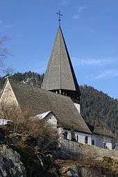 |
Church | Pfruendmatte 74 | 586.165 | 148.790 | 46°29′25″N 7°15′30″E / 46.490281°N 7.258445°E |
| Unknown | ISOS Village: Saanen |
Saicourt
| KGS No.? |
Picture | Name | Street Address | CH1903 X coordinate | CH1903 Y coordinate | Location |
|---|---|---|---|---|---|---|
| 1203 |  |
Former Premonstratensian Abbey | Belellay 163 | 579.563 | 234.834 | 47°15′51″N 7°10′07″E / 47.264094°N 7.168602°E |
| Unknown | ISOS cas particulier: Bellelay |
Saint-Imier
| KGS No.? |
Picture | Name | Street Address | CH1903 X coordinate | CH1903 Y coordinate | Location |
|---|---|---|---|---|---|---|
| 1245 |  |
Collégiale | Place Du Marché 10 | 566.478 | 222.495 | 47°09′09″N 6°59′48″E / 47.152575°N 6.996631°E |
| 9282 |  |
Longines watchmaking factory | Les Longines 8 | 566.998 | 222.127 | 47°08′57″N 7°00′13″E / 47.149291°N 7.003514°E |
| Unknown | ISOS village urbanisé: Saint-Imier |
Sauge
| KGS No.? |
Picture | Name | Street Address | CH1903 X coordinate | CH1903 Y coordinate | Location |
|---|---|---|---|---|---|---|
| Unknown |  |
ISOS Spezialfall: Taubenlochschlucht (Biel/Bienne, Orvin, Péry, Sauge) |
Schangnau
| KGS No.? |
Picture | Name | Street Address | CH1903 X coordinate | CH1903 Y coordinate | Location |
|---|---|---|---|---|---|---|
| 9238 |  |
Krämer House | Dorf 39 | 632.196 | 186.336 | 46°49′39″N 7°51′38″E / 46.827391°N 7.860597°E |
Schlosswil
| KGS No.? |
Picture | Name | Street Address | CH1903 X coordinate | CH1903 Y coordinate | Location |
|---|---|---|---|---|---|---|
| 1211 |  |
Castle and Park | Schlossweg 8–10 | 612.903 | 195.232 | 46°54′29″N 7°36′29″E / 46.908067°N 7.607996°E |
Schüpfen
| KGS No.? |
Picture | Name | Street Address | CH1903 X coordinate | CH1903 Y coordinate | Location |
|---|---|---|---|---|---|---|
| Unknown | ISOS Village: Schwanden | |||||
| Unknown | ISOS hamlet: Winterswil |
Schwarzenburg
| KGS No.? |
Picture | Name | Street Address | CH1903 X coordinate | CH1903 Y coordinate | Location |
|---|---|---|---|---|---|---|
| 1327 |  |
Bauernhof Aeckenmatt | Aeckenmatt 6 | 594.270 | 189.650 | 46°51′29″N 7°21′49″E / 46.857955°N 7.363498°E |
| 1317 |  |
Castle Ruin Grasburg | 591.850 | 186.970 | 46°50′02″N 7°19′55″E / 46.833823°N 7.331811°E | |
| 1319 |  |
Frühmess Chapel | Käppeligässli 5 | 592.620 | 185.100 | 46°49′01″N 7°20′31″E / 46.81701°N 7.341934°E |
| 1318 | Rossgrabenbrücke (Bridge, shared with Rüeggisberg) |
596.920 | 186.295 | 46°49′40″N 7°23′54″E / 46.827794°N 7.398271°E | ||
| 1320 |  |
Schwarzenburg Castle | Schlossgasse 13 | 592.579 | 184.882 | 46°48′54″N 7°20′29″E / 46.815049°N 7.341401°E |
| 9230 | 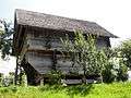 |
Granary | Henzischwand 298 A | 595.786 | 184.288 | 46°48′35″N 7°23′00″E / 46.809734°N 7.383427°E |
| Unknown | ISOS Town / Region: Schwarzenburg | |||||
| Unknown | ISOS hamlet: Aeckenmatt | |||||
| Unknown | ISOS hamlet: Elisried |
Seeberg
| KGS No.? |
Picture | Name | Street Address | CH1903 X coordinate | CH1903 Y coordinate | Location |
|---|---|---|---|---|---|---|
| Unknown | ISOS Village: Riedtwil |
Signau
| KGS No.? |
Picture | Name | Street Address | CH1903 X coordinate | CH1903 Y coordinate | Location |
|---|---|---|---|---|---|---|
| Unknown | ISOS Village: Signau |
Sigriswil
| KGS No.? |
Picture | Name | Street Address | CH1903 X coordinate | CH1903 Y coordinate | Location |
|---|---|---|---|---|---|---|
| Unknown | ISOS hamlet: Wiler |
Siselen
| KGS No.? |
Picture | Name | Street Address | CH1903 X coordinate | CH1903 Y coordinate | Location |
|---|---|---|---|---|---|---|
| 1229 |  |
Rectory | Juchen 5 | 581.023 | 208.969 | 47°01′53″N 7°11′20″E / 47.031487°N 7.18898°E |
| Unknown | ISOS Village: Siselen |
Sonvilier
| KGS No.? |
Picture | Name | Street Address | CH1903 X coordinate | CH1903 Y coordinate | Location |
|---|---|---|---|---|---|---|
| 1230 | Ferme De La Grande Coronelle | La Coronelle 94 | 562.541 | 223.600 | 47°09′44″N 6°56′41″E / 47.162303°N 6.944629°E |
Spiez
| KGS No.? |
Picture | Name | Street Address | CH1903 X coordinate | CH1903 Y coordinate | Location |
|---|---|---|---|---|---|---|
| 9578 | Bürg (Prehistoric / Medieval Hilltop Settlement) | 619.630 | 170.000 | 46°40′51″N 7°41′43″E / 46.680931°N 7.695209°E | ||
| 1236 |  |
Swiss Reformed Castle Church | Schlossstrasse 17 | 619.110 | 170.899 | 46°41′21″N 7°41′18″E / 46.689033°N 7.68845°E |
| 1237 |  |
Spiez Castle | Schlossstrasse 16 | 619.028 | 170.912 | 46°41′21″N 7°41′15″E / 46.689153°N 7.687378°E |
| 9239 |  |
Weinbauernhof | Spiezbergstrasse 46 | 618.770 | 171.095 | 46°41′27″N 7°41′02″E / 46.690806°N 7.684013°E |
Steffisburg
| KGS No.? |
Picture | Name | Street Address | CH1903 X coordinate | CH1903 Y coordinate | Location |
|---|---|---|---|---|---|---|
| 9089 | Former Regie of Steffisburg | Schwäbis 103 | 613.560 | 179.092 | 46°45′46″N 7°36′58″E / 46.762869°N 7.616141°E |
Studen
| KGS No.? |
Picture | Name | Street Address | CH1903 X coordinate | CH1903 Y coordinate | Location |
|---|---|---|---|---|---|---|
| 1247 |  |
Petinesca Roman era Vicus / Temple Complex |
589.150 | 217.700 | 47°06′37″N 7°17′44″E / 47.110205°N 7.295688°E |
Sumiswald
| KGS No.? |
Picture | Name | Street Address | CH1903 X coordinate | CH1903 Y coordinate | Location |
|---|---|---|---|---|---|---|
| 9240 |  |
Gasthof Bären | Marktgasse 1 | 623.353 | 208.548 | 47°01′39″N 7°44′45″E / 47.02756°N 7.745842°E |
| 9241 |  |
Rectory | Pfarrgässli 2 | 623.363 | 208.590 | 47°01′41″N 7°44′46″E / 47.027938°N 7.745975°E |
| 1250 |  |
Swiss Reformed Church | Kirchgasse 4 | 623.290 | 208.570 | 47°01′40″N 7°44′42″E / 47.027761°N 7.745014°E |
| Unknown | ISOS Village: Sumiswald |
Sutz-Lattrigen
| KGS No.? |
Picture | Name | Street Address | CH1903 X coordinate | CH1903 Y coordinate | Location |
|---|---|---|---|---|---|---|
| 9579 | Neolithic / Bronze Age Lake-Side Settlement | 583.000 | 217.200 | 47°06′20″N 7°12′53″E / 47.105578°N 7.21468°E | ||
| 9127 |  |
Von Rütte-Gut | Seestrasse 6 | 582.945 | 216.877 | 47°06′10″N 7°12′50″E / 47.102671°N 7.213968°E |
Tavannes
| KGS No.? |
Picture | Name | Street Address | CH1903 X coordinate | CH1903 Y coordinate | Location |
|---|---|---|---|---|---|---|
| 9765 |  |
Eglise Du Christ-Roi | Rue Du Général Voirol 7 | 581.730 | 230.099 | 47°13′18″N 7°11′51″E / 47.221568°N 7.197427°E |
| 9580 |  |
Pierre Pertuis (passage carved into the rock above the Roman road) |
passage taillé dans le rocher | 581.480 | 229.150 | 47°12′47″N 7°11′39″E / 47.213025°N 7.194166°E |
| Unknown | ISOS village urbanisé: Tavannes |
Thun
| KGS No.? |
Picture | Name | Street Address | CH1903 X coordinate | CH1903 Y coordinate | Location |
|---|---|---|---|---|---|---|
| 1260 |  |
Dampfschiff Blüemlisalp (Steamship Blüemlisalp) |
614.745 | 178.125 | 46°45′15″N 7°37′54″E / 46.754145°N 7.631621°E | |
| 1269 |  |
Former Hotel Bellevue-Du Parc | Göttibachweg 2 | 614.801 | 178.511 | 46°45′27″N 7°37′57″E / 46.757616°N 7.632367°E |
| 1272 |  |
Former Hotel Thunerhof | Hofstettenstrasse 14 | 614.927 | 178.324 | 46°45′21″N 7°38′02″E / 46.755931°N 7.63401°E |
| 1261 |  |
zum Rosengarten House | Freienhofgasse 20 | 614.666 | 178.478 | 46°45′26″N 7°37′50″E / 46.757322°N 7.630599°E |
| 1271 |  |
Landsitz Bellerive | Gwattstrasse 120 | 614.227 | 174.968 | 46°43′33″N 7°37′29″E / 46.725758°N 7.624744°E |
| 1273 |  |
Mannschaftskaserne (Armory) | Allmendstrasse 243–248 | 613.851 | 178.710 | 46°45′34″N 7°37′12″E / 46.759427°N 7.619938°E |
| 9512 |  |
Platzschulhaus (Former Hospital) | Rathausplatz 3 | 614.544 | 178.728 | 46°45′34″N 7°37′44″E / 46.759574°N 7.62901°E |
| 1262 |  |
Rathaus (Town council house) | Rathausplatz 1 | 614.486 | 178.713 | 46°45′34″N 7°37′42″E / 46.75944°N 7.62825°E |
| 1263 |  |
Reformed Church of Scherzligen | Seestrasse 41 | 615.110 | 177.370 | 46°44′50″N 7°38′11″E / 46.747345°N 7.636374°E |
| 11719 | Sammlung Historisches Armeematerial (Collection of Historical Military Equipment) (Shared between Thun, Burgdorf and Dübendorf in Zurich) |
613.800 | 178.500 | 46°45′27″N 7°37′09″E / 46.757539°N 7.619265°E | ||
| 1264 |  |
Thun Castle | Schlossberg 1 | 614.606 | 178.784 | 46°45′36″N 7°37′47″E / 46.760076°N 7.629823°E |
| 1265 |  |
Schadau Castle | Seestrasse 45 | 615.184 | 177.234 | 46°44′46″N 7°38′14″E / 46.74612°N 7.637338°E |
| 8586 | Schweizerisches Armeemuseum (Swiss Army Museum) |
612.901 | 178.926 | 46°45′41″N 7°36′27″E / 46.761389°N 7.60751°E | ||
| 10423 |  |
City Walls | 614.680 | 178.700 | 46°45′34″N 7°37′51″E / 46.759319°N 7.630789°E | |
| 1276 | Vaporama, Museum of Steam Power | Schadau-Kutscherei | 615.081 | 177.186 | 46°44′44″N 7°38′10″E / 46.745691°N 7.635988°E | |
| 1267 |  |
Wocher-Panorama | Seestrasse 45 F | 615.081 | 177.186 | 46°44′44″N 7°38′10″E / 46.745691°N 7.635988°E |
| Unknown | ISOS Stadt: Thun |
Thunstetten
| KGS No.? |
Picture | Name | Street Address | CH1903 X coordinate | CH1903 Y coordinate | Location |
|---|---|---|---|---|---|---|
| 1277 | _259.JPG) |
Thunstetten Castle | Bergasse 5 | 623.865 | 228.322 | 47°12′19″N 7°45′13″E / 47.205406°N 7.753621°E |
Toffen
| KGS No.? |
Picture | Name | Street Address | CH1903 X coordinate | CH1903 Y coordinate | Location |
|---|---|---|---|---|---|---|
| 1279 |  |
Toffen Castle | Schlossweg 4 | 603.843 | 190.259 | 46°51′48″N 7°29′21″E / 46.863447°N 7.489037°E |
Trachselwald
| KGS No.? |
Picture | Name | Street Address | CH1903 X coordinate | CH1903 Y coordinate | Location |
|---|---|---|---|---|---|---|
| 1281 |  |
Village Church | Village 4 | 622.740 | 207.320 | 47°01′00″N 7°44′16″E / 47.016536°N 7.737716°E |
| 1283 |  |
Trachselwald Castle | Schloss 8 | 623.056 | 207.430 | 47°01′03″N 7°44′31″E / 47.017514°N 7.741878°E |
| Unknown | ISOS Village: Trachselwald (Lützelflüh) |
Tramelan
| KGS No.? |
Picture | Name | Street Address | CH1903 X coordinate | CH1903 Y coordinate | Location |
|---|---|---|---|---|---|---|
| Unknown | ISOS hameau: Le Cernil / La Chaux de Tramelan |
Trub
| KGS No.? |
Picture | Name | Street Address | CH1903 X coordinate | CH1903 Y coordinate | Location |
|---|---|---|---|---|---|---|
| 9767 | Farm House | Hinter Hütten 239 | 633.009 | 203.129 | 46°58′42″N 7°52′21″E / 46.978406°N 7.872468°E | |
| 9227 |  |
Farm House Ober-Brandösch | Brandösch 146 | 634.713 | 202.527 | 46°58′22″N 7°53′41″E / 46.972905°N 7.894817°E |
| 9228 |  |
Farm House | Schwithtenhof 11 | 631.819 | 197.863 | 46°55′52″N 7°51′23″E / 46.931097°N 7.85646°E |
| Unknown | ISOS Village: Trub |
Tschugg
| KGS No.? |
Picture | Name | Street Address | CH1903 X coordinate | CH1903 Y coordinate | Location |
|---|---|---|---|---|---|---|
| 1291 |  |
Former Landgut Steiger | Unterdorf 44 | 572.614 | 208.457 | 47°01′36″N 7°04′42″E / 47.026588°N 7.078386°E |
Twann-Tüscherz
| KGS No.? |
Picture | Name | Street Address | CH1903 X coordinate | CH1903 Y coordinate | Location |
|---|---|---|---|---|---|---|
| 1294 |  |
Former Clunic Priory | St. Petersinsel 26 | 577.517 | 213.230 | 47°04′11″N 7°08′34″E / 47.069705°N 7.142645°E |
| 1297 |  |
Former Thormanngut | Wingreis 22 | 580.024 | 216.784 | 47°06′06″N 7°10′32″E / 47.101753°N 7.175493°E |
| 9229 |  |
Fraubrunnen House | Dorfgasse 28 | 578.693 | 216.052 | 47°05′42″N 7°09′29″E / 47.095127°N 7.157994°E |
| Unknown | ISOS Village: Tüscherz | |||||
| Unknown | ISOS Village: Twann | |||||
| Unknown | ISOS hamlet: Wingreis |
Unterseen
| KGS No.? |
Picture | Name | Street Address | CH1903 X coordinate | CH1903 Y coordinate | Location |
|---|---|---|---|---|---|---|
| 9581 |  |
Old City of Unterseen | 631.400 | 170.700 | 46°41′12″N 7°50′57″E / 46.686778°N 7.849093°E | |
| 1301 |  |
Weissenau Ruins | 630.140 | 168.840 | 46°40′12″N 7°49′57″E / 46.670105°N 7.832501°E | |
| Unknown | ISOS Town / Region: Unterseen |
Utzenstorf
| KGS No.? |
Picture | Name | Street Address | CH1903 X coordinate | CH1903 Y coordinate | Location |
|---|---|---|---|---|---|---|
| 9582 | Bürglenhubel, Neolithic Hilltop Settlement |
610.900 | 220.050 | 47°07′53″N 7°34′56″E / 47.131342°N 7.582302°E | ||
| 9774 |  |
Gasthof Bären | Hauptstrasse 18 | 609.010 | 219.786 | 47°07′44″N 7°33′27″E / 47.128996°N 7.557386°E |
| 1307 |  |
Landshut Castle | Schlossstrasse 15–21 | 608.343 | 220.715 | 47°08′14″N 7°32′55″E / 47.137361°N 7.548613°E |
| Unknown | ISOS Spezialfall: Landshut Castle |
Vechigen
| KGS No.? |
Picture | Name | Street Address | CH1903 X coordinate | CH1903 Y coordinate | Location |
|---|---|---|---|---|---|---|
| Unknown | ISOS hamlet: Lindental |
Vinelz
| KGS No.? |
Picture | Name | Street Address | CH1903 X coordinate | CH1903 Y coordinate | Location |
|---|---|---|---|---|---|---|
| 9583 | Ländti, Neolithic / Bronze Age Lakeshore Settlement |
575.150 | 209.660 | 47°02′15″N 7°06′42″E / 47.037508°N 7.111679°E | ||
| Unknown | ISOS Village: Vinelz |
Walperswil
| KGS No.? |
Picture | Name | Street Address | CH1903 X coordinate | CH1903 Y coordinate | Location |
|---|---|---|---|---|---|---|
| 1330 |  |
Rectory | Kirchweg | 583.976 | 212.050 | 47°03′33″N 7°13′40″E / 47.059279°N 7.22772°E |
| Unknown | ISOS Village: Walperswil |
Wangen an der Aare
| KGS No.? |
Picture | Name | Street Address | CH1903 X coordinate | CH1903 Y coordinate | Location |
|---|---|---|---|---|---|---|
| 9251 |  |
Former Watch Tower, now Rectory | Städtli 40 | 616.292 | 231.703 | 47°14′10″N 7°39′14″E / 47.236047°N 7.653791°E |
| 1333 |  |
Wooden Bridge | Aarebrücke | 616.400 | 231.830 | 47°14′14″N 7°39′19″E / 47.237186°N 7.655222°E |
| 1337 | _066.JPG) |
Castle | Städtli 26 | 616.346 | 231.714 | 47°14′10″N 7°39′16″E / 47.236144°N 7.654504°E |
| Unknown | ISOS Town / Region: Wangen an der Aare |
Wiedlisbach
| KGS No.? |
Picture | Name | Street Address | CH1903 X coordinate | CH1903 Y coordinate | Location |
|---|---|---|---|---|---|---|
| Unknown | ISOS Town / Region: Wiedlisbach |
Wiggiswil
| KGS No.? |
Picture | Name | Street Address | CH1903 X coordinate | CH1903 Y coordinate | Location |
|---|---|---|---|---|---|---|
| Unknown | ISOS hamlet: Wiggiswil |
Wilderswil
| KGS No.? |
Picture | Name | Street Address | CH1903 X coordinate | CH1903 Y coordinate | Location |
|---|---|---|---|---|---|---|
| Unknown | ISOS Urbanized Village: Wilderswil | |||||
| Unknown | ISOS Village: Gsteig bei Interlaken (with Gsteigwiler) |
Wileroltigen
| KGS No.? |
Picture | Name | Street Address | CH1903 X coordinate | CH1903 Y coordinate | Location |
|---|---|---|---|---|---|---|
| Unknown | ISOS Village: Wileroltigen |
Willadingen
| KGS No.? |
Picture | Name | Street Address | CH1903 X coordinate | CH1903 Y coordinate | Location |
|---|---|---|---|---|---|---|
| Unknown | ISOS Village: Willadingen |
Wimmis
| KGS No.? |
Picture | Name | Street Address | CH1903 X coordinate | CH1903 Y coordinate | Location |
|---|---|---|---|---|---|---|
| 1347 |  |
Village Church | Schlossgasse 2 A | 615.064 | 169.100 | 46°40′23″N 7°38′08″E / 46.672954°N 7.6355°E |
| 10474 | .JPG) |
Letzi Spissi | Talsperre | 614.590 | 168.480 | 46°40′03″N 7°37′45″E / 46.667387°N 7.629286°E |
| 9925 |  |
Wimmis Castle | Schlossgasse 6 | 614.981 | 169.051 | 46°40′21″N 7°38′04″E / 46.672515°N 7.634414°E |
| Unknown | ISOS Village: Wimmis |
Wohlen bei Bern
| KGS No.? |
Picture | Name | Street Address | CH1903 X coordinate | CH1903 Y coordinate | Location |
|---|---|---|---|---|---|---|
| 1348 | |
Hofenmühle | Mühlegasse 21 | 593.325 | 201.915 | 46°58′06″N 7°21′03″E / 46.968273°N 7.350926°E |
| Unknown | ISOS hamlet: Hofen | |||||
| Unknown | ISOS hamlet: Illiswil | |||||
| Unknown | ISOS hamlet: Möriswil | |||||
| Unknown | ISOS hamlet: Oberdettigen |
Worb
| KGS No.? |
Picture | Name | Street Address | CH1903 X coordinate | CH1903 Y coordinate | Location |
|---|---|---|---|---|---|---|
| 1352 |  |
Worb Castle or Altes Schloss | Schloss 2–6 | 609.819 | 197.816 | 46°55′53″N 7°34′03″E / 46.931363°N 7.567573°E |
| 1354 |  |
Swiss Reformed Church | Enggisteinstrasse 6 | 609.575 | 197.680 | 46°55′49″N 7°33′52″E / 46.930143°N 7.564366°E |
| Unknown | ISOS hamlet: Wattenwil |
Wynau
| KGS No.? |
Picture | Name | Street Address | CH1903 X coordinate | CH1903 Y coordinate | Location |
|---|---|---|---|---|---|---|
| 9782 |  |
Rectory | Kirchweg 12 | 627.994 | 234.657 | 47°15′44″N 7°48′31″E / 47.262224°N 7.808511°E |
| 1356 |  |
Swiss Reformed Church | Kirchweg 10 | 627.984 | 234.656 | 47°15′44″N 7°48′30″E / 47.262216°N 7.808378°E |
| 9252 |  |
Speicherstöckli | Aarwangenstrasse 5 | 627.994 | 234.514 | 47°15′39″N 7°48′31″E / 47.260938°N 7.808502°E |
Wynigen
| KGS No.? |
Picture | Name | Street Address | CH1903 X coordinate | CH1903 Y coordinate | Location |
|---|---|---|---|---|---|---|
| 9253 |  |
Farm House | Oberbühl 239 | 619.763 | 217.166 | 47°06′19″N 7°41′56″E / 47.105196°N 7.698992°E |
| 9768 |  |
Farm House Glungge | Brechershäusern 340 | 618.829 | 218.754 | 47°07′10″N 7°41′12″E / 47.119507°N 7.686754°E |
| 9254 |  |
Dorfbrunnen (Fountain) | Dorfstrasse | 617.382 | 217.248 | 47°06′22″N 7°40′03″E / 47.106°N 7.667629°E |
| 1358 |  |
Former Gasthof Wilder Mann | Dorfstrasse 12 | 617.288 | 217.225 | 47°06′21″N 7°39′59″E / 47.105796°N 7.666389°E |
| 1360 |  |
Rectory | Dorfstrasse 8 | 617.310 | 217.255 | 47°06′22″N 7°40′00″E / 47.106065°N 7.66668°E |
| 9255 |  |
Granary in Oberbüel | Oberbüel 239 C | 619.747 | 217.158 | 47°06′18″N 7°41′56″E / 47.105124°N 7.698781°E |
| Unknown | ISOS hamlet: Breitenegg |
Zollikofen
| KGS No.? |
Picture | Name | Street Address | CH1903 X coordinate | CH1903 Y coordinate | Location |
|---|---|---|---|---|---|---|
| 9167 |  |
Archiv Schweizer Milchproduzenten (Archive of Swiss Milk Production) |
Molkereistrasse 23 | 601.634 | 204.699 | 46°59′36″N 7°27′36″E / 46.993347°N 7.460118°E |
| 1364 |  |
Reichenbach Castle | Schloss Reichenbach 6–11 | 600.826 | 204.411 | 46°59′27″N 7°26′58″E / 46.990758°N 7.449496°E |
| Unknown | ISOS hamlet: Büelikofen / Graben |
Zweisimmen
| KGS No.? |
Picture | Name | Street Address | CH1903 X coordinate | CH1903 Y coordinate | Location |
|---|---|---|---|---|---|---|
| 1367 |  |
Swiss Reformed Church and Rectory | Kirchgasse 231 | 595.650 | 157.820 | 46°34′18″N 7°22′55″E / 46.57164°N 7.381896°E |
| 1369 |  |
Ruins of Oberer Mannenberg Castle | Manneberg Riedli | 595.480 | 157.680 | 46°34′13″N 7°22′47″E / 46.570379°N 7.37968°E |
| 11720 |  |
Ruins of Unterer Mannenberg Castle | 594.874 | 155.626 | 46°33′07″N 7°22′18″E / 46.551898°N 7.371798°E |
References
- All entries, addresses and coordinates are from: "Kantonsliste A-Objekte". KGS Inventar (in German). Federal Office of Civil Protection. 2009. Retrieved 25 April 2011.
External links
- Swiss Inventory of Cultural Property of National and Regional Significance, 2009 edition:
- "Revision of the PCP Inventory (Revision des KGS-Inventars)". KGS Forum. Federal Office of Civil Protection (13/2008). 2008.
| Wikimedia Commons has media related to Cultural properties of national significance in the canton of Bern. |
This article is issued from Wikipedia - version of the 8/12/2016. The text is available under the Creative Commons Attribution/Share Alike but additional terms may apply for the media files.