Leanyer, Northern Territory
| Leanyer Darwin, Northern Territory | |||||||||||||
|---|---|---|---|---|---|---|---|---|---|---|---|---|---|
 | |||||||||||||
| Population | 4,964 (2006)[1] | ||||||||||||
| • Density | 1,990/km2 (5,140/sq mi) | ||||||||||||
| Established | 1869 | ||||||||||||
| Postcode(s) | 0812 | ||||||||||||
| Area | 2.5 km2 (1.0 sq mi) | ||||||||||||
| Location | 14.4 km (9 mi) from Darwin | ||||||||||||
| LGA(s) | City of Darwin | ||||||||||||
| Territory electorate(s) | Wanguri | ||||||||||||
| Federal Division(s) | Solomon | ||||||||||||
| |||||||||||||
Leanyer is a northern suburb of Darwin, in the Northern Territory of Australia.
History
The name Leanyer was in general use for the area at the time of development and first appeared on 1869 survey plans. Leanyer is thought to be derived from an Aboriginal word.[2]
Leanyer was established as a military and residential area. The development of the Leanyer area was primarily during the 1970s and 1980s.
The roads and streets within the suburb are named after coastal features and rivers in the northern part of the Northern Territory.
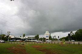
In 2011 the suburb recorded, 3,160.0 millimetres (124.41 in), the highest 2010/11 wet season rainfall total recorded in the Northern Territory, breaking the previous all-time record of 3,048.6 millimetres (120.02 in) set in Pirlangimpi on the Melville Island during the 1999/2000 wet season.[3][4]
Present day
There are a number of schools in the suburb such as Leanyer Primary School and Good Shepherd Lutheran College. Attractions in the area include the Casuarina Coastal Reserve and beach, Holmes Jungle Nature Park, Leanyer Swamp, Leanyer Recreation Park - a free water park, the Tracy Village Social Club and the Hibiscus Shoppingtown.
References
- ↑ Australian Bureau of Statistics (25 October 2007). "Leanyer (State Suburb)". 2006 Census QuickStats. Retrieved 30 December 2007.
- ↑ "Place Names Register Extract". NT Place Names Register. Northern Territory Government. Retrieved 11 April 2011.
- ↑ "Darwin suburb breaks NT wet season record". ABC News. Australian Broadcasting Corporation. 11 April 2011. Retrieved 11 April 2011.
- ↑ "Darwin wet season rainfall record falls". Northern Territory Regional Office. Bureau of Meteorology. 4 March 2011. Retrieved 11 April 2011.
External links
- http://www.nt.gov.au/lands/lis/placenames/origins/greaterdarwin.shtml#l
- City of Darwin Community Profiles
Coordinates: 12°22′46″S 130°53′51″E / 12.37944°S 130.89750°E