Flöha
| Flöha | ||
|---|---|---|
|
Flöha | ||
| ||
 Flöha | ||
Location of Flöha within Mittelsachsen district 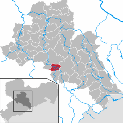 | ||
| Coordinates: 50°51′21″N 13°4′17″E / 50.85583°N 13.07139°ECoordinates: 50°51′21″N 13°4′17″E / 50.85583°N 13.07139°E | ||
| Country | Germany | |
| State | Saxony | |
| District | Mittelsachsen | |
| Government | ||
| • Mayor | Friedrich Schlosser (CDU) | |
| Area | ||
| • Total | 27.61 km2 (10.66 sq mi) | |
| Population (2015-12-31)[1] | ||
| • Total | 10,967 | |
| • Density | 400/km2 (1,000/sq mi) | |
| Time zone | CET/CEST (UTC+1/+2) | |
| Postal codes | 09557 | |
| Dialling codes | 03726 | |
| Vehicle registration | FG, BED, DL, FLÖ, HC, MW, RL | |
| Website | www.floeha.de | |
.jpg)

Flöha is a town in the district of Mittelsachsen, in the Free State of Saxony, Germany. Flöha is situated on the confluence of the rivers Zschopau and Flöha, 10 km (6.21 mi) east of Chemnitz.
History
During World War II, a subcamp of Flossenbürg concentration camp was located in Flöha.[2]
Sons and daughters of the city
- Lothar Kreyssig (1898-1986), founder of the Aktion Sühnezeichen, was born in Flöha
- Stefan Schmidt (born 1989), football goalkeeper
Personalities who have worked in the city

Samuel-von-Pufendorf
- Samuel von Pufendorf (1632-1694), natural law philosopher, historian and natural and international law teacher,
- Herbert Jobst (1915-1990), writer
- Marcus Popp (born 1981), volleyball player
References
- ↑ "Aktuelle Einwohnerzahlen nach Gemeinden 2015] (Einwohnerzahlen auf Grundlage des Zensus 2011)" (PDF). Statistisches Landesamt des Freistaates Sachsen (in German). July 2016.
- ↑ Christine O'Keefe. Concentration Camps
| Wikimedia Commons has media related to Flöha. |
This article is issued from Wikipedia - version of the 10/23/2016. The text is available under the Creative Commons Attribution/Share Alike but additional terms may apply for the media files.