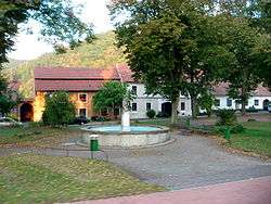
Doubravník
| Doubravník | |||
|---|---|---|---|
| Městys | |||
 | |||
| |||
 Doubravník | |||
| Coordinates: 49°25′30″N 16°21′6″E / 49.42500°N 16.35167°ECoordinates: 49°25′30″N 16°21′6″E / 49.42500°N 16.35167°E | |||
| Country |
| ||
| Region | South Moravian | ||
| District | Brno-Country | ||
| Area | |||
| • Total | 11.46 km2 (4.42 sq mi) | ||
| Elevation | 313 m (1,027 ft) | ||
| Population (2012) | |||
| • Total | 819 | ||
| • Density | 71/km2 (190/sq mi) | ||
| Postal code | 592 61 to 592 62 | ||


Doubravník is a small town (městys) in Brno-Country District in the South Moravian Region of the Czech Republic.
The town covers an area of 11.46 square kilometres (4.42 sq mi), and has a population of 791 (as at 3 July 2006).
Doubravník lies approximately 32 kilometres (20 mi) north-west of Brno and 158 km (98 mi) south-east of Prague.
References
| Wikimedia Commons has media related to Doubravník. |
This article is issued from Wikipedia - version of the 4/4/2016. The text is available under the Creative Commons Attribution/Share Alike but additional terms may apply for the media files.