Dixon, Missouri
| Dixon, Missouri | |
|---|---|
| City | |
 Location of Dixon, Missouri | |
| Coordinates: 37°59′43″N 92°5′46″W / 37.99528°N 92.09611°WCoordinates: 37°59′43″N 92°5′46″W / 37.99528°N 92.09611°W | |
| Country | United States |
| State | Missouri |
| County | Pulaski |
| Area[1] | |
| • Total | 1.01 sq mi (2.62 km2) |
| • Land | 1.01 sq mi (2.62 km2) |
| • Water | 0 sq mi (0 km2) |
| Elevation | 1,168 ft (356 m) |
| Population (2010)[2] | |
| • Total | 1,549 |
| • Estimate (2012[3]) | 1,571 |
| • Density | 1,533.7/sq mi (592.2/km2) |
| Time zone | Central (CST) (UTC-6) |
| • Summer (DST) | CDT (UTC-5) |
| ZIP code | 65459 |
| Area code(s) | 573 |
| FIPS code | 29-19630[4] |
| GNIS feature ID | 0749667[5] |
Dixon is a city in Pulaski County, Missouri, United States. The population was 1,549 at the 2010 census.
Dixon, Missouri was born a railroad town - a boom town, in fact, because of a fortunate meeting of time, place, and need. Dixon's fortune at first depended largely on the Frisco Railroad, which continues today as the BNSF Railroad. Although a number of nearby settlements older than Dixon had survived the Civil War period, the first large settlement near the town itself was a camp consisting of about 100 workers who were "working on the railroad" in 1867-1868. This camp was located on what is widely remembered now as the Bennett Jones property just west of Dixon, approaching the intersection with Highway 133 and C Highway.
Later, the workers moved into town. In 1869, Dixon was surveyed and laid out on both sides of the tracks by Frisco surveyor, Milton Santee, who originally came from Dixon, Illinois, He suggested naming the new Missouri city after an Indian trader who had donated the land which became Dixon, Illinois. John Dixon was an interpreter for local Indians and counsel to U.S. Army officers assigned to the southern Illinois area. The Winnebago Indians call Dixon "Nada-ch u-ra-sak" due to his long flowing white hair.
For many years after Dixon donated the land for the village in Illinois, the Indians passing through the area would stop and visit with the elderly gentleman. A well-preserved photograph of John Dixon hangs in the Dixon City Hall today. The Dixon area has continued to prosper and grow at a slow but steady pace. Today, More than 125 years later Dixon is a pleasant, progressive community that is a "hometown place" to more than 1500 citizens.
Spread comfortably around the top of a rolling Ozark foothill, Dixon offers a unique blend of modern lifestyles and old-fashioned country living. Dixon boasts a premiere school system, Country Mart, a weekly newspaper the Dixon Pilot, Home-plate Grill, Dollar General, Tri County Hardware & Lumber, a feed store and small engine repair shop and is home base for Gascosage Electric Cooperative and the Dixon Weather Service. Along with thriving small industries and competitive businesses and shops.
Dixon residents are fortunate to have two community banking facilities to serve their financial needs. Mid America Bank and the Community Bank of Dixon (a branch of Maries County Bank) are both staffed by progressive and supportive civic leaders.
The city has two parks, one reserved for family reunions and children's playgrounds, the other for sporting events like youth soccer, baseball, softball, and family recreation.
Dixon also has a modern 60-bed nursing home, a magnificent country club with one of the most beautiful 9-hole golf courses in mid-Missouri, more than 20 churches of various Christian denominations, and several active service clubs and fraternal organizations.
Geography
Dixon is located at 37°59′43″N 92°5′46″W / 37.99528°N 92.09611°W (37.995273, -92.095979).[6]
According to the United States Census Bureau, the city has a total area of 1.01 square miles (2.62 km2), all of it land.[1]
Demographics
| Historical population | |||
|---|---|---|---|
| Census | Pop. | %± | |
| 1890 | 404 | — | |
| 1900 | 500 | 23.8% | |
| 1910 | 715 | 43.0% | |
| 1920 | 810 | 13.3% | |
| 1930 | 721 | −11.0% | |
| 1940 | 741 | 2.8% | |
| 1950 | 988 | 33.3% | |
| 1960 | 1,473 | 49.1% | |
| 1970 | 1,387 | −5.8% | |
| 1980 | 1,402 | 1.1% | |
| 1990 | 1,585 | 13.1% | |
| 2000 | 1,570 | −0.9% | |
| 2010 | 1,549 | −1.3% | |
| Est. 2015 | 1,499 | [7] | −3.2% |
2010 census
As of the census[2] of 2010, there were 1,549 people, 645 households, and 363 families residing in the city. The population density was 1,533.7 inhabitants per square mile (592.2/km2). There were 738 housing units at an average density of 730.7 per square mile (282.1/km2). The racial makeup of the city was 94.5% White, 0.9% African American, 0.3% Native American, 0.6% Asian, 0.9% Pacific Islander, 0.5% from other races, and 2.3% from two or more races. Hispanic or Latino of any race were 4.7% of the population.
There were 645 households of which 30.9% had children under the age of 18 living with them, 38.9% were married couples living together, 13.2% had a female householder with no husband present, 4.2% had a male householder with no wife present, and 43.7% were non-families. 38.4% of all households were made up of individuals and 17% had someone living alone who was 65 years of age or older. The average household size was 2.33 and the average family size was 3.10.
The median age in the city was 38.3 years. 25.7% of residents were under the age of 18; 8% were between the ages of 18 and 24; 23.8% were from 25 to 44; 25.2% were from 45 to 64; and 17.2% were 65 years of age or older. The gender makeup of the city was 46.8% male and 53.2% female.
2000 census
As of the census[4] of 2000, there were 1,570 people, 667 households, and 414 families residing in the city. The population density was 1,545.8 people per square mile (594.3/km²). There were 751 housing units at an average density of 739.4 per square mile (284.3/km²). The racial makeup of the city was 96.05% White, 0.06% African American, 0.57% Native American, 1.02% Asian, 0.45% Pacific Islander, 1.02% from other races, and 0.83% from two or more races. Hispanic or Latino of any race were 2.04% of the population.
There were 667 households out of which 32.2% had children under the age of 18 living with them, 44.5% were married couples living together, 14.1% had a female householder with no husband present, and 37.8% were non-families. 33.6% of all households were made up of individuals and 18.6% had someone living alone who was 65 years of age or older. The average household size was 2.28 and the average family size was 2.91.
In the city the population was spread out with 25.4% under the age of 18, 8.5% from 18 to 24, 25.5% from 25 to 44, 18.5% from 45 to 64, and 22.2% who were 65 years of age or older. The median age was 38 years. For every 100 females there were 79.0 males. For every 100 females age 18 and over, there were 75.6 males.
The median income for a household in the city was $21,821, and the median income for a family was $28,693. Males had a median income of $21,667 versus $17,115 for females. The per capita income for the city was $12,405. About 21.3% of families and 23.5% of the population were below the poverty line, including 37.6% of those under age 18 and 12.9% of those age 65 or over.
Transportation
Major north-south routes near Dixon include:
- Route 133 runs north from Interstate 44 exit 145 about two miles east of Hazelgreen to Richland, Swedeborg, Crocker, and about two miles west of Dixon, then north out of the county.
- Route 28 begins Interstate 44 at exit 163 at the eastern edge of St. Robert, runs north through Dixon, and then runs north out of the county.
- A secondary road parallels Highway 28, beginning as Highway Y at exit 161 of Interstate 44 in St. Robert, running north to the Gasconade River bridge where it becomes the county-maintained Cave Road and turning north as Highway O until it meets Highway 28 about a mile south of Dixon.
Notable people
- John Brown, former professional basketball player, attended Dixon High School
- David A. Day, Missouri state legislator, resides in Dixon. Day served in the Missouri House of Representatives from 2005-2012 and served as Chairman of the House Veterans Committee.
- Morrie Martin, Major League Baseball player 1949-1959, Brooklyn Dodgers, Philadelphia Athletics, Chicago White Sox, Baltimore Orioles, St. Louis Cardinals, Cleveland Indians, Chicago Cubs. WWII Veteran 49th Engineer Combat Battalion and was involved in amphibious landings at North Africa, Sicily and Omaha Beach on D-Day. He suffered shrapnel wounds twice and was buried alive in Germany when the house he was in was shelled. Left for dead, he and two other soldiers clawed their way out and rejoined their battalion. At the Battle of the Bulge, he suffered a bullet wound to the thigh and nearly lost a leg after gangrene set in. It took more than 150 shots of penicillin to spare him from an amputation. Graduate Dixon H.S, Dixon Mo. Copyright © 2010 Gary Bedingfield (Baseball in Wartime). All Rights Reserved.
References
- 1 2 "US Gazetteer files 2010". United States Census Bureau. Retrieved 2012-07-08.
- 1 2 "American FactFinder". United States Census Bureau. Retrieved 2012-07-08.
- ↑ "Population Estimates". United States Census Bureau. Retrieved 2013-05-30.
- 1 2 "American FactFinder". United States Census Bureau. Retrieved 2008-01-31.
- ↑ "US Board on Geographic Names". United States Geological Survey. 2007-10-25. Retrieved 2008-01-31.
- ↑ "US Gazetteer files: 2010, 2000, and 1990". United States Census Bureau. 2011-02-12. Retrieved 2011-04-23.
- ↑ "Annual Estimates of the Resident Population for Incorporated Places: April 1, 2010 to July 1, 2015". Retrieved July 2, 2016.
- ↑ "Census of Population and Housing". Census.gov. Retrieved June 4, 2015.
External links
- Historic maps of Dixon in the Sanborn Maps of Missouri Collection at the University of Missouri
Municipalities and communities of Pulaski County, Missouri, United States | ||
|---|---|---|
| Cities | 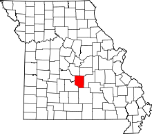 | |
| Townships |
| |
| CDP | ||
| Unincorporated communities | ||
| Footnotes | ‡This populated place also has portions in an adjacent county or counties | |
- Dixon Weather Service Storm spotters, Storm Chasers, Severe weather services Dixon, MO