Bourscheid, Luxembourg
| Bourscheid Buerschent | ||
|---|---|---|
| Commune | ||
 | ||
| ||
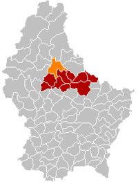 Map of Luxembourg with Bourscheid highlighted in orange, and the canton in dark red | ||
| Coordinates: 49°54′33″N 6°03′46″E / 49.909167°N 6.062778°ECoordinates: 49°54′33″N 6°03′46″E / 49.909167°N 6.062778°E | ||
| Country |
| |
| Canton | Diekirch | |
| Government | ||
| • Mayor | Annie Nickels-Theis | |
| Area | ||
| • Total | 36.86 km2 (14.23 sq mi) | |
| Area rank | 15 of 105 | |
| Highest elevation | 513 m (1,683 ft) | |
| • Rank | 17th of 105 | |
| Lowest elevation | 207 m (679 ft) | |
| • Rank | 28th of 105 | |
| Population (2014) | ||
| • Total | 1,567 | |
| • Rank | 83rd of 105 | |
| • Density | 43/km2 (110/sq mi) | |
| • Density rank | 98th of 105 | |
| Time zone | CET (UTC+1) | |
| • Summer (DST) | CEST (UTC+2) | |
| LAU 2 | LU00002003 | |

Bourscheid (Luxembourgish: Buerschent, German: Burscheid) is a commune and small town in north-eastern Luxembourg. It is part of the canton of Diekirch, which is part of the district of Diekirch.
As of 2005, the town of Bourscheid, which lies in the centre of the commune, has a population of 266. Other settlements within the commune include Goebelsmuhle, Lipperscheid, Michelau, Schlindermanderscheid, and Welscheid.
Bourscheid Castle located close to the village is Luxembourg's largest and one of the most important medieval castles between the Meuse and the Rhine.[1]

Bourscheid Castle
References
- ↑ "Château de Bourscheid" Archived December 20, 2009, at the Wayback Machine., Bourscheid castle. (English) Retrieved 18 octobre 2012.
External links
-
 Media related to Bourscheid, Luxembourg at Wikimedia Commons
 |
Kiischpelt | Parc Hosingen | Putscheid | |
| Goesdorf | |
Tandel | ||
| ||||
| | ||||
| Esch-sur-Sûre | Feulen, Ettelbruck, Erpeldange |
 | ||
This article is issued from Wikipedia - version of the 12/1/2016. The text is available under the Creative Commons Attribution/Share Alike but additional terms may apply for the media files.