Zierikzee
| Zierikzee | |||
|---|---|---|---|
| City | |||
| |||
 | |||
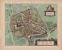
 The town centre (dark green) and the statistical district (light green) of Zierikzee in the municipality of Schouwen-Duiveland. | |||
| Coordinates: 51°38′59″N 3°54′59″E / 51.64972°N 3.91639°ECoordinates: 51°38′59″N 3°54′59″E / 51.64972°N 3.91639°E | |||
| Country | Netherlands | ||
| Province | Zeeland | ||
| Municipality | Schouwen-Duiveland | ||
| Population (5-1-2009) | |||
| • Total | 10,483 | ||
| Time zone | CET (UTC+1) | ||
| • Summer (DST) | CEST (UTC+2) | ||
| Postal code | 4301 | ||
| Dialing code | 0111 | ||


Zierikzee (Dutch pronunciation: [ˈzi.rɪk.ˌseː]) is a small city, located on the former island of Schouwen in the Dutch province of Zeeland. It is a part of the municipality of Schouwen-Duiveland, and lies about 26 km southwest of Hellevoetsluis.
Zierikzee received city rights in 1248 and was an independent municipality until 1997. The city is connected to the Oosterschelde by a 2 km long canal.
In 2001, the town of Zierikzee had 10,313 inhabitants. The built-up area of the town was 3.0 km², and contained 4,295 residences.[1] The statistical area "Zierikzee", which also can include the surrounding countryside, has a population of around 10,730.[2]
In 1953, Zierikzee was damaged by the catastrophic North Sea flood of 1953. The English town of Hatfield sent help and a friendship has developed. The two towns have been twinned. There was a sea battle in 1304.
In 2015, the last surviving example of the city's defensive cannons; cast in 1552, was donated to the city by the British coastguard. The coastguard had recovered it from a commercial diver, during a criminal investigation. The diver had found it off the Kent coast.[3]
Notable inhabitants


References
- ↑ Statistics Netherlands (CBS), Bevolkingskernen in Nederland 2001. (Statistics are for the continuous built-up area).
- ↑ Statistics Netherlands (CBS), Statline: Kerncijfers wijken en buurten 2003-2005 Archived 2006-07-24 at WebCite. As of 1 January 2005.
- ↑ "Historic cannon returned to its Dutch home". Maritime and Coastguard Agency. 9 December 2015. Retrieved 9 December 2015.
| Wikimedia Commons has media related to Zierikzee. |
| Wikivoyage has a travel guide for Zierikzee. |