Zhigansk
| Zhigansk (English) Жиганск (Russian) Эдьигээн (Sakha) | |
|---|---|
|
- Rural locality[1] - Selo[1] | |
|
| |
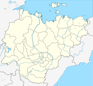
_Republic_(2008-03).svg.png) Location of the Sakha (Yakutia) Republic in Russia | |
 Zhigansk | |
|
| |
| Administrative status (as of June 2009) | |
| Country | Russia |
| Federal subject | Sakha Republic[1] |
| Administrative district | Zhigansky District[1] |
| Rural okrug | Zhigansky Rural Okrug[1] |
| Administrative center of | Zhigansky Rural Okrug[1] |
| Municipal status (as of April 2012) | |
| Municipal district | Zhigansky Municipal District[2] |
| Rural settlement | Zhigansky Rural Settlement[2] |
| Administrative center of | Zhigansky Rural Settlement[2] |
| Statistics | |
| Population (2010 Census) | 3,420 inhabitants[3] |
| Time zone | YAKT (UTC+09:00)[4] |
| Founded | 1632 |
| Rural locality status since | 1783 |
| Postal code(s)[5] | 678330, 678349 |
| Zhigansk on Wikimedia Commons | |
Zhigansk (Russian: Жига́нск; Yakut: Эдьигээн, Ecigeen, IPA: [eɟigeːn]) is a rural locality (a selo) and the administrative center of Zhigansky District in the Sakha Republic, Russia, located on the left bank of the Lena River near where it is joined by its tributary the Nuora, approximately 600 kilometers (370 mi) northwest of Yakutsk, the capital of the republic. Population: 3,420 (2010 Census);[3] 3,346 (2002 Census);[6] 4,511 (1989 Census).[7]
History
It was founded in 1632 as an ostrog by Cossacks led by Pyotr Beketov. In 1783, Zhigansk was granted town status and made the seat of a newly created uyezd within Yakutsk Oblast. It lost this function in 1805 with the dissolution of the uyezd, but remained the most northerly town on the Lena until 1917, when it was demoted to rural status.
In 1930, Zhigansk became the administrative center of the newly created Zhigansky District, which was declared an "Evenk National District" due to its large population of Evenks. In 2002, Evenks represented around 47% of the local population and Yakuts a further 34%.
Transportation
Zhigansk is served by the Zhigansk Airport.[8]
There is no year-round road access to Zhigansk, but during the summer months Yakutsk is reachable via boat on the Lena. In the months when the river is frozen, a winter road also leads to Yakutsk.
Climate
Zhigansk has an extreme subarctic climate (Köppen climate classification Dfd), with extremely cold winters, although not quite as cold as Verkhoyansk or Oymyakon further east. Precipitation is quite low but is somewhat higher in summer than at other times of the year.
| Climate data for Zhigansk | |||||||||||||
|---|---|---|---|---|---|---|---|---|---|---|---|---|---|
| Month | Jan | Feb | Mar | Apr | May | Jun | Jul | Aug | Sep | Oct | Nov | Dec | Year |
| Record high °C (°F) | −11.4 (11.5) |
−10.1 (13.8) |
4.6 (40.3) |
11.9 (53.4) |
28.5 (83.3) |
32.5 (90.5) |
34.6 (94.3) |
30.6 (87.1) |
24.0 (75.2) |
12.7 (54.9) |
−0.4 (31.3) |
−10.4 (13.3) |
34.6 (94.3) |
| Average high °C (°F) | −35.5 (−31.9) |
−31.0 (−23.8) |
−18.1 (−0.6) |
−5.0 (23) |
6.0 (42.8) |
17.3 (63.1) |
21.4 (70.5) |
17.0 (62.6) |
7.9 (46.2) |
−7.2 (19) |
−25.8 (−14.4) |
−33.5 (−28.3) |
−7.21 (19.02) |
| Daily mean °C (°F) | −38.8 (−37.8) |
−34.4 (−29.9) |
−23.3 (−9.9) |
−10.6 (12.9) |
1.5 (34.7) |
12.1 (53.8) |
16.1 (61) |
12.0 (53.6) |
3.7 (38.7) |
−10.3 (13.5) |
−29.3 (−20.7) |
−36.9 (−34.4) |
−11.52 (11.29) |
| Average low °C (°F) | −42.2 (−44) |
−38.2 (−36.8) |
−28.5 (−19.3) |
−16.6 (2.1) |
−3.2 (26.2) |
7.1 (44.8) |
10.7 (51.3) |
6.9 (44.4) |
−0.1 (31.8) |
−13.6 (7.5) |
−32.9 (−27.2) |
−40.5 (−40.9) |
−15.92 (3.32) |
| Record low °C (°F) | −59.6 (−75.3) |
−58.1 (−72.6) |
−51.9 (−61.4) |
−44.4 (−47.9) |
−22.6 (−8.7) |
−4.5 (23.9) |
−2.1 (28.2) |
−5.4 (22.3) |
−21.7 (−7.1) |
−42.6 (−44.7) |
−53.4 (−64.1) |
−60.0 (−76) |
−60 (−76) |
| Average precipitation mm (inches) | 10.4 (0.409) |
11.4 (0.449) |
11.9 (0.469) |
12.4 (0.488) |
21.8 (0.858) |
36.2 (1.425) |
46.3 (1.823) |
45.8 (1.803) |
37.5 (1.476) |
37.4 (1.472) |
18.1 (0.713) |
13.6 (0.535) |
302.8 (11.92) |
| Average precipitation days (≥ 0.1 mm) | 22.7 | 17.7 | 14.1 | 11.8 | 10.9 | 13.1 | 9.6 | 12.1 | 15.3 | 25.6 | 24.3 | 20.8 | 198 |
| Average relative humidity (%) | 76.1 | 76.0 | 72.7 | 63.0 | 57.9 | 61.3 | 67.2 | 76.1 | 78.0 | 85.0 | 80.5 | 76.0 | 72.48 |
| Mean monthly sunshine hours | 9.3 | 96.6 | 215.5 | 286.5 | 299.2 | 330.0 | 337.9 | 243.4 | 130.5 | 57.4 | 22.5 | 0.0 | 2,028.8 |
| Source: climatebase.ru (1948–2011)[9] | |||||||||||||
References
Notes
- 1 2 3 4 5 6 Registry of the Administrative-Territorial Divisions of the Sakha Republic
- 1 2 3 Law #173-Z 353-III
- 1 2 Russian Federal State Statistics Service (2011). "Всероссийская перепись населения 2010 года. Том 1" [2010 All-Russian Population Census, vol. 1]. Всероссийская перепись населения 2010 года (2010 All-Russia Population Census) (in Russian). Federal State Statistics Service. Retrieved June 29, 2012.
- ↑ Правительство Российской Федерации. Федеральный закон №107-ФЗ от 3 июня 2011 г. «Об исчислении времени», в ред. Федерального закона №271-ФЗ от 03 июля 2016 г. «О внесении изменений в Федеральный закон "Об исчислении времени"». Вступил в силу по истечении шестидесяти дней после дня официального опубликования (6 августа 2011 г.). Опубликован: "Российская газета", №120, 6 июня 2011 г. (Government of the Russian Federation. Federal Law #107-FZ of June 31, 2011 On Calculating Time, as amended by the Federal Law #271-FZ of July 03, 2016 On Amending Federal Law "On Calculating Time". Effective as of after sixty days following the day of the official publication.).
- ↑ Почта России. Информационно-вычислительный центр ОАСУ РПО. (Russian Post). Поиск объектов почтовой связи (Postal Objects Search) (Russian)
- ↑ Russian Federal State Statistics Service (May 21, 2004). "Численность населения России, субъектов Российской Федерации в составе федеральных округов, районов, городских поселений, сельских населённых пунктов – районных центров и сельских населённых пунктов с населением 3 тысячи и более человек" [Population of Russia, Its Federal Districts, Federal Subjects, Districts, Urban Localities, Rural Localities—Administrative Centers, and Rural Localities with Population of Over 3,000] (XLS). Всероссийская перепись населения 2002 года [All-Russia Population Census of 2002] (in Russian). Retrieved August 9, 2014.
- ↑ Demoscope Weekly (1989). "Всесоюзная перепись населения 1989 г. Численность наличного населения союзных и автономных республик, автономных областей и округов, краёв, областей, районов, городских поселений и сёл-райцентров" [All Union Population Census of 1989: Present Population of Union and Autonomous Republics, Autonomous Oblasts and Okrugs, Krais, Oblasts, Districts, Urban Settlements, and Villages Serving as District Administrative Centers]. Всесоюзная перепись населения 1989 года [All-Union Population Census of 1989] (in Russian). Институт демографии Национального исследовательского университета: Высшая школа экономики [Institute of Demography at the National Research University: Higher School of Economics]. Retrieved August 9, 2014.
- ↑ "Zhigansk Airport". OurAirports. Retrieved January 19, 2013.
- ↑ "Zhigansk, Russia". Climatebase.ru. Retrieved January 21, 2013.
Sources
- Official website of the Sakha Republic. Registry of the Administrative-Territorial Divisions of the Sakha Republic. Zhigansky District. (Russian)
- Государственное Собрание (Ил Тумэн) Республики Саха (Якутия). Закон №173-З №353-III от 30 ноября 2004 г. «Об установлении границ и о наделении статусом городского и сельского поселений муниципальных образований Республики Саха (Якутия)», в ред. Закона №1058-З №1007-IV от 25 апреля 2012 г. «О внесении изменений в Закон Республики Саха (Якутия) "Об установлении границ и о наделении статусом городского и сельского поселений муниципальных образований Республики Саха (Якутия)"». Вступил в силу со дня официального опубликования. Опубликован: "Якутия", №245, 31 декабря 2004 г. (State Assembly (Il Tumen) of the Sakha (Yakutia) Republic. Law #173-Z No. 353-III of November 30, 2004 On Establishing the Borders and on Granting the Urban and Rural Settlement Status to the Municipal Formations of the Sakha (Yakutia) Republic, as amended by the Law #1058-Z No. 1007-IV of April 25, 2012 On Amending the Law of the Sakha (Yakutia) Republic "On Establishing the Borders and on Granting the Urban and Rural Settlement Status to the Municipal Formations of the Sakha (Yakutia) Republic". Effective as of the day of the official publication.).