Zhangwu County
| Zhangwu County 彰武县 | |
|---|---|
| County | |
 Location in Fuxin City | |
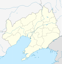 Zhangwu Location of the seat in Liaoning | |
| Coordinates: 42°23′N 122°32′E / 42.383°N 122.533°ECoordinates: 42°23′N 122°32′E / 42.383°N 122.533°E | |
| Country | People's Republic of China |
| Province | Liaoning |
| Prefecture-level city | Fuxin |
| Township-level divisions |
|
| County seat | Zhangwu Town (彰武镇) |
| Area | |
| • Total | 3,635 km2 (1,403 sq mi) |
| Elevation | 84 m (275 ft) |
| Population | |
| • Total | 410,000 |
| • Density | 110/km2 (290/sq mi) |
| Time zone | China Standard (UTC+8) |
| Postal code | 123200 |
| Area code(s) | 0418 |
| Website |
zhangwu |
Zhangwu County (Chinese: 彰武; pinyin: Zhāngwǔ) is a county in the north of Liaoning province, China. It is under the administration of Fuxin City, the centre of which lies 82 kilometres (51 mi) to the southwest, with a population of 410,000 residing in an area of 3,635 km2 (1,403 sq mi). It is served by G25 Changchun–Shenzhen Expressway, G2511 Xinmin–Lubei Expressway, and China National Highways 101 and 304.
Geography
Zhangwu County has a monsoon-influenced humid continental climate (Köppen Dwa), with great seasonal contrast in temperature, precipitation, and humidity. Winters are long and cold, with a January average of −11.7 °C (10.9 °F), while summers are hot and humid, with a July average of 24.1 °C (75.4 °F). Precipitation is very low in winter and is heavily concentrated in the summer months. With monthly percent possible sunshine ranging from 46% in July to 67% in January and February, there are 2,673 hours of bright sunshine annually. The annual mean temperature is 7.54 °C (45.6 °F).
| Climate data for Zhangwu County (1971−2000) | |||||||||||||
|---|---|---|---|---|---|---|---|---|---|---|---|---|---|
| Month | Jan | Feb | Mar | Apr | May | Jun | Jul | Aug | Sep | Oct | Nov | Dec | Year |
| Average high °C (°F) | −5.4 (22.3) |
−1.2 (29.8) |
6.5 (43.7) |
16.1 (61) |
23.0 (73.4) |
27.3 (81.1) |
28.9 (84) |
28.1 (82.6) |
23.6 (74.5) |
15.5 (59.9) |
5.0 (41) |
−2.8 (27) |
13.7 (56.7) |
| Average low °C (°F) | −17.1 (1.2) |
−13.5 (7.7) |
−5.6 (21.9) |
2.8 (37) |
10.1 (50.2) |
15.9 (60.6) |
19.8 (67.6) |
18.2 (64.8) |
10.9 (51.6) |
3.0 (37.4) |
−6.2 (20.8) |
−13.9 (7) |
2.0 (35.7) |
| Average precipitation mm (inches) | 2.0 (0.079) |
2.0 (0.079) |
10.2 (0.402) |
24.9 (0.98) |
41.4 (1.63) |
87.7 (3.453) |
144.9 (5.705) |
103.1 (4.059) |
57.3 (2.256) |
24.6 (0.969) |
8.3 (0.327) |
2.7 (0.106) |
509.1 (20.045) |
| Average precipitation days (≥ 0.1 mm) | 1.8 | 2.1 | 3.5 | 6.2 | 8.4 | 12.3 | 12.7 | 10.5 | 7.7 | 5.3 | 3.1 | 1.8 | 75.4 |
| Average relative humidity (%) | 54 | 49 | 47 | 50 | 53 | 67 | 79 | 79 | 70 | 61 | 58 | 57 | 60.3 |
| Mean monthly sunshine hours | 194.5 | 199.6 | 240.3 | 245.2 | 267.2 | 251.8 | 214.1 | 230.3 | 241.2 | 224.7 | 186.0 | 178.4 | 2,673.3 |
| Percent possible sunshine | 67 | 67 | 65 | 62 | 60 | 55 | 46 | 54 | 65 | 66 | 63 | 63 | 62 |
| Source: China Meteorological Administration | |||||||||||||
Administrative divisions
There are eight towns, 12 townships, and four ethnic townships in the county.[1]
Towns:
- Zhangwu (彰武镇)
- Harto (哈尔套镇)
- Zhanggutai (章古台镇)
- Dongliujiazi (东六家子镇)
- Wufeng (五峰镇)
- Fengjia (冯家镇)
- Houxinqiu (后新邱镇)
- A'erxiang (阿尔乡镇)
Townships:
|
|
References
- ↑ 2011年统计用区划代码和城乡划分代码:彰武县 (in Chinese). National Bureau of Statistics of the People's Republic of China. Retrieved 2012-07-17.