Zeewolde
| Zeewolde | |||
|---|---|---|---|
| Municipality | |||
|
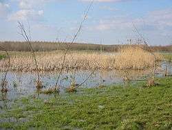
Horsterwold forest | |||
| |||
.svg.png) Location in Flevoland | |||
| Coordinates: 52°20′N 5°33′E / 52.333°N 5.550°ECoordinates: 52°20′N 5°33′E / 52.333°N 5.550°E | |||
| Country | Netherlands | ||
| Province | Flevoland | ||
| Established | 1 January 1984 | ||
| Government[1] | |||
| • Body | Municipal council | ||
| • Mayor | Gerrit Jan Gorter | ||
| Area[2] | |||
| • Total | 268.86 km2 (103.81 sq mi) | ||
| • Land | 248.54 km2 (95.96 sq mi) | ||
| • Water | 20.32 km2 (7.85 sq mi) | ||
| Elevation[3] | 2 m (7 ft) | ||
| Population (May 2014)[4] | |||
| • Total | 21,530 | ||
| • Density | 87/km2 (230/sq mi) | ||
| Time zone | CET (UTC+1) | ||
| • Summer (DST) | CEST (UTC+2) | ||
| Postcode | 3890–3899 | ||
| Area code | 036 | ||
| Website |
www | ||


Zeewolde (![]() pronunciation ) is a municipality and a town in the Flevoland province in the central Netherlands. It has a population of approximately 20,000. It is situated in the polder of Flevoland with the small lake called the Wolderwijd to the east. To the south is a large deciduous forest called the Horsterwold. The area to the west is principally agricultural.
pronunciation ) is a municipality and a town in the Flevoland province in the central Netherlands. It has a population of approximately 20,000. It is situated in the polder of Flevoland with the small lake called the Wolderwijd to the east. To the south is a large deciduous forest called the Horsterwold. The area to the west is principally agricultural.
Zeewolde is known for its landscape and nature art; the most well-known art work is Sea Level by Richard Serra, located in the Landschapspark De Wetering. Edinburgh Rugby players and brothers Tim and Sep Visser come from Zeewolde.
In the wood Hulkesteinse Bos there is the nudist resort Flevo-Natuur, with recreation bungalows, a camp site, and the possibility of day recreation.[5]
History
The municipality of Zeewolde was founded in 1984 and is therefore one of the youngest in the Netherlands. Before 1984, the area was administrated by the Openbaar Lichaam Zuidelijke IJsselmeerpoldersNL (OLZIJ) (English: Public Body of Southern IJsselmeer Polders), founded by the Dutch national government after the province of Flevoland was created. The name 'Zeewolde' was always meant to be used during the planning stages, but on various locations.
Zeewolde's first inhabitants were the so-called 'pioneers', moving in from the 'old land' to the newly created polder in 1979. They were mostly farmers and in the beginning stages deprived of amenities such as electricity or tap water. The planned village was then mostly meant to provide services to the neighbouring farmers. Alongside the farmers, two holiday resorts were founded in the area.
In August 1980, the Zeewolde advisory board, headed by Han Lammers who was at the time the head of the OLZIJ, met for the first time. In February 1982, municipal elections were held and the first streekplan (Structural plan) was drawn, envisaging the village to grow to 15.000 inhabitants. The actual village itself was started in 1983, after which in 1984 Zeewolde became a municipality in its own right. On 23 February 1984, the official first inhabitant of the village of Zeewolde was handed the keys of his house.
Topography

Dutch Topographic map of the municipality of Zeewolde, Sept. 2014.
Transportation
There are no railway stations in the municipality, but the nearest stations are Harderwijk, Nijkerk and the stations in Almere.
References
- ↑ "Samenstelling College van B&W" [Members of the board of mayor and aldermen] (in Dutch). Gemeente Zeewolde. Retrieved 5 September 2013.
- ↑ "Kerncijfers wijken en buurten" [Key figures for neighbourhoods]. CBS Statline (in Dutch). CBS. 2 July 2013. Retrieved 12 March 2014.
- ↑ "Postcodetool for 3891ER". Actueel Hoogtebestand Nederland (in Dutch). Het Waterschapshuis. Retrieved 5 September 2013.
- ↑ "Bevolkingsontwikkeling; regio per maand" [Population growth; regions per month]. CBS Statline (in Dutch). CBS. 26 June 2014. Retrieved 24 July 2014.
- ↑ Flevo-Natuur
External links
| Wikimedia Commons has media related to Zeewolde. |
 |
Lelystad | Dronten | | |
| Almere | |
Wolderwijd / Harderwijk (GE) Nuldernauw / Ermelo (GE) | ||
| ||||
| | ||||
| Eemnes (UT), Bunschoten (UT) / Eemmeer | Nijkerkernauw Nijkerk (GE) |
Nuldernauw / Putten (GE) |
Municipalities of Flevoland | ||
|---|---|---|
 | ||
| ||