Zaysan (town)
| Zaysan Зайсан | |
|---|---|
 Zaysan | |
| Coordinates: 47°28′00″N 84°52′00″E / 47.46667°N 84.86667°ECoordinates: 47°28′00″N 84°52′00″E / 47.46667°N 84.86667°E | |
| Country |
|
| Region | East Kazakhstan Region |
| Founded: Established: |
1868 1941 |
| Elevation | 660 m (2,170 ft) |
| Population (2009) | |
| • Total | 14,389 |
| Time zone | OMST (UTC+6) |
| • Summer (DST) | OMSST (UTC+7) |
Zaysan (or Zaisan; Kazakh and Russian: Зайсан) is a town in the East Kazakhstan Region of Kazakhstan, the administrative center of Zaysan District. It is situated near the southeastern corner of Lake Zaysan at an altitude of 660 meters (2170 ft) above sea level.[1] Population: 14,389 (2009 Census results);[2] 16,021 (1999 Census results).[2]
History
Zaysan was founded in 1868 as a Russian military post.[3]
Climate
| Climate data for Zaysan | |||||||||||||
|---|---|---|---|---|---|---|---|---|---|---|---|---|---|
| Month | Jan | Feb | Mar | Apr | May | Jun | Jul | Aug | Sep | Oct | Nov | Dec | Year |
| Average high °C (°F) | −12 (11) |
−9 (15) |
−1 (31) |
13 (55) |
21 (70) |
26 (79) |
28 (83) |
27 (80) |
21 (70) |
12 (54) |
−1 (30) |
−10 (14) |
9 (49) |
| Average low °C (°F) | −21 (−6) |
−19 (−3) |
−12 (11) |
1 (34) |
9 (49) |
14 (58) |
17 (63) |
16 (60) |
9 (49) |
2 (35) |
−11 (13) |
−18 (−1) |
−1 (30) |
| Average precipitation mm (inches) | 18 (0.7) |
10 (0.4) |
36 (1.4) |
30 (1.2) |
33 (1.3) |
33 (1.3) |
50 (2) |
38 (1.5) |
23 (0.9) |
36 (1.4) |
33 (1.3) |
20 (0.8) |
363 (14.3) |
| Source: Weatherbase [4] | |||||||||||||
References
- ↑ Falling Rain Global Gazetteer entry for Zaysan, Kazakhstan. Retrieved January 29, 2006.
- 1 2 "Население Республики Казахстан" (in Russian). Департамент социальной и демографической статистики. Retrieved 8 December 2013.
- ↑ Cohen, Saul (1998). The Columbia Gazetteer of the World. Columbia University Press. p. 3547.
- ↑ "Weatherbase: Historical Weather for Zaysan, Kazakhstan". Weatherbase. 2011. Retrieved on November 24, 2011.
External links
Capital: Oskemen | ||
| Districts | 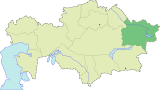 | |
| Major cities | ||
This article is issued from Wikipedia - version of the 9/19/2016. The text is available under the Creative Commons Attribution/Share Alike but additional terms may apply for the media files.