Ypsilanti Township, Stutsman County, North Dakota
For other uses of Ypsilanti, see Ypsilanti (disambiguation).
| Ypsilanti Township, North Dakota | |
|---|---|
| Township | |
 Ypsilanti Township, North Dakota Location within the state of North Dakota | |
| Coordinates: 46°46′20″N 98°32′2″W / 46.77222°N 98.53389°WCoordinates: 46°46′20″N 98°32′2″W / 46.77222°N 98.53389°W | |
| Country | United States |
| State | North Dakota |
| County | Stutsman |
| Area | |
| • Total | 36.1 sq mi (93.4 km2) |
| • Land | 36.1 sq mi (93.4 km2) |
| • Water | 0.0 sq mi (0.0 km2) |
| Elevation | 1,447 ft (441 m) |
| Population (2000) | |
| • Total | 168 |
| • Density | 4.7/sq mi (1.8/km2) |
| Time zone | Central (CST) (UTC-6) |
| • Summer (DST) | CDT (UTC-5) |
| ZIP code | 58497 |
| Area code(s) | 701 |
| FIPS code | 38-88060[1] |
| GNIS feature ID | 1036451[2] |
Ypsilanti Township is one of the sixty-two townships of Stutsman County, North Dakota, in the United States. The population was 168 at the 2000 census. The median household income was $29,444.
History
The United States Government granted 621 acres of land to the Northern Pacific Railroad in 1879. Part of this land became Ypsilanti Township and the Ypsilanti townsite. The town and township were named for Ypsilanti, Michigan.[3][4]
References
- ↑ "American FactFinder". United States Census Bureau. Archived from the original on September 11, 2013. Retrieved 2008-01-31.
- ↑ "US Board on Geographic Names". United States Geological Survey. 2007-10-25. Retrieved 2008-01-31.
- ↑ 1982 Centennial Committee. 1882-1982 Ypsilanti Centennial. Two Rivers Printing, 1982, p.1.
- ↑ Ypsilanti, North Dakota 58497. Retrieved 2013-04-24.
External links
Municipalities and communities of Stutsman County, North Dakota, United States | ||
|---|---|---|
| Cities | 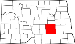 | |
| Townships |
| |
| CDPs | ||
| Unorganized territories |
| |
| Unincorporated communities | ||
This article is issued from Wikipedia - version of the 7/21/2016. The text is available under the Creative Commons Attribution/Share Alike but additional terms may apply for the media files.