Yettem, California
| Yettem | |
|---|---|
| census-designated place | |
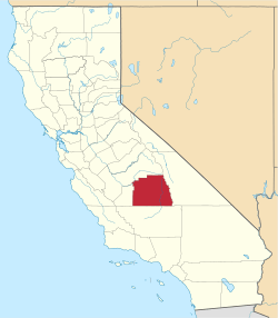
 Yettem Position in California. | |
| Coordinates: 36°29′12″N 119°15′18″W / 36.48667°N 119.25500°WCoordinates: 36°29′12″N 119°15′18″W / 36.48667°N 119.25500°W | |
| Country |
|
| State |
|
| County | Tulare |
| Area[1] | |
| • Total | 0.153 sq mi (0.398 km2) |
| • Land | 0.153 sq mi (0.398 km2) |
| • Water | 0 sq mi (0 km2) 0% |
| Elevation[2] | 348 ft (106 m) |
| Population (2010) | |
| • Total | 211 |
| • Density | 1,400/sq mi (530/km2) |
| Time zone | Pacific (PST) (UTC-8) |
| • Summer (DST) | PDT (UTC-7) |
| ZIP code | 93670 |
| Area code(s) | 559 |
| GNIS feature IDs | 1661715; 2585465 |
| U.S. Geological Survey Geographic Names Information System: Yettem, California; U.S. Geological Survey Geographic Names Information System: Yettem, California | |
Yettem is a census-designated place (CDP) in Tulare County, California.[2] Yettem is located on California State Route 201 11 miles (18 km) north of Visalia. Yettem has a post office with ZIP code 93670.[3] Yettem sits at an elevation of 348 feet (106 m).[2] The 2010 United States census reported Yettem's population was 211.
Yettem's name was Lovell until Hagop Hamalian, the town storekeeper and postmaster, along with Ezekiel Kendigian and Devlat Agha Moorsalian submitted Armenia, Ararat, and Yettem as suggestions for a name change for the town to the Post Office Department, which chose Yettem.[4] Yettem, is how Western Armenians pronounce the Armenian word for Eden. Although most of the Armenian population has moved away, there is still an active St. Mary's Armenian Church in Yettem.[5]
Geography
According to the United States Census Bureau, the CDP covers an area of 0.2 square miles (0.4 km²), all of it land.
Demographics
The 2010 United States Census[6] reported that Yettem had a population of 211. The population density was 1,374.7 people per square mile (530.8/km²). The racial makeup of Yettem was 48 (22.7%) White, 5 (2.4%) African American, 0 (0.0%) Native American, 0 (0.0%) Asian, 0 (0.0%) Pacific Islander, 148 (70.1%) from other races, and 10 (4.7%) from two or more races. Hispanic or Latino of any race were 199 persons (94.3%).
The Census reported that 211 people (100% of the population) lived in households, 0 (0%) lived in non-institutionalized group quarters, and 0 (0%) were institutionalized.
There were 51 households, out of which 35 (68.6%) had children under the age of 18 living in them, 32 (62.7%) were opposite-sex married couples living together, 7 (13.7%) had a female householder with no husband present, 6 (11.8%) had a male householder with no wife present. There were 4 (7.8%) unmarried opposite-sex partnerships, and 0 (0%) same-sex married couples or partnerships. 5 households (9.8%) were made up of individuals and 4 (7.8%) had someone living alone who was 65 years of age or older. The average household size was 4.14. There were 45 families (88.2% of all households); the average family size was 4.38.
The population was spread out with 78 people (37.0%) under the age of 18, 36 people (17.1%) aged 18 to 24, 55 people (26.1%) aged 25 to 44, 32 people (15.2%) aged 45 to 64, and 10 people (4.7%) who were 65 years of age or older. The median age was 23.8 years. For every 100 females there were 119.8 males. For every 100 females age 18 and over, there were 121.7 males.
There were 62 housing units at an average density of 403.9 per square mile (156.0/km²), of which 13 (25.5%) were owner-occupied, and 38 (74.5%) were occupied by renters. The homeowner vacancy rate was 23.5%; the rental vacancy rate was 11.6%. 43 people (20.4% of the population) lived in owner-occupied housing units and 168 people (79.6%) lived in rental housing units.
References
- ↑ U.S. Census Archived 2012-07-14 at WebCite
- 1 2 3 U.S. Geological Survey Geographic Names Information System: Yettem, California
- ↑ ZIP Code Lookup
- ↑ http://www.putnampit.com/yettem_html.html
- ↑ http://www.stmaryyettem.org
- ↑ "2010 Census Interactive Population Search: CA - Yettem CDP". U.S. Census Bureau. Retrieved July 12, 2014.