Yeongcheon
| Yeongcheon 영천시 | ||
|---|---|---|
| Municipal City | ||
| Korean transcription(s) | ||
| • Hangul | 영천시 | |
| • Hanja | 永川市 | |
| • Revised Romanization | Yeongcheon-si | |
| • McCune-Reischauer | Yŏngch'ŏn-si | |
 | ||
| ||
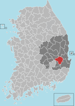 Location in South Korea | ||
| Country |
| |
| Region | Yeongnam | |
| Administrative divisions | 1 eup, 10 myeon, 5 dong | |
| Area | ||
| • Total | 919.76 km2 (355.12 sq mi) | |
| Population (2003) | ||
| • Total | 113,807 | |
| • Density | 123.7/km2 (320/sq mi) | |
| • Dialect | Gyeongsang | |
Yeongcheon (Hangul: 영천) is a city in North Gyeongsang Province, South Korea.
Yeongcheon is located 350 km southeast of Seoul, in the southeast of North Gyeongsang Province. It is on the Gyeongbu Expressway linking Seoul and Busan, and is also the junction of the Jungang and Daegu railway lines.
Symbols
- City bird: pigeon
- City flower: rose
- City tree: ginkgo
Economy of Yeongcheon
As a rural city, many of Yeongcheon's citizens farm to earn their living. The most well-known crop is the grape, which is generally large, seeded and often peeled before consuming (due to Koreans' concern over fertilizers and pesticides).
Festivals
The Bohyeon Mountain Starlight Festival takes place in summer and is centered in the Bohyeon Mountain Observatory, which houses the third-largest telescope in Korea. In late summer, the Grape Festival takes place, hosting events such as the Miss Grape contest and a grape-eating competition. Yeongcheon is also well known for its Herbal Medicine Festival, which takes place in October and hosts traditional singing and lots of herbs.
People
Notable individuals born in the city include Goryeo period general Choe Mu-seon and Goryeo intellectual Jeong Mong-ju. Also, it was the hometown of Paek Gun Sang, a tremendous Korean War veteran, who led himself to a high government position without being paid any kind of salary during the Korean War.
Notable Tourist Destinations
Tourists to Yeongcheon are few, but popular destinations include Eunhaesa Temple, the War Memorial Park, Cyan Art Gallery, Yeongcheon Dam, the Jeong Sowon and Gatbawi.
Climate
| Climate data for Yeongcheon (1981–2010) | |||||||||||||
|---|---|---|---|---|---|---|---|---|---|---|---|---|---|
| Month | Jan | Feb | Mar | Apr | May | Jun | Jul | Aug | Sep | Oct | Nov | Dec | Year |
| Average high °C (°F) | 5.0 (41) |
7.7 (45.9) |
12.8 (55) |
19.8 (67.6) |
24.5 (76.1) |
27.3 (81.1) |
29.5 (85.1) |
30.3 (86.5) |
26.0 (78.8) |
21.4 (70.5) |
14.2 (57.6) |
7.6 (45.7) |
18.8 (65.8) |
| Daily mean °C (°F) | −1.0 (30.2) |
1.2 (34.2) |
6.0 (42.8) |
12.5 (54.5) |
17.3 (63.1) |
21.3 (70.3) |
24.6 (76.3) |
25.1 (77.2) |
20.0 (68) |
13.7 (56.7) |
6.9 (44.4) |
0.9 (33.6) |
12.4 (54.3) |
| Average low °C (°F) | −6.4 (20.5) |
−4.5 (23.9) |
−0.2 (31.6) |
5.0 (41) |
10.4 (50.7) |
15.9 (60.6) |
20.6 (69.1) |
21.0 (69.8) |
15.1 (59.2) |
7.4 (45.3) |
0.7 (33.3) |
−4.6 (23.7) |
6.7 (44.1) |
| Average precipitation mm (inches) | 22.6 (0.89) |
27.3 (1.075) |
46.9 (1.846) |
62.4 (2.457) |
87.2 (3.433) |
135.8 (5.346) |
224.4 (8.835) |
225.3 (8.87) |
135.0 (5.315) |
31.8 (1.252) |
32.8 (1.291) |
15.2 (0.598) |
1,046.8 (41.213) |
| Average precipitation days (≥ 0.1 mm) | 4.0 | 5.1 | 7.1 | 7.2 | 8.3 | 9.0 | 13.0 | 12.0 | 8.8 | 4.2 | 4.6 | 3.5 | 86.8 |
| Average relative humidity (%) | 58.0 | 58.2 | 59.4 | 57.0 | 61.9 | 68.6 | 75.3 | 74.8 | 73.8 | 68.3 | 65.0 | 61.3 | 65.1 |
| Mean monthly sunshine hours | 169.4 | 179.5 | 203.4 | 222.7 | 232.1 | 196.8 | 172.3 | 187.2 | 167.4 | 198.8 | 160.4 | 156.6 | 2,248.9 |
| Source: Korea Meteorological Administration[1] | |||||||||||||
Sister cities
See also
- List of cities in South Korea
- Yeongcheon River in South Korea
References
http://www.nytimes.com/2007/02/22/world/asia/22brides.html?pagewanted=2 http://en.yc.go.kr/
- ↑ "평년값자료(1981–2010) 영천(281)". Korea Meteorological Administration. Retrieved 2011-05-11.
- 1 2 "Yeongcheon official home page". Sister cities. Retrieved 20 November 2015.
External links
Andong (capital) | ||||
 | Specific city |
| ||
| Cities | ||||
| Counties | ||||
Coordinates: 35°58′24″N 128°56′19″E / 35.973196°N 128.938612°E