Didim

| Didim | |
|---|---|
 Didim | |
| Coordinates: TR 37°22′32″N 27°16′04″E / 37.3756°N 27.2678°ECoordinates: TR 37°22′32″N 27°16′04″E / 37.3756°N 27.2678°E | |
| Country |
|
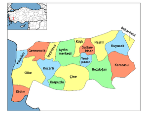
| Province | Aydın |
| District | Didim |
| Government | |
| • Mayor | Ahmet Deniz Atabay (CHP) |
| • Kaymakam | İskender Yönden |
| Area[1] | |
| • District | 333.10 km2 (128.61 sq mi) |
| Population (2012)[2] | |
| • Urban | 47,872 |
| • District | 59,939 |
| • District density | 180/km2 (470/sq mi) |
| Post code | 09256 |
| Website |
www |


Didim is a small town, popular seaside holiday resort, and district of Aydın Province on the Aegean coast of western Turkey, 123 km (76 mi) from the provincial capital city of Aydın. Didim is the site of the antique city of Didyma with its ruined Temple of Apollo.
Etymology
Didim takes its name from ancient Didyma, situated close to the modern town. During the Ottoman Empire era, the town was known as Yoranda or Yoran, and under the modern Republic of Turkey, it was originally named Hisar ("Castle"). Following its destruction in an earthquake in 1955, the town was rebuilt and renamed Yenihisar ("New Castle"). The town was part of Söke district until 1991. The area became a top-level district of Aydın Province and was given the ancient name Didim in 1997 to distinguish it from the many other places in Turkey named Yenihisar.
Geography
Didim is located on the north shore of the gulf of Güllük, opposite Bodrum peninsula villages such as Torba, Türkbükü, and Yalıkavak. The district consists of Didim itself, a coastal town of 26,000 people, and a number of small towns including Altınkum (which means "golden sand"), Gümüşkum ("silver sand") and Sarıkum ("yellow sand"). Its neighbours are Söke from north-east and Milas from south-east.
Tourism is the main source of income for the area, especially in summer, but agriculture is also an important contributor; the main crops are wheat and cotton. Animals, especially sheep and goats, are raised mainly for local consumption.
Geographic divisions
Altinkum- West
Yalıköy - West
Mavişehir - West
Mersindere - West
Cumhuriyet - Central
Efeler - Central
Yenimahalle - Central
Çamlık - South - third beach, main beach, and D-Marin Didim
Altınkum - South - main beach and second beach
Fevzipaşa - South
Yeşilkent - South/East
History
The area was settled in the neolithic period, established as colony of Crete and then Mycenae in the 16th century BC and subsequently possessed by Lycians, Persians, Seleucids, Attalids, Ancient Romans, and Byzantines as part of the province of Caria. The area came into the hands of Turks following the defeat of Byzantium at the Battle of Malazgirt in 1086. The town was captured again by the Byzantines in 1098, by Menteşe in 1280, and then Aydinids in 1300. Didim was brought into the Ottoman Empire by sultan Mehmed I in 1413. At Ottoman Empire Didim's name Was "Yoran".
Tourism

This coast has become a very popular holiday resort, known for its long sandy beaches, clear blue sea, ancient ruins, and its own microclimate, benefiting from hundreds of days of sun annually and warm winters, allowing residents to use the beaches and engage in watersports even in January. Less frequented beaches are ones further from the centre, such as Haydar, along a dirt road around the shore of Akbük (meaning "white bay").
Recent renewal of main roads means the area is easily served by Bodrum and İzmir airports.
Because of Didim's location, people in the 1980s came from large cities around Turkey, especially Ankara, began to buy holiday homes, apartments, and villas in the area. Most of these were built as cooperative housing projects with private beaches. The attraction of the area is proved by the number of Ankara families that have now been going to Didim for two or more generations. Property values have recently been rising, and the building boom continues as foreign buyers, especially the families of Turks living and working in Europe, follow their lead. The growth of Didim in the 1980s was further accelerated with the building of hotels to accommodate visitors, originally from Britain but now from Turkey itself, on inexpensive package holidays. Since about 2000, British people have begun to buy holiday homes in Didim, establishing themselves as a visible community of many thousands, to the extent that utility bills in the district are now printed in English as well as Turkish.[3] Many bars around Didim are noted for having the Union Jack hanging inside.
Didim town has hotels, a weekly market, a waterpark, and the antique Temple of Apollo nearby. Didim is also close to a number of other ancient towns and natural formations, such as Lake Bafa national park, the Büyük Menderes River, and historic sites like Miletus and Priene.
Didim has a number of discothèques, smaller bars, and clubs, some with live music, mostly Türkü (Turkish folk music). Rakı consumption is popular among tourists and residents in Didim. The local station, Didim TV, is an amateur project by a television repair shop owner and neighbourhood councillor (muhtar), and is mostly advertisements for local shops and hotels.
Recently, a $50 million Didim Marina (D-Marin Didim) was constructed by Doğuş Holding and became operational in 2009 with berths for 8 m to 50 m boats, 400-ton boat lift, dry docks, hangars, maintenance yard, yacht club, shopping mall, restaurants, and visitor facilities. The new marina is expected to encourage further tourism and rising property prices in the area.
Places of interest
- The ruins of the Ionic Temple of Apollo with its columns pointing up into the sky and its legend of the romance between Apollo and Daphne is nearby. The original temple and home of an oracle was destroyed during the Persian Wars and the one seen today was rebuilt following Alexander the Great's victory over the Persians[4][5][6]
- Miletos, the ruins of the ancient city including a well-preserved antique theatre, stadium, baths of Faustina, and the temple of Serapis
- Denizköy VLF transmitter, a transmitter of the US military with 2,380-meter-tall guyed masts
Climate
Didim (Aydin) has a Mediterranean climate consisting of very hot, long and dry summers with an average of 34 °C (93 °F) in the daytime, winters are cool and rainy with a daytime average of 14 °C (57 °F).
| Climate data for Fethiye | |||||||||||||
|---|---|---|---|---|---|---|---|---|---|---|---|---|---|
| Month | Jan | Feb | Mar | Apr | May | Jun | Jul | Aug | Sep | Oct | Nov | Dec | Year |
| Average high °C (°F) | 13.4 (56.1) |
14.6 (58.3) |
18.1 (64.6) |
22.4 (72.3) |
28.4 (83.1) |
33.5 (92.3) |
36.1 (97) |
35.5 (95.9) |
31.9 (89.4) |
26.3 (79.3) |
19.5 (67.1) |
14.4 (57.9) |
24.51 (76.11) |
| Average low °C (°F) | 4.2 (39.6) |
4.8 (40.6) |
6.8 (44.2) |
10.1 (50.2) |
14.1 (57.4) |
18.1 (64.6) |
20.4 (68.7) |
20.1 (68.2) |
16.5 (61.7) |
12.7 (54.9) |
8.4 (47.1) |
5.5 (41.9) |
11.81 (53.26) |
| Average precipitation mm (inches) | 99.5 (3.917) |
93.0 (3.661) |
70.7 (2.783) |
53.7 (2.114) |
33.2 (1.307) |
15.7 (0.618) |
8.9 (0.35) |
5.7 (0.224) |
15.5 (0.61) |
45.4 (1.787) |
85.9 (3.382) |
111.3 (4.382) |
638.5 (25.135) |
| Average rainy days | 10.9 | 10.1 | 9.1 | 8.8 | 6.0 | 2.5 | 1.8 | 1.2 | 3.0 | 5.6 | 8.3 | 12.0 | 79.3 |
| Source: Devlet Meteoroloji İşleri Genel Müdürlüğü [7] | |||||||||||||
International relations
Twin towns — Sister cities
Didim is twinned with:
References
- ↑ "Area of regions (including lakes), km²". Regional Statistics Database. Turkish Statistical Institute. 2002. Retrieved 2013-03-05.
- ↑ "Population of province/district centers and towns/villages by districts - 2012". Address Based Population Registration System (ABPRS) Database. Turkish Statistical Institute. Retrieved 2013-02-27.
- ↑ Elsewhere | Weekend | Guardian Unlimited
- ↑ "Didim". Elevated Locations. Retrieved 27 July 2012.
- ↑ "Didyma". CNES. Retrieved 27 July 2012.
- ↑ "Didyma". Shunya. Retrieved 27 July 2012.
- ↑ İl ve İlçelerimize Ait İstatistiki Veriler- Meteoroloji Genel Müdürlüğü. Dmi.gov.tr. Retrieved on 2011-10-15.
External links
| Wikimedia Commons has media related to Didim. |
- District governor (Turkish)
- Chamber of commerce (English)
- Visit Didim (English)
- Didim Guide (English)