Yasothon
| Yasothon ยโสธร | |
|---|---|
|
Yasothon Municipal Hall | |
| Nickname(s): Mueang Yot Nakorn (Proud Capital City) | |
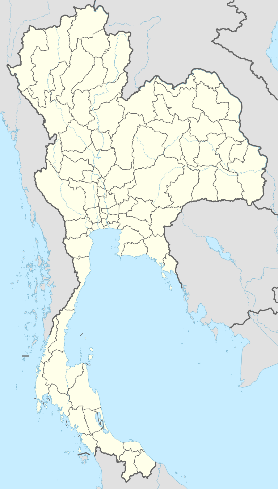 Yasothon Location in Thailand | |
| Coordinates: 15°47′50″N 104°08′35″E / 15.79722°N 104.14306°E | |
| Country |
|
| Province | Yasothon Province |
| Districts of Thailand | Amphoe Mueang Yasothon |
| Population (2005) | |
| • Total | 21,134 |
| Time zone | ICT (UTC+7) |
| Thai highway |
|

Yasothon (Thai: ยโสธร, pronounced [já.sǒː.tʰɔ̄ːn]) is a town on the Chi River in the north-eastern region of Thailand. It is the capital and administrative center of Yasothon Province and seat of its City District. Within this district, subdistrict Nai Mueang (ในเมือง In town) comprises the bounds of the town proper, which had a population of 21,134 in 2005. It lies a little more than 500 km (310 mi) north-east of Bangkok, the Thai capital.
History
Founding
In AD 1811/2354 B.E., Chao ("Lord") Racha Wong Singh (เจ้าราชวงศ์สิงห์ — Descended from Lions) more often transliterated Sing, led a number of people to landing on the River Chi, to found a town on a bluff by a deserted temple ground. Sing was a son of Chao Phraya Wichai (เจ้าพระยาวิชัยฯ) in the capital of Champasak (นครจำปาศักดิ์) The town was first called Ban Sing Kow (บ้านสิงห์เก่า Old Lion Village) or Ban Sing Tha (บ้านสิงห์ท่า).[1] While there are numerous Khmer artifacts in and around the city, no written history is known prior to that year.

A weather-worn and now nearly illegible marker erected by Thailand's Fine Arts department (กรมศิลปากร) for a Khmer chedi by Wat Sing Tha, related that during the Thonburi Era, grandson Thao Kham Su (ท้าวคำสู) called the settlement Ban Sing Thong (บ้านสิงห์ทอง Ban Gold Lion). The wat, which had been deserted until dense jungle growth blocked the landing, was cleared, re-built and renamed after the new village. The change from Thong (Gold) to Tha (ท่า) was influenced by two factors: Tha means port or landing. and also pose with many connotations.[2] Thus the change in name to Sing Tha means Port Lion, and also Imposing Lion such as those posed on the Lion Gate, and on pedestals on the temple grounds. (For the legendary version, see Symbols of Yasothon province.)
Name changes
In AD 1814/2357 B.E., King Rama II announced a change in the town's name to Mueang Yasothon (เมืองยโสธร). The name proposed had been Mueang Yotsunthon (เมืองยศสุนทร.) (The Yaso ยโส part of the name actually bestowed translates as arrogant: one pretending to Yot ยศ high rank.[3] This may not have been the intention: compare Yasodharapura and Yasovarman.) At the same time, the Chao ("Lord") of Yasothon received a new style (manner of address): Phra Sunthorn Racha Wongsa (พระสุนทรราชวงศา RTGS: phrasunotraratwongsa.)
Yasothon was successively governed by five Phra Sunthon Ratcha Wongsa: Singh or Sing, 1815–1823; Thao Sicha, 1823; Fai, 1823–1857; Thao Men, 1857–1873; Suphrom, 1873–1895.
During the 1827–1829 Laotian Rebellion led by Chao Anouvong, Fai was active in encouraging left (eastern) bank people to migrate to establish their muang on the right (western) bank of the Mekong. King Rama III, in recognition of his achievements, also appointed him as chao muang of Nakhon Phanom, and he briefly governed both Yasothon and Nakhon Phanom.[4]

Singh
On 15 August 2011, in the Thai solar calendar month of Singhakhom (สิงหาคม,) a monument was erected in the city on the grounds of Wat Srithammaram, dedicated to Singh, the first Phra Sunthon Ratcha Wongsa. Rain fell heavily as the statue was raised onto its pedestal, but the sun broke through at 5 p.m. to smile on the dedication.[5]
The town's unofficial nickname is Mueang Yot Nakhon เมืองยศนคร Proud Capital.
Bodindecha


Chao Phraya Bodindecha (เจ้าพระยาบดินทรเดชา) (1777–1849), (personal name Singh or Sing, family Singhaseni (สิงห์ ต้นสกุลสิงหเสนี) was a chancellor (สมุห์บัญชี) and army general (แม่ทัพใหญ่) during the reign of Rama III (1824-1851). He led the army from Bangkok that put down the 1826–1828 Laotian Rebellion (ปราบกบฎ) of Chao Anouvong of Vientiane (เจ้าอนุวงศ์ เวียงจันทน์). General Sing then brought his army to Yasothon to rest. The campsite is now Wat Tung Sawang Chaiyaphum (วัดทุ่งสว่างชัยภูมิ field of bright victory,) featuring a nine-spire chedi. The chedi is open to the public; its north-east corner contains the golden image of a captive, and along the south wall is a Buddha footprint.
Camp Bodindecha (ค่ายบดินทรเดชา), located west of the city proper on Route 23 (Chaeng Sanit Road ถนนแจ้งสนิท) in Ban Doet (บ้านเดิด) Tambon Doet, Amphoe Mueang, is named in his honor. The camp has been home to the Royal Thai Army 16th Infantry (กรมทหารราบที่ ๑๖) since 23 December 1985.[6] The camp also hosts the Bodindecha Golf Club, which is open to the public. 15°54′26″N 104°03′41″E / 15.907329°N 104.061321°E
During the Haw wars (ปราบกบฏฮ่อ) (1865–1890). Yasothon aided Bangkok in repelling Chinese invaders at Nong Khai.
Municipality
The local administration of Yasothon was created in 1944 as a subdistrict municipality.[7] With the creation of Yasothon province, the municipality was upgraded to a town municipality.[8]
Chinese influence

The city has a significant Thai Chinese influence. The city pillar, erected in AD 1987/2530 BE a short walk from Wat Singh Tha, is housed in a shrine (ศาลเจ้าพ่อหลักเมือง) that resembles a Chinese temple. A Chinese warrior impersonates the city spirit in the annual parade celebrating the Chinese lunar date of the shrine's dedication.
Yasothon Rocket Festival
Yasothon's rocket festival ประเพณีบุญบั้งไฟ Prapheni Bun Bang Fai |Tradition of Boon of Bong of Fire) is held annually over the weekend that falls in the middle of the month of May. The festival's origins lie in a custom of firing rockets into the sky at the start of the rice-growing season to remind King of the Sky, Phaya Thaen, to send promised rain. The festival is a competition marked by a weekend of celebration, including highly decorated floats parading through the town, accompanied by partying, dancing, music, and a fair. Friday the main thoroughfare is transformed into a parade ground lined on both sides by concert stages, which will feature Mor lam performers throughout the night. Saturday sponsored parade groups compete for prizes. Many of the traditional dances and floats have to do with the legend of Phadaeng and Nang Ai,[9] but others have to do with that year's particular theme.
Sunday the action moves from the city center to Phaya Thaen Park at its eastern edge. The park is not only a beautiful playground with an athletic stadium and outdoor stage, it is also part of the city's flood-control project for those times when Phaya Thaen sends too much rain.
The festival now takes the form of a competition to see whose rocket will stay aloft for the longest time.
On May 10, 1999, the Yasothon Rocket Festival made world headlines when a 120 kg rocket exploded 50 meters above ground, just two seconds after launch, killing four persons and wounding 11.[10]
Transport

Yasothon city is about 500 km (310 mi) or seven hours drive from Bangkok at the intersection of Highways of Thailand Routes 23 and 202, and the southern end of Route 2169. Pedicabs serve within the city. Tuk-tuks are prohibited. Motorcycle taxis with yellow license plates and drivers with identifying vests do serve outlying areas and may take passengers about within the city limits. Several bus lines connect daily and at frequent intervals to Bangkok's Northern Bus Terminal (often called Mo Chit Mai หมอชิดใหม่), . and Pattaya's Northern Terminal, as well as all bus terminals in the North and north-east. Train and Air services connect Bangkok to Ubon Ratchathani, 100 kilometres east on Highways of Thailand Route 23. Yasothon's bus terminal re-located from the city centre to Route 23 Bypass just east of the Ban Kham Noi Junction with Vittaya Thamrong Road/Rural Road YS-2018. 15°48′35.25″N 104°9′25.43″E / 15.8097917°N 104.1570639°E
Places of interest

- Phra That Anon – a Thai chedi or stupa over 1,000 years old, said to contain a relic of Ananda, a favoured disciple of the Buddha. An annual festival is held in March to honour the temple.

- That Kong Khao Noi – a chedi south-west of Yasothon by the village of Tat Thong (ตาดทอง), housing a statue of Buddha. Each April the statue is bathed in a ceremony to call for rains. The Tat or chedi is similar in style to Phra That Anon in the center of Yasothon, and to Phra That Si Kotaboon in Kam Muam district of Laos PDR. Thai
- Tat Thong is also an excavation site of a prehistoric settlement.
- Bodindecha Golf Club, which is open to the public. 15°54′26″N 104°03′41″E / 15.907329°N 104.061321°E
References
- ↑ สำลี รักสุทธี, (Somlee Raksutthi) (2001). นิืทานพืนบ้านอีสานและตำนานการก่อตั้งจังวัด [Country fables of Isan and histories of the provinces.]. กรุงเทพ ฯ Bangkok: พัฌนาศึกษา Wattanaseuksa.
- ↑ thai2english
- ↑ "Royal Institute Dictionary". Royal Institute of Thailand. 1999. Retrieved November 10, 2011.
ยโส ก. เย่อหยิ่งเพราะถือตัวว่ามียศ มีปัญญา มีความรู้ มีกําลัง มีทรัพย์ ฯลฯ.
- ↑ 飯島 明子 [Akiko Iijima] (October 14, 2005). "A Historical Approach to the Palm-Leaf Manuscripts Preserved in Wat Mahathat, Yasothon (Thailand)" (PDF 316 KB). Paper published in The Literary Heritage of Laos: Preservation, Dissemination and Research Perspectives, Vientiane: National Library of Laos, 2005. Digital Library of Lao Manuscripts. Retrieved November 10, 2011.
A Brief History of Muang Yasothon
- ↑ Nuntiya (20 August 2011). อนุสาวรีย์เจ้าเมืองยโสธรพระสุนทรราชวงศา (สิงห์) (in Thai). Kutchum Hospital. Retrieved November 7, 2011.
- ↑ "ค่ายบดินทรเดชา" (in Thai). ท่องเที่ยวค่ายทหาร. Retrieved 2010-06-26.
กรมทหารราบ ที่ ๑๖ จัดตั้งขึ้นเมื่อวันที่ ๒ พฤศจิกายน ๒๕๒๖ โดยมี ที่ตั้งอยู่ที่บ้านเดิด ตำบลเดิด อำเภอเมือง จังหวัด ยโสธร ต่อมาเมื่อวันที่ ๒๓ ธันวาคม ๒๕๒๘
- ↑ พระราชกฤษฎีกาจัดตั้งเทศบาลตำบลยโสธร จังหวัดอุบลราชธานี พุทธศักราช ๒๔๘๗ (PDF). Royal Gazette (in Thai). 61 (77 ก): 1180–1183. 1944-12-26.
- ↑ พระราชกฤษฎีกาเปลี่ยนแปลงฐานะเทศบาลตำบลยโสธรเป็นเทศบาลเมืองยโสธร พ.ศ. ๒๕๓๗ (PDF). Royal Gazette (in Thai). 111 (52 ก): 46. 1994-11-23.
- ↑ Nāng Ai and Phādāēng
- ↑ The Nation (Thailand), 05-10-1999, archive accessed July 31, 2015
External links
 Yasothon travel guide from Wikivoyage
Coordinates: 15°47′50″N 104°08′35″E / 15.79722°N 104.14306°E
| ||