Yapeen
| Yapeen Victoria | |
|---|---|
 A building in Yapeen | |
 Yapeen | |
| Coordinates | 37°7′0″S 144°10′0″E / 37.11667°S 144.16667°ECoordinates: 37°7′0″S 144°10′0″E / 37.11667°S 144.16667°E |
| Population | 310 (2011 census)[1] |
| Postcode(s) | 3451 |
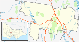
| Location |
|
| LGA(s) | Shire of Mount Alexander |
| State electorate(s) | Bendigo West |
| Federal Division(s) | Division of Bendigo |
Yapeen is a town in central Victoria, Australia. The locality is in the Shire of Mount Alexander local government area and on the Midland Highway, 131 kilometres (81 mi) north west of the state capital, Melbourne and 9 kilometres (5.6 mi) south of Castlemaine. At the 2011 census, Yapeen had a population of 310.[1]
The locality was originally part of the Strathloddon pastoral run. Gold was discovered in the area in 1852 and miners flocked to what was known as the "Pennyweight Flat diggings". The settlement was named "Yapeen" in 1861, for an Aboriginal word meaning "green hill" or "valley". Chinese miners were prominent in the area and some later established market gardens.[2]
A school was first established in Yapeen in 1858 with a dedicated school building constructed in 1877. The school closed in 2010.[3]
References
- 1 2 Australian Bureau of Statistics (31 October 2012). "Yapeen". 2011 Census QuickStats. Retrieved 22 February 2015.
- ↑ "Yapeen, VIC". eGold: Electronic Encyclopedia of Gold in Australia. Cultural Heritage Unit, The University of Melbourne. Retrieved 22 February 2015.
- ↑ "Yapeen school to close". ABC News. Australian Broadcasting Corporation. 10 June 2010. Retrieved 22 February 2015.
External links
![]() Media related to Yapeen at Wikimedia Commons
Media related to Yapeen at Wikimedia Commons