Yangbajain
| Yangbajain | |
|---|---|
| Tibetan transcription(s) | |
| • Tibetan | ཡངས་པ་ཅན། |
| • Wylie transliteration | yangs pa can |
| • pronunciation in IPA | [jaŋpatɕɛ̃] |
| • official transcription (PRC) | Yangbajain |
| • THDL | Yangpachen |
| • other transcriptions | Yangpachän |
| Chinese transcription(s) | |
| • Traditional | 羊八井 |
| • Simplified | 羊八井 |
| • Pinyin | Yángbājǐng |
|
Yangpachen Valley | |
 Yangbajain Location within Tibet | |
| Coordinates: 30°5′N 90°33′E / 30.083°N 90.550°E | |
| Country | China |
| Region | Tibet |
| Prefecture | Lhasa |
| County | Damxung County |
| Population | |
| • Major Nationalities | Tibetan |
| • Regional dialect | Tibetan language |
| Time zone | +8 |

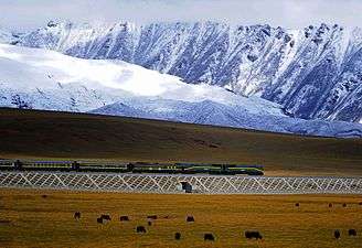
Yangbajain (also spelled Yangbajing) is a town approximately 87 kilometers (54 mi) north-west of Lhasa, halfway to Damxung in the Tibet Autonomous Region of China. The town lies just south of the Nyainqêntanglha Mountains, in an upland lush green valley surrounded by the tents of nomads with grazing yak and sheep populating the hillside. It is the site Yangpachen Monastery, which was historically the seat of the Shamarpas of Karma Kagyü and the Yangbajing International Cosmic Ray Observatory.
Geothermal field
The area is famous for the Yangbajain Geothermal Field, which has been harnessed to produce electricity for the capital Lhasa. There is a thermoelectric power plant on the edge of the Yangbajain field covering 20–30 square kilometers.[1] The power plant was established in 1977, and was the first development of geothermal power not only in Tibet but in the whole of China.
The Yangbajain hot springs field is at an altitude of 4,290 to 4,500 metres (14,070 to 14,760 ft)[2] which makes it the highest altitude set of hot springs in China, and possibly the world.[3] The highest temperature inside the drilling hole is 125.5°C.[4]
Holy Medical Spring Resort
The Holy Medical Spring Resort has both two indoor swimming pools and one outdoor swimming pool, all filled with hot springs water.[4] Bathing is allowed at an altitude of 4200m AMSL, likely making it the highest swimming pool in the world.

Yangbajing International Cosmic Ray Observatory
The YBJ International Cosmic Ray Observatory (羊八井国际宇宙线观测站) is located in the Yangbajing valley of the Tibetan highland, a site chosen for its high altitude at 4300 meters above sea level.[5] Collaborating institutes includes the INFN (Istituto Nazionale di Fisica Nucleare) and various Chinese and Japanese universities.[6] [7] The KOSMA 3-m submillimeter telescope is being relocated to a nearby site.
References
- ↑ Geography
- ↑ Forecast and evaluation of hot dry rock geothermal resource in China, Zhijun Wan, Yangsheng Zhao and Jianrong Kang, Renewable Energy, Volume 30, Issue 12 , October 2005, Pages 1831-1846.
- ↑ Chinese cultural organization site making claim that these are the highest altitude hot springs in the world
- 1 2 安才旦. Travel guide to Tibet of China. China Intercontinental Press. p. 28. Retrieved 2010-11-30.
- ↑ "羊八井国际宇宙线观测站主页". 高能所网. 2005-09-26. Retrieved July 29, 2008.
- ↑ "The ARGO-YBJ Experiment". INFN. 2008-12-03. Retrieved January 29, 2009.
- ↑ "The Tibet ASgamma Collaboration". ICRR. 2008-02-02. Retrieved January 29, 2009.
Coordinates: 30°5′N 90°33′E / 30.083°N 90.550°E