Yale, Michigan
| Yale, Michigan | |
|---|---|
| City | |
 Location of Yale, Michigan | |
| Coordinates: 43°7′49″N 82°47′52″W / 43.13028°N 82.79778°WCoordinates: 43°7′49″N 82°47′52″W / 43.13028°N 82.79778°W | |
| Country | United States |
| State | Michigan |
| County | St. Clair |
| Government | |
| • Type | Mayor/Council |
| • Mayor | Richard F. Busch |
| Area[1] | |
| • Total | 1.39 sq mi (3.60 km2) |
| • Land | 1.38 sq mi (3.57 km2) |
| • Water | 0.01 sq mi (0.03 km2) |
| Elevation | 794 ft (242 m) |
| Population (2010)[2] | |
| • Total | 1,955 |
| • Estimate (2012[3]) | 1,919 |
| • Density | 1,416.7/sq mi (547.0/km2) |
| Time zone | Eastern (EST) (UTC-5) |
| • Summer (DST) | EDT (UTC-4) |
| Area code(s) | 810 |
| FIPS code | 26-89000[4] |
| GNIS feature ID | 1625031[5] |
Yale is a city in St. Clair County in the U.S. state of Michigan. The population was 1,955 at the 2010 census. Yale is considered unofficially as the Bologna Capital of the world, in part due to its Yale Bologna Festival, which began in 1989. Yale bologna is sold in grocery stores throughout the area. Yale is also home to the Yale Airport.
Notable residents include Dylan Murphy and Stephen Barr.
History
Yale was founded in 1851 by Nathan White as Brockway Center. However, in 1889, it was renamed Yale at the suggestion of B. R. Noble, honoring Yale University.
Geography
- According to the United States Census Bureau, the city has a total area of 1.39 square miles (3.60 km2), of which 1.38 square miles (3.57 km2) is land and 0.01 square miles (0.03 km2) is water.[1]
- It is considered to be part of the Thumb of Michigan, which in turn is a subregion of the Flint/Tri-Cities.
- Yale can also be considered as in the Blue Water Area, a subregion of the Thumb.
- Yale is in St Clair County, but is sometimes mistaken as being in Sanilac County because it is only two miles from the county line.
Demographics
| Historical population | |||
|---|---|---|---|
| Census | Pop. | %± | |
| 1890 | 937 | — | |
| 1900 | 1,125 | 20.1% | |
| 1910 | 1,223 | 8.7% | |
| 1920 | 1,223 | 0.0% | |
| 1930 | 1,345 | 10.0% | |
| 1940 | 1,489 | 10.7% | |
| 1950 | 1,641 | 10.2% | |
| 1960 | 1,621 | −1.2% | |
| 1970 | 1,505 | −7.2% | |
| 1980 | 1,814 | 20.5% | |
| 1990 | 1,977 | 9.0% | |
| 2000 | 2,063 | 4.4% | |
| 2010 | 1,955 | −5.2% | |
| Est. 2015 | 1,905 | [6] | −2.6% |
2010 census
As of the census[2] of 2010, there were 1,955 people, 722 households, and 459 families residing in the city. The population density was 1,416.7 inhabitants per square mile (547.0/km2). There were 859 housing units at an average density of 622.5 per square mile (240.3/km2). The racial makeup of the city was 96.8% White, 0.6% African American, 0.1% Native American, 0.1% Asian, 0.9% from other races, and 1.6% from two or more races. Hispanic or Latino of any race were 1.3% of the population.
There were 722 households of which 36.7% had children under the age of 18 living with them, 44.9% were married couples living together, 11.6% had a female householder with no husband present, 7.1% had a male householder with no wife present, and 36.4% were non-families. 30.2% of all households were made up of individuals and 16% had someone living alone who was 65 years of age or older. The average household size was 2.56 and the average family size was 3.23.
The median age in the city was 38.2 years. 27% of residents were under the age of 18; 8.3% were between the ages of 18 and 24; 24.2% were from 25 to 44; 23.2% were from 45 to 64; and 17.3% were 65 years of age or older. The gender makeup of the city was 45.6% male and 54.4% female.
2000 census
As of the census[4] of 2000, there were 2,063 people, 742 households, and 494 families residing in the city. The population density was 1,599.2 per square mile (617.5/km²). There were 805 housing units at an average density of 624.0 per square mile (240.9/km²). The racial makeup of the city was 97.67% White, 0.15% African American, 0.58% Native American, 0.05% Pacific Islander, 0.63% from other races, and 0.92% from two or more races. Hispanic or Latino of any race were 1.41% of the population.
There were 742 households out of which 39.1% had children under the age of 18 living with them, 48.9% were married couples living together, 12.9% had a female householder with no husband present, and 33.4% were non-families. 30.2% of all households were made up of individuals and 16.2% had someone living alone who was 65 years of age or older. The average household size was 2.63 and the average family size was 3.29.
In the city the population was spread out with 29.6% under the age of 18, 8.8% from 18 to 24, 27.6% from 25 to 44, 17.1% from 45 to 64, and 16.9% who were 65 years of age or older. The median age was 33 years. For every 100 females there were 86.4 males. For every 100 females age 18 and over, there were 83.0 males.
The median income for a household in the city was $38,375, and the median income for a family was $45,450. Males had a median income of $37,241 versus $23,654 for females. The per capita income for the city was $17,054. About 4.7% of families and 6.1% of the population were below the poverty line, including 6.6% of those under age 18 and 6.7% of those age 65 or over.
Climate
This climatic region is typified by large seasonal temperature differences, with warm to hot (and often humid) summers and cold (sometimes severely cold) winters. According to the Köppen Climate Classification system, Yale has a humid continental climate, abbreviated "Dfb" on climate maps.[8]
References
- 1 2 "US Gazetteer files 2010". United States Census Bureau. Retrieved 2012-11-25.
- 1 2 "American FactFinder". United States Census Bureau. Retrieved 2012-11-25.
- ↑ "Population Estimates". United States Census Bureau. Retrieved 2013-06-03.
- 1 2 "American FactFinder". United States Census Bureau. Retrieved 2008-01-31.
- ↑ "US Board on Geographic Names". United States Geological Survey. 2007-10-25. Retrieved 2008-01-31.
- ↑ "Annual Estimates of the Resident Population for Incorporated Places: April 1, 2010 to July 1, 2015". Retrieved July 2, 2016.
- ↑ "Census of Population and Housing". Census.gov. Retrieved June 4, 2015.
- ↑ Climate Summary for Yale, Michigan
External links
Municipalities and communities of St. Clair County, Michigan, United States | ||
|---|---|---|
| Cities | 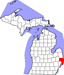 | |
| Villages | ||
| Charter townships | ||
| General law townships | ||
| CDP | ||
| Other unincorporated communities |
| |
| Footnotes | ‡This populated place also has portions in an adjacent county or counties | |