Xupu County
| Xupu County 溆浦县 | |
|---|---|
| County | |
 | |
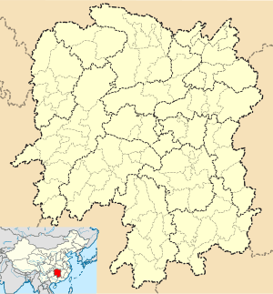 Xupu Location in Hunan | |
| Coordinates: 27°54′40″N 110°35′38″E / 27.911°N 110.594°ECoordinates: 27°54′40″N 110°35′38″E / 27.911°N 110.594°E[1] | |
| Country | People's Republic of China |
| Province | Hunan |
| Prefecture-level city | Huaihua |
| Area[2] | |
| • Total | 3,437.93 km2 (1,327.39 sq mi) |
| Population (2010)[3] | |
| • Total | 741,014 |
| • Density | 220/km2 (560/sq mi) |
| Time zone | China Standard (UTC+8) |
| Postal code | 4193XX |
Xupu County (simplified Chinese: 溆浦县; traditional Chinese: 溆浦縣; pinyin: Xùpǔ Xiàn) is under the administration of Huaihua, Hunan province, China. The Xu River (溆水) flows through the built-up area where it is joined by the Sandu River (三都河). Some kilometers downstream it joins the Yuan River. Xupu borders the prefecture-level cities of Yiyang to the northeast, Loudi to the east, and Shaoyang to the southeast. Yuanling County is to the Northwest.
Yao people
According to the Xupu County Almanac (1993:641), the following three subgroups of Yao live in over 41 villages and number about 2,600 people.
- Flowery Yao 花瑶
- Flowery-Trouser Yao 花裤瑶
- Seven-Surname Yao 七姓瑶
References
- www.xzqh.org (Chinese)
- ↑ Google (2014-07-02). "Xupu" (Map). Google Maps. Google. Retrieved 2014-07-02.
- ↑ Huaihua City Land Use Plan (2006–20)/《怀化市土地利用总体规划(2006-2020年)》.(Chinese) Accessed 8 July 2014.
- ↑ "怀化市2010年第六次全国人口普查主要数据公报" (in Chinese). Huaihua Statistical Bureau/怀化市统计局. Archived from the original on July 14, 2014. Retrieved 9 July 2014.
External links
This article is issued from Wikipedia - version of the 10/28/2016. The text is available under the Creative Commons Attribution/Share Alike but additional terms may apply for the media files.