Wyoming Highway 130
| ||||
|---|---|---|---|---|
| Snowy Range Road | ||||
| Route information | ||||
| Maintained by WYDOT | ||||
| Length: | 98.52 mi[1] (158.55 km) | |||
| Major junctions | ||||
| West end: |
| |||
|
| ||||
| East end: |
| |||
| Location | ||||
| Counties: | Albany, Carbon | |||
| Highway system | ||||
| ||||

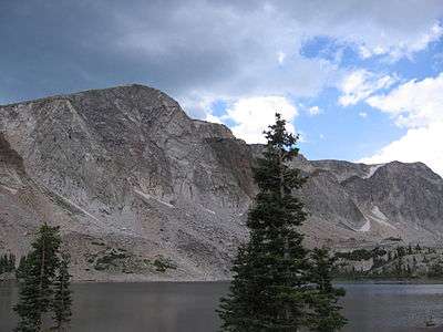
Wyoming Highway 130 is known locally as the Snowy Range Road. It makes its way west from Laramie across the plains, and rises over the Medicine Bow Mountains. The road then turns north through the town of Saratoga, and ends at Interstate 80. The stretch of road over the mountains is a National Forest Byway. WYO 130 over Snowy Range Pass is closed during winter (November–May)[2]
Route description

Wyoming Highway 130 travels from Interstate 80 (Exit 235) and US 30/US 287 at Walcott south through Saratoga, intersecting unsigned Wyoming Highway 74 at 20.3 miles (32.7 km), and continuing further south to a junction with Wyoming Highway 230 at 28.2 miles (45.4 km), where WYO 130 turns east to head to Laramie. WYO 130 heads east across the Medicine Bow Mountains (or Snowy Range Mountains) and through part of the Medicine Bow National Forest, and passes through Centennial at around 69 miles (111 km). Six miles east of Centennial, 130 intersects Wyoming Highway 11 which provides a route to Albany. From there Highway 130 travels 17 miles (27 km) in a relatively due east direction over rolling hills. At 91.7 miles (147.6 km) Wyoming Highway 12 is intersected, and at 96.2 miles (154.8 km) Highway 130 meets Highway 230 once again just west of Laramie. From here the routes 130 and 230 run together (or concurrent) into Laramie as Snowy Range Road. This is the only instance in Wyoming where two state routes are merged.[3] Shortly after, Snowy Range Road (WYO 130/WYO 230) has an interchange with I-80 (Exit 311). Almost 2 miles (3.2 km) after that interchange Wyoming Highway 130, as well as Wyoming Highway 230, ends at I-80 BUS/US 30/US 287
History
Highway 130 used to begin in downtown Saratoga at the current unmarked junction with Wyoming Highway 74 (the corner of First and Bridge Streets). The current routing of Wyoming 130 from the Highway 74 junction south to the Highway 230 junction was once part of Wyoming Highway 70. Originally Highway 130 traveled southeast along the Carbon County Route 504 path to Ryan Park. The roadway from Ryan Park to the WYO 130/WYO 230 junction was not built at that time. Then 130 resumes its current course east to Centennial and Laramie.[4][5]
Major intersections
| County | Location | mi | km | Destinations | Notes |
|---|---|---|---|---|---|
| Carbon | Walcott | 0.00 | 0.00 | Western (Northern) terminus of WYO 130 Exit 235 (I-80) | |
| Saratoga | 20.3 | 32.7 | Unsigned State Route | ||
| | 28.2 | 45.4 | |||
| Albany | east of Centennial | 74.6 | 120.1 | ||
| west of Laramie | 91.4 | 147.1 | |||
| 93.5 | 150.5 | Airport Rd/General Brees Rd - access to Laramie Regional Airport | |||
| Laramie | 96.2 | 154.8 | West end concurrency with WYO 230 | ||
| 97.0 | 156.1 | Exit 311 (I-80) | |||
| 98.52 | 158.55 | Eastern terminus of WYO 130 East end concurrency with WYO 230 | |||
| 1.000 mi = 1.609 km; 1.000 km = 0.621 mi | |||||
References
- ↑ Wyoming @ AARoads.com - Wyoming Routes 100-199
- ↑ Official 2003 State Highway Map of Wyoming
- ↑ Wyoming @ AARoads.com - Wyoming Highway 230
- ↑ Wyoming @ AARoads.com - Wyoming Highway 130
- ↑ Google (June 8, 2009). "overview map of WYO 130's former routing" (Map). Google Maps. Google. Retrieved June 8, 2009.
External links
- Wyoming State Route 200-299
- WYO 130 - I-80 Bus/US 30/US 287/WYO 230 to I-80/US 30/US 287 (see Wyoming 130)
- Snowy Range Scenic Byway
- Scenic Mountain Drives - Snowy Range Road