Wyoming, Pennsylvania
| Wyoming, Pennsylvania | |
|---|---|
| Borough | |
|
Wyoming Monument, burial site for Wyoming Massacre victims | |
 Wyoming, Pennsylvania | |
| Coordinates: 41°18′34″N 75°50′13″W / 41.30944°N 75.83694°WCoordinates: 41°18′34″N 75°50′13″W / 41.30944°N 75.83694°W | |
| Country | United States |
| State | Pennsylvania |
| County | Luzerne |
| Region | Greater Pittston |
| Settled | 1780 |
| Incorporated | 1885 |
| Government | |
| • Type | Borough Council |
| Area | |
| • Total | 1.6 sq mi (4.1 km2) |
| • Land | 1.4 sq mi (3.7 km2) |
| • Water | 0.2 sq mi (0.4 km2) |
| Population (2010) | |
| • Total | 3,073 |
| • Density | 1,900/sq mi (750/km2) |
| Time zone | Eastern (EST) (UTC-5) |
| • Summer (DST) | EDT (UTC-4) |
| Area code(s) | 570 |
| Website | http://wyomingpa.org/ |

Wyoming is a borough in the Greater Pittston area of Luzerne County, Pennsylvania, United States. It is located 5 miles (8.0 km) north of Wilkes Barre, on the Susquehanna River.[1] Formerly, coal mining was the chief industry. The population was 3,073 at the 2010 census.[2]
History
The Wyoming Monument marks the gravesite of victims of the July 1778 Battle of Wyoming. The battle was named for the Wyoming Valley of Pennsylvania, of which the current borough of Wyoming is a part.
A force of British and Tories led by John Butler, with the assistance of about 700 Native Americans, attacked the outnumbered Wyoming Valley settlers on 3 July 1778, north of Wyoming in what is now Exeter. The exact fatality count is not known, but it is estimated between 200 and 300 settlers were killed in the battle.
An annual observance, sponsored by the Wyoming Commemorative Association, takes place at the obelisk grounds to honor the fallen heroes of this Revolutionary War battle. The monument has been listed on the National Register of Historic Places.
The Wyoming Valley was made famous by the 1809 poem "Gertrude of Wyoming" by Thomas Campbell. The state of Wyoming was named after the valley, owing to the popularity of the poem.
The Luzerne Presbyterial Institute, Swetland Homestead, and Wyoming Monument are listed on the National Register of Historic Places.[3]
Geography
Wyoming is located at 41°18′34″N 75°50′13″W / 41.30944°N 75.83694°W (41.309346, -75.836849).[4]
According to the United States Census Bureau, the borough has a total area of 1.6 square miles (4.1 km2), of which 1.4 square miles (3.7 km2) is land and 0.15 square miles (0.4 km2), or 9.26%, is water.[5]
Demographics
| Historical population | |||
|---|---|---|---|
| Census | Pop. | %± | |
| 1880 | 1,147 | — | |
| 1890 | 1,794 | 56.4% | |
| 1900 | 1,909 | 6.4% | |
| 1910 | 3,010 | 57.7% | |
| 1920 | 3,582 | 19.0% | |
| 1930 | 4,648 | 29.8% | |
| 1940 | 4,728 | 1.7% | |
| 1950 | 4,511 | −4.6% | |
| 1960 | 4,127 | −8.5% | |
| 1970 | 4,195 | 1.6% | |
| 1980 | 3,655 | −12.9% | |
| 1990 | 3,255 | −10.9% | |
| 2000 | 3,221 | −1.0% | |
| 2010 | 3,073 | −4.6% | |
| Est. 2015 | 3,044 | [6] | −0.9% |
| Sources:[7][8][9] | |||
As of the census[8] of 2000, there were 3,221 people, 1,487 households, and 852 families residing in the borough. The population density was 2,271.6 people per square mile (875.8/km2). There were 1,580 housing units at an average density of 1,114.3 per square mile (429.6/km2). The racial makeup of the borough was 99.50% White, 0.06% African American, 0.06% Asian, 0.03% Pacific Islander, 0.16% from other races, and 0.19% from two or more races. Hispanic or Latino of any race were 0.28% of the population.
There were 1,487 households, out of which 21.5% had children under the age of 18 living with them, 43.6% were married couples living together, 10.1% had a female householder with no husband present, and 42.7% were non-families. 38.5% of all households were made up of individuals, and 21.6% had someone living alone who was 65 years of age or older. The average household size was 2.13 and the average family size was 2.87.
In the borough the population was spread out, with 19.2% under the age of 18, 5.7% from 18 to 24, 27.9% from 25 to 44, 21.5% from 45 to 64, and 25.6% who were 65 years of age or older. The median age was 43 years. For every 100 females there were 82.8 males. For every 100 females age 18 and over, there were 78.9 males.
The median income for a household in the borough was $33,576, and the median income for a family was $44,087. Males had a median income of $33,015 versus $24,718 for females. The per capita income for the borough was $18,428. About 5.7% of families and 9.9% of the population were below the poverty line, including 14.9% of those under age 18 and 9.3% of those age 65 or over.
References
- ↑
 Rines, George Edwin, ed. (1920). "Wyoming, Pa". Encyclopedia Americana.
 - ↑ "Profile of General Population and Housing Characteristics: 2010 Demographic Profile Data (DP-1): Wyoming borough, Pennsylvania". U.S. Census Bureau, American Factfinder. Archived from the original on September 11, 2013. Retrieved April 13, 2012.
- ↑ National Park Service (2010-07-09). "National Register Information System". National Register of Historic Places. National Park Service.
- ↑ "US Gazetteer files: 2010, 2000, and 1990". United States Census Bureau. 2011-02-12. Retrieved 2011-04-23.
- ↑ "Geographic Identifiers: 2010 Demographic Profile Data (G001): Wyoming borough, Pennsylvania". U.S. Census Bureau, American Factfinder. Archived from the original on September 11, 2013. Retrieved April 13, 2012.
- ↑ "Annual Estimates of the Resident Population for Incorporated Places: April 1, 2010 to July 1, 2015". Retrieved July 2, 2016.
- ↑ "Census of Population and Housing". U.S. Census Bureau. Archived from the original on May 11, 2015. Retrieved 11 December 2013.
- 1 2 "American FactFinder". United States Census Bureau. Archived from the original on September 11, 2013. Retrieved 2008-01-31.
- ↑ "Incorporated Places and Minor Civil Divisions Datasets: Subcounty Resident Population Estimates: April 1, 2010 to July 1, 2012". Population Estimates. U.S. Census Bureau. Archived from the original on June 17, 2013. Retrieved 11 December 2013.
Municipalities and communities of Luzerne County, Pennsylvania, United States | ||
|---|---|---|
| Cities | 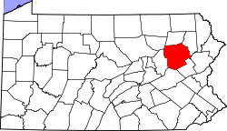 | |
| Boroughs |
| |
| Townships | ||
| CDPs | ||
| Unincorporated communities |
| |
| Footnotes | ‡This populated place also has portions in an adjacent county or counties | |