Wynyard, Tasmania
| Wynyard Tasmania | |||||||
|---|---|---|---|---|---|---|---|
 Table Cape as seen at dusk | |||||||
 Wynyard | |||||||
| Coordinates | 41°00′S 145°43′E / 41.000°S 145.717°ECoordinates: 41°00′S 145°43′E / 41.000°S 145.717°E | ||||||
| Population | 5,061 (2011 census)[1] | ||||||
| Postcode(s) | 7325 | ||||||
| Elevation | 12 m (39 ft)[2] | ||||||
| Location |
| ||||||
| LGA(s) | Waratah-Wynyard Council | ||||||
| State electorate(s) | Braddon | ||||||
| Federal Division(s) | Braddon | ||||||
| |||||||


Wynyard is a rural town on the north-west coast of Tasmania, Australia 16 kilometres (10 mi) west of Burnie on the Bass Highway at the mouth of the Inglis River.
At the 2011 census Wynyard had an urban population of 5,061[1] and a total greater population of 5,990.[3] It is part of the Waratah-Wynyard Council local government area and is a regional hub, servicing the surrounding rural districts. The largest employer in the town is the dairy processing plant, owned by the New Zealand company Fonterra.
History
The Tommeginner were a tribe of Indigenous Australians who lived in the region along the coastline until soon after the arrival of Europeans in the 19th century. As hunter-gatherers, the Tommeginner hunted for game on the plains inland, but they also built tidal fish traps with rocks close to the shore at Fossil Bluff which are still evident today.[4]
Three ex-convict Alexander brothers established a settlement, Alexandria, on the west, or Table Cape, side of the Inglis River in the 1850s. They bought large areas of farmland on Table Cape and built several small ships. Shortly afterwards, Wynyard town, on the east side of the river, was laid out, but lagged well behind Alexandria. After the Inglis River was bridged in 1861, Alexandria began to fade and Wynyard, with better wharfing, became the district's centre of commerce. It handled more shipping than Burnie in the late nineteenth century and its population reached 500 by 1900. In the twentieth century Burnie flourished and Wynyard largely stagnated, though employment was provided by a butter factory and in the 1990s a Danish factory which builds windmills for windfarms.[5]
Wynyard was probably named after Major-General Edward Buckley Wynyard in the early 1850s.[6][7]
Community
Community Radio
Coast FM is a volunteer community radio station servicing the North-West coast of Tasmania, with the studio based in Wynyard.
Notable residents
- F. M. Alexander the creator of the Alexander technique was born on the northern bank of the Inglis River at a settlement called Alexandria, situated about three km upstream from the river mouth. He later moved to Waratah, Melbourne, London and New York to pursue acting and teaching.
- Carla Boyd is a retired Australian women's basketball player who was born in Wynyard. Boyd Competed at the 1996 and 2000 Olympic Games, and the 1998 World Championship, winning medals at all three events (1 silver and 2 bronze).
Tulip Festival
The Wynyard Tulip Festival, also commonly known as 'Bloomin' Tulips' since 2004, is one of Wynyard's major annual events. The event coincides with the flowering of tulip fields on Table Cape and the surrounds, lily fields also come into flower at around the same time.
Tourism
Wynyard is an increasingly popular tourist centre. Visitors flock to see the local scenic attraction of Table Cape, an extinct volcano with views inland along the north coast and out to Bass Strait. The Lighthouse was commissioned in 1888 and was manned by three keepers until 1920 when it was automated. Another remarkable sight nearby is Fossil Bluff, a natural headland fronting onto Bass Strait, where many fossils including Wynyardii bassiana have been found. This was named, but not discovered, by Sir Walter Baldwin Spencer, a controversial scientist who served for many years as president of the Victorian Football League (now AFL). The Inglis River, with its yacht club and anchorage for fishing boats is the most notable feature of Wynyard itself. The Inglis, though, is tidal and subject to fast and dangerous currents, so swimming is only possible at low tide when the flow of water from inland is modest. The first white settlers in the area were the King family, who lived on a seaside parcel of land, now occupied by the Wynyard Golf Club. Family patriarch John King drowned while fording the mouth of the Inglis River in the 1840s. There are, however, good swimming beaches at East Wynyard and near the Old Port. Close by are camp sites with cabin accommodation.
The town has an annual Christmas parade held on Christmas Eve, a colourful summer fair with free lollies for everyone, and regular markets, on the foreshore, at a site near the airport and a farmers' market at the showground, which backs onto the river.
Access
Within walking distance of the centre of Wynyard is Burnie Airport, run by the Burnie Port Authority. This well-used little airport serves the nearby city of Burnie, about 15 minutes' drive east and offers air access to Melbourne, King Island and Devonport. Buses and car-hire facilities are available as well as adequate car parking. The cafeteria and gift shop are close to the waiting area.
By car, Wynyard is approximately two hours' drive west of Launceston, along the Bass Highway.
Devonport, the southern terminus of the Spirit of Tasmania ferry to the mainland, is 40 minutes east by car.
There are bus services to Wynyard from Hobart, Launceston and Devonport.
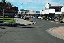
Town centre
Free car parking and level walking, along with a wide range of facilities, make Wynyard attractive for weekly shopping. It is an increasingly popular retirement town for the same reason, with a number of new housing developments. The town boasts two fine old churches, including the Alexander North Heritage-listed Anglican church of St Stephen in Dodgin Street. Its clean beaches are particularly good for walking, thanks to firm quartz sand. There are sheltered spots for swimming at 'The Old Port', changing facilities and showers for bathers on the main beach, and good provision for children, including barbecue and picnic areas, playgrounds and a supervised swimming pool, open in the summer school vacations.
Wynyard is a good place to start exploration of the north west of Tasmania. There are motels and bed-and-breakfast accommodation, including the very popular Alexandria Bed and Breakfast, which is a beautiful and elegant federation home built in 1905 on the banks of the Inglis River. For those who wish to explore the immediate area, there are Table Cape, the tulip fields in spring, the lighthouse at Table Cape, and from the Tollymore Road from Table Cape to the Bass Highway, views can be enjoyed to the west along the coast as far as The Nut at Stanley, taking in the sweep of coast past Boat Harbour beach and Rocky Cape. From Table Cape itself, views east can on a fine day extend beyond the Dial Range to Low Head and the Asbestos Range. Inland, it is possible to see St Valentine's Peak, Black Bluff and on a good day Mount Roland.
The new Tourist Information Centre behind the main shopping area has a complete range of tourist information, its own parking area, and an attractive display. Tourists can book many trips inland from there.
Transport
Private flights may be booked from Wynyard's own airport (Burnie Airport), including tourist circuits to the Wilderness in the South West and around the locality. Regional Express Airlines operates scheduled passenger flights to Melbourne at least 4 times a day using Saab 340 turboprop aircraft. Additionally Sharp Airlines offers multiple daily flights between Wynyard and nearby King Island with metro 23 turboprop aircraft. The airport has two runways and is unusual with the secondary runway and a defunct railway line that intersect each other;[8] the line is now in a state of disrepair. Passenger train services run by Tasman Limited from Hobart to Wynyard ceased on 21 July 1978. The service ran daily to and from Hobart with a connection at Western Junction to/from Launceston. It was a narrow-gauge (3'6" - 1067mm) mostly single-track service.[9]
The King family were the first white settlers to take up land on the western bank of the Inglis estuary. They settled there in the early 1840s.
Table Cape Post Office opened around 1856 and was renamed Wynyard in 1882.[10]
References
| Wikimedia Commons has media related to Wynyard, Tasmania. |
- 1 2 Australian Bureau of Statistics (31 October 2012). "Wynyard (Urban Centre/Locality)". 2011 Census QuickStats. Retrieved 2015-03-04.
- ↑ Bureau of Meteorology. Retrieved on 2007-11-17.
- ↑ Australian Bureau of Statistics (31 October 2012). "Wynyard (Statistical Area Level 2)". 2011 Census QuickStats. Retrieved 2015-03-04.
- ↑ The Aboriginal Tribes of North West Tasmania: A History, by Ian McFarlane, 2008, published by Riawunna, Fullers Bookshop and UTas.
- ↑ Pink, Kerry (2006). "Wynyard". The companion to Tasmanian History. University of Tasmania. Retrieved 28 November 2016.
- ↑ H. A. Nichols (6 October 1923). "Glimpses of the Past". The Advocate. Burnie, Tas.: National Library of Australia. p. 14. Retrieved 13 April 2015.
- ↑ "Table Cape Became Wynyard About 100 Years Ago". The Advocate. Burnie, Tas.: National Library of Australia. 30 January 1954. p. 11. Retrieved 14 April 2015.
- ↑ http://www.nationaltrusttas.org.au/aviation/pages/aviation_heritage.htm
- ↑ http://www.railtasmania.com/photos/
- ↑ Premier Postal History. "Post Office List". Premier Postal Auctions. Retrieved 16 June 2012.