Wani, Yavatmal
| Wani Wun[1] | |
|---|---|
| town | |
|
Entrance | |
| Nickname(s): Black Diamond City | |
 Wani Location in Maharashtra, India | |
| Coordinates: 20°03′20″N 78°57′12″E / 20.05556°N 78.95333°ECoordinates: 20°03′20″N 78°57′12″E / 20.05556°N 78.95333°E | |
| Country |
|
| State | Maharashtra |
| District | Yavatmal |
| Elevation | 228 m (748 ft) |
| Population (2011)[2] | |
| • Total | 58,820 |
| • Rank | 3rd in Yavatmal District |
| Languages | |
| • Official | Marathi |
| Time zone | IST (UTC+5:30) |
| Vehicle registration | MH29 |
| Website | www.yavatmal.nic.in/wani |

Wani ![]() pronunciation is a town and a municipal council in Yavatmal district in the Indian state of Maharashtra.[3]
pronunciation is a town and a municipal council in Yavatmal district in the Indian state of Maharashtra.[3]
Demographics
As of the 2011 census of India, Wani had a population of 58,820. Males constituted 51% of the population and females 49%. Wani had an average literacy rate of 74%, higher than the national average of 59.5%: male literacy was 80%, and female literacy was 68%. In 2011 in Wani, 13% of the population was under 6 years of age.
In earlier times, Wani was known as 'Wun'. Wani was a district headquarters in Berar Province during British rule. Later on Wani became a taluka and Yavatmal its district (earlier name 'Yeoti').
The economy of the town is mostly driven by agriculture and mining businesses in the surrounding area. The town received the name "Black Diamond City" due to the huge coal deposits and many coal mines in the adjacent area. Limestone is also quarried in the area. The principal crops are cotton and soyabeans.
Geography
Wani is located at the eastern edge of Yavatmal District about 105 km from Yavatmal. It is on the Yavatmal-Chandrapur Road, nearly 55 km from Chandrapur and 135 km from Nagpur.
 Gunjecha Maroti Mandir
 Wani Railway Station
 Ranganath-Swami Statue
 Ranganatha-Swami Temple entry
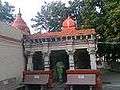 Ranganatha-Swami Temple view
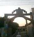 Ranganatha-Swami Temple main gate
 Ranganatha-Swami Temple inner
Schools in town
- Vivekanand Vidyalay, Primary and High School, Wani (D.M.Thawari)
- KIDZ international school
- Black Diamond international school
- Wani Public School, Wani
- Adarsh Highschool, Wani
- Gurupeeth primary English medium school, jain layout, Wani
- Lokamanya Tilak Mahavidyalay, Wani
- Lions English Medium High School
- Swarnleela International School
- Shikshan Prasarak Mandal Junior College and High School
- Janata High School Junior College and High School
- Bal Vidya Mandir
- Mata Yashoda Primary School
- Macroon Students Academy
- Noorjahan Begum Salam Ahmed College of Arts and Commerce
- Noorjahan Begum Salam Ahmed Women's College of Law ,Buranda
- chopane highschool ,wani
- New Galaxy Convent, Lalguda
Square
wani has many famous squares
- shivaji square ( has many shops and is the main point of wani city, it has a big statue of Shivaji maharaj in the center of the road )
- tilak square ( is near Shivaji square )
- Gandhi square ( this square is also known as gol bajar( gol is marathi word for"round" ) this place is a market of fruits and vegetables )
- Ambedkar Square. ( near this Wani has a Palika (municipal) market )
famous temples
- The Shri Ranganathaswami Temple situated here is visited by devotees between Falguna Vadya and Chaitra Sudha.There are only two temples in India of The Shri Ranganathaswami.First is in Srirangam,Tamilnadu and the second one is in Wani.Shri Nandeshwar temple is there. Nandeshwar was bullock of cart of Shri Jagannath baba
- The jaitai mata is temple of hindu godess , in navaratri this temple organizes garbha and many religious shows , many people from other cities and town come to wani to visit this temple
- The sai mandir is a temple of saibaba it is near jaitai mandir.
The villages near wani [4]
| Villages |
| Aheri |
| Amlon |
| Babapur |
| Belora |
| Besa |
| Bhalar |
| Bhandewada |
| Bhurki |
| Bodad Bk. |
| Borda |
| Borgaon |
| Borgoan |
| Bori |
| Bramhani |
| Chanakha |
| Chargaon |
| Chendkapur |
| Chikhalgaon |
| Chikhali |
| Chilai |
| Chincholi |
| Dahegaon |
| Dahegaon |
| Deurwada |
| Dhabapur |
| Dhakori |
| Dhandir |
| Dhoptala |
| Dhunki |
| Dongargaon |
| Dorli |
| Fulora |
| Gadeghat |
| Ganeshpur |
| Ghonsa |
| Godgaon |
| Gopalpur |
| Gopalpur |
| Gowari |
| Gowari |
| Hiwardhara |
| Injasan |
| Jugad |
| Junada |
| Kalmana Bk. |
| Kalmana Kh |
| Kawadshi |
| Kayar |
| Keshav Nagar |
| Kesurli |
| Khandla |
| Kolera |
| Kolgaon |
| Kona |
| Korambhi |
| Krishnanpur |
| Kumbhari |
| Kumbharkhani |
| Kundra |
| Kurai |
| Kurli |
| Lalguda |
| Lathi |
| Mahankalpur |
| Majra |
| Malegaon |
| Mandar |
| Manki |
| Maregaon |
| Matholi |
| Mendholi |
| Mohada |
| Mohorli |
| Mungoli |
| Murdhoni |
| Murti |
| Nagala |
| Naigaon Bk. |
| Naigaon Kh |
| Nandepera |
| Nawargaon |
| Nawegaon |
| Nerad |
| Nilapur |
| Niljai |
| Nimbala |
| Nimbala Bk. |
| Niwali |
| Palsoni |
| Paramdoh |
| Parsoda |
| Parsoda |
| Patharpur |
| Pathri |
| Petur |
| Pimpalgaon |
| Pimpari |
| Pimpri |
| Pohana |
| Punvat |
| Purad |
| Purad |
| Rangana |
| Rasa |
| Sakhara |
| Sakhara |
| Sawangi |
| Sawarla |
| Shelu Bk |
| Shelu Kh |
| Shewala |
| Shindola |
| Shirgiri |
| Shirpur |
| Shivni |
| Somnala |
| Sonapur |
| Sonegaon |
| Suknegaon |
| Takli |
| Taroda |
| Tejapur |
| Ukani |
| Umari |
| Virkund |
| Vithalnagar |
| Wadgaon |
| Wadgaon Tip |
| Wadhona Pilki |
| Wadjapur |
| Wagdara |
| Wanjari |
| Wargaon |
| Warzadi |
| Welabai |
| Welhala |
| Yenad |
| Yenak |
| Zarpat |
| Zola |
Transport
Road
The nearest cities by road are warora , chandrapur , durgapur.
Railway
the wani railway station belongs to the central railway , nagpur only nandigram express stops at this station
Language and culture
since the city is located in india state maharshtra the main native language is Marathi but city also includes many other tribes so hindi and other languages are also spoken by the people
There is an anuual fair that takes place on jatra road wani , around ram navratri , which is festivel devoted to lord ram a hindu god
Coal mining in Wani
Western Coalfields Ltd., A subsidiary of Coal India Ltd. has a coal mining area - Wani North Area in the surroundings of Wani city. There are coal mines like Ukni, Pimpalgaon, Junad, Kolarpimpri, Rajur, Kumbarkhani, Ghonsa, Kartikay Coal Washeries and some new upcoming mining projects near Wani city.
References
- ↑ Wūn (Variant - V) at GEOnet Names Server, United States National Geospatial-Intelligence Agency
- ↑ "Maharastra, Yavatmal, Wani Subdistrict, Wani (M Cl)". The Registrar General & Census Commissioner, India. 2011. Archived from the original on 28 July 2014.
- ↑ Wani (Approved - N) at GEOnet Names Server, United States National Geospatial-Intelligence Agency
- ↑ "Villages & Towns in Wani Taluka of Yavatmal, Maharashtra". www.census2011.co.in. Retrieved 2016-10-08.
 |
Maregaon, Yavatmal | Warora | | |
| Kelapur | |
|||
| ||||
| | ||||
| Welabal Andhra Pradesh Border | Ghugus, Chandrapur |
Yavatmal district topics | ||
|---|---|---|
| History |  | |
| Geography | ||
| Cities and towns | ||
| Transport | ||
| Culture | ||
| Lok Sabha constituencies | ||
| Vidhan Sabha constituencies | ||