Wothorpe
| Wothorpe | |
 Wothorpe Towers |
|
 Wothorpe |
|
| Population | 226 (2001 census) |
|---|---|
| Unitary authority | Peterborough |
| Ceremonial county | Cambridgeshire |
| Region | East |
| Country | England |
| Sovereign state | United Kingdom |
| EU Parliament | East of England |
|
|
Coordinates: 52°38′35″N 0°28′59″W / 52.643°N 0.483°W
Wothorpe is a village and civil parish in the Peterborough unitary authority of Cambridgeshire, England. It is in the far north-west of the district, and to the south of Stamford (in Lincolnshire). The parish borders Northamptonshire on its west.
Overview
Wothorpe Priory was a "small Benedictine nunnery", founded apparently around 1160. All but one of the nuns died in the outbreak of Plague in 1349, with the survivor becoming part of the Priory of Stamford. The property was dissolved by Henry VIII, being granted to Richard Cecil.[1][2]
As a parish, it was considered a hamlet within the parish of Stamford Baron, becoming a separate civil parish once more in 1866. Historically the parish was part of the Soke of Peterborough, associated with Northamptonshire. Administratively, it became part of the Stamford rural sanitary district in the 19th century, then later the Barnack Rural District of the administrative county of the Soke, then passing to Huntingdon and Peterborough in 1965 and Cambridgeshire in 1974 under the Local Government Act 1972.
The early-seventeenth-century Wothorpe Towers was a lodge that was once part of the Burghley estate, which was used as a dower house and then, apparently, part dismantled to provide an eye-catcher in the new landscaped park. The main house has been put into a trust which is restoring the gardens.
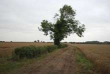
Racecourse road
Within the parish of Wothorpe is the highest point of the historic Soke of Peterborough. The high point of 81 metres (266 ft) is located on Racecourse Road at TF 0353 0417, next to the county boundary with Northamptonshire. Although unmarked, the summit is of interest to participants in Hill Bagging who visit these high points of the historic counties of England.[3]
References
- ↑ Wothorpe House and Towers Hidden Heritage (retrieved 22 December 2011)
- ↑ R.M. Serjeantson, W.R.D. Adkins (editors) (1906). "Houses of Benedictine nuns: The priory of Wothorpe". A History of the County of Northampton: Volume 2. Institute of Historical Research. Retrieved 28 May 2014.
- ↑ Simon Edwardes (2001). "Racecourse Road". The Mountains of England and Wales. Retrieved 20 May 2014.
- http://www.visionofbritain.org.uk/relationships.jsp?u_id=10287212
- http://monasticmatrix.usc.edu/monasticon/?function=detail&id=899&PHPSESSID=1e6aeff1f699c2e36de654658d0029fc
- Youngs, Guide to the Local Administrative Units of England, Volume II