Worlaby
| Worlaby | |
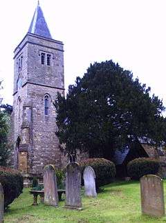 St Clement’s Church, Worlaby |
|
 Worlaby |
|
| Population | 547 (2011) |
|---|---|
| OS grid reference | TA012137 |
| – London | 145 mi (233 km) S |
| Unitary authority | North Lincolnshire |
| Ceremonial county | Lincolnshire |
| Region | Yorkshire and the Humber |
| Country | England |
| Sovereign state | United Kingdom |
| Post town | Brigg |
| Postcode district | DN20 |
| Dialling code | 01652 |
| Police | Humberside |
| Fire | Humberside |
| Ambulance | East Midlands |
| EU Parliament | Yorkshire and the Humber |
| UK Parliament | Brigg and Goole (UK Parliament constituency) |
|
|
Coordinates: 53°36′40″N 0°28′01″W / 53.611°N 0.467°W
Worlaby is a village and civil parish in North Lincolnshire, England, 6 miles (10 km) south-west from Barton-Upon-Humber and 5 miles (8 km) north-east from Brigg. The population of the civil parish at the 2011 census was 547.[1] It lies on the B1204, and to the east of the River Ancholme. It is one of the five Low Villages – South Ferriby, Horkstow, Saxby All Saints, Bonby, and Worlaby – between Brigg and the River Humber, named so because of their position below the northern edge of the Lincolnshire Wolds.[2] Worlaby was previously part of South Humberside administrative district, and before that, the North Lindsey division of Lindsey, Lincolnshire.
In the Domesday account, the village is listed as "Uluricebi" or "Wirichebi".[3][4]
The original 13th- to 14th-century Grade II listed parish church dedicated to St Clement[5][6] was re-built between 1873 and 1877, although the early Norman piers of the nave, windows and Late Saxon tower arch were re-used.[7] The churchyard contains the war grave of a Second World War Home Guard volunteer.[8]
Other listed buildings include Worlaby Hospital,[3][9] originally almshouses founded by John, 1st Lord Bellasye of Worlaby, and built in 1663 for four poor women.[7][10]
Worlaby Carrs
To the west of the village to the River Ancholme is Worlaby Carrs, an area of arable land converted by Defra to wet grassland as sanctuary for wintering fowl.[11][12] In early 2011 a proposal to site a wind farm on the Carrs met with local opposition.[13][14]
References
- ↑ "Civil Parish population 2011". Neighbourhood Statistics. Office for National Statistics. Retrieved 4 June 2016.
- ↑ Worlaby - North Lincolnshire, Northlincs.com. Retrieved 21 June 2011
- 1 2 About the Village, Worlaby.org.uk. Retrieved 21 June 2011
- ↑ Worlaby, Domesdaymap.co.uk. Retrieved 21 June
- ↑ St Clement's Church, Churchtrails.com. Retrieved 21 June 2011
- ↑ Church History, Genuki. Retrieved 21 June 2011
- 1 2 Cox, J. Charles (1916) Lincolnshire p. 344; Methuen & Co. Ltd
- ↑ CWGC Casualty details, Cwgc.org
- ↑ The Old Almshouses, British Listed Buildings. Retrieved 21 June 2011
- ↑ The History of Parliament: the House of Commons, 1660-1690, edited by Basil Duke Henning, Haynes Publishing (1983) ISBN 0-436-19274-8. Retrieved 21 June 2011
- ↑ Worlaby Carrs, Defra.gov.uk. Retrieved 21 June 2011
- ↑ Worlaby Carrs, Geograph.org.uk. Retrieved 21 June 2011
- ↑ Worlaby Turbine, Worlaby.org.uk. Retrieved 21 June 2011
- ↑ "Villagers sign petition to stop wind turbine being built at wildlife haven", This is Scunthorpe 11 February 2011. Retrieved 21 June 2011
Further reading
- Machin, Nannette (1989) Worlaby: A Miscellany of a North Lincolnshire Village, Between 1870-1970
- Machin, Nanette. (1990) One hundred years of Worlaby school
External links
 Media related to Worlaby at Wikimedia Commons
England Portal | |
| Unitary authorities | |
| Boroughs or districts | |
| Major settlements |
|
| Topics | |