Woodlands Road tram stop
| Metrolink | |||||||||||||||||||||||||||||||||||||||||||||||||||||||||||||||||||||||||||||||||||||||||||||||||||||||||||
|
Woodlands Road tram stop in 2009 | |||||||||||||||||||||||||||||||||||||||||||||||||||||||||||||||||||||||||||||||||||||||||||||||||||||||||||
 Woodlands Road Location of Woodlands Road in Greater Manchester | |||||||||||||||||||||||||||||||||||||||||||||||||||||||||||||||||||||||||||||||||||||||||||||||||||||||||||
| Location | |||||||||||||||||||||||||||||||||||||||||||||||||||||||||||||||||||||||||||||||||||||||||||||||||||||||||||
| Place | Cheetham Hill | ||||||||||||||||||||||||||||||||||||||||||||||||||||||||||||||||||||||||||||||||||||||||||||||||||||||||||
| Local authority | Manchester | ||||||||||||||||||||||||||||||||||||||||||||||||||||||||||||||||||||||||||||||||||||||||||||||||||||||||||
| Coordinates | 53°30′29″N 2°13′57″W / 53.5081°N 2.2326°WCoordinates: 53°30′29″N 2°13′57″W / 53.5081°N 2.2326°W | ||||||||||||||||||||||||||||||||||||||||||||||||||||||||||||||||||||||||||||||||||||||||||||||||||||||||||
| Grid reference | SD846013 | ||||||||||||||||||||||||||||||||||||||||||||||||||||||||||||||||||||||||||||||||||||||||||||||||||||||||||
| Platforms | 2 | ||||||||||||||||||||||||||||||||||||||||||||||||||||||||||||||||||||||||||||||||||||||||||||||||||||||||||
| Fare zone information | |||||||||||||||||||||||||||||||||||||||||||||||||||||||||||||||||||||||||||||||||||||||||||||||||||||||||||
| Metrolink Zone | C | ||||||||||||||||||||||||||||||||||||||||||||||||||||||||||||||||||||||||||||||||||||||||||||||||||||||||||
| Present status | Disused | ||||||||||||||||||||||||||||||||||||||||||||||||||||||||||||||||||||||||||||||||||||||||||||||||||||||||||
| Operations | |||||||||||||||||||||||||||||||||||||||||||||||||||||||||||||||||||||||||||||||||||||||||||||||||||||||||||
| Original operator | Lancashire and Yorkshire Railway | ||||||||||||||||||||||||||||||||||||||||||||||||||||||||||||||||||||||||||||||||||||||||||||||||||||||||||
| Pre-grouping company | Lancashire and Yorkshire Railway | ||||||||||||||||||||||||||||||||||||||||||||||||||||||||||||||||||||||||||||||||||||||||||||||||||||||||||
| Post-grouping company |
London, Midland and Scottish Railway British Rail | ||||||||||||||||||||||||||||||||||||||||||||||||||||||||||||||||||||||||||||||||||||||||||||||||||||||||||
| History | |||||||||||||||||||||||||||||||||||||||||||||||||||||||||||||||||||||||||||||||||||||||||||||||||||||||||||
| Opened | 3 March 1913 | ||||||||||||||||||||||||||||||||||||||||||||||||||||||||||||||||||||||||||||||||||||||||||||||||||||||||||
| Closed as rail station | 14 July 1991 | ||||||||||||||||||||||||||||||||||||||||||||||||||||||||||||||||||||||||||||||||||||||||||||||||||||||||||
| Conversion to Metrolink operation | 6 April 1992 | ||||||||||||||||||||||||||||||||||||||||||||||||||||||||||||||||||||||||||||||||||||||||||||||||||||||||||
| Former name | Woodlands Road Halt | ||||||||||||||||||||||||||||||||||||||||||||||||||||||||||||||||||||||||||||||||||||||||||||||||||||||||||
| Renamed | after 1923 | ||||||||||||||||||||||||||||||||||||||||||||||||||||||||||||||||||||||||||||||||||||||||||||||||||||||||||
| Closed | 16 December 2013 | ||||||||||||||||||||||||||||||||||||||||||||||||||||||||||||||||||||||||||||||||||||||||||||||||||||||||||
| |||||||||||||||||||||||||||||||||||||||||||||||||||||||||||||||||||||||||||||||||||||||||||||||||||||||||||
| Disused railway stations in the United Kingdom | |||||||||||||||||||||||||||||||||||||||||||||||||||||||||||||||||||||||||||||||||||||||||||||||||||||||||||
| A B C D-F G H-J K-L M-O P-R S T-V W-Z | |||||||||||||||||||||||||||||||||||||||||||||||||||||||||||||||||||||||||||||||||||||||||||||||||||||||||||
|
| |||||||||||||||||||||||||||||||||||||||||||||||||||||||||||||||||||||||||||||||||||||||||||||||||||||||||||

Woodlands Road was a tram stop on the Bury Line of the Metrolink system in Greater Manchester, England. It was located in the Cheetham Hill area of North Manchester, England. It was originally opened in 1913 as a heavy rail station and was closed for conversion to light rail in 1991, opening with the new Metrolink system in 1992.
Woodlands Road was the closest station to the Manchester Museum of Transport on Boyle Street. Two new stations opened nearby (Abraham Moss and Queens Road), which led to the closure of the stop on 16 December 2013.[1]
History
The original railway line was opened in 1879 by the Lancashire and Yorkshire Railway between Manchester Victoria and Bury.[2] Woodlands Road, Bowker Vale and Besses o' th' Barn stations were added to the line in 1913, in an attempt to fend off growing electric tramway competition in the Cheetham Hill area. The original halt had wooden platforms. The site is near the vanished junction of a former branch line to the chemical works in Blackley.
Closure

The UK Government announced that £4 million from the Community Infrastructure Fund was awarded to two new stops on the Bury Metrolink line. This was part of £30 million allocated to transport projects to support thousands of extra homes being built across the country over the coming months. The Chairman of the Greater Manchester Integrated Transport Authority, Councillor Keith Whitmore, stated that the funding would help realise a long-held ambition to open new Metrolink stops in the area.
The two new stops were:
- Abraham Moss (opened 2011), situated close to the Abraham Moss Centre, the library and leisure centre and the City College Manchester; it is located approximately 0.25 miles (0.40 km) from Woodlands Road station.
- Queens Road (opened 2013), providing a closer stop to the Museum of Transport. The site is close to the Queens Road tram depot and there was a small tram halt there for Metrolink staff only, which was replaced by a full passenger station. The station opened on 16 December 2013.[3]
These two new tram stops replaced Woodlands Road station, which was closed on 16 December 2013; the decision provoked some opposition from local residents who campaigned to retain the station.[5]
Services
Woodlands Road was located on the Bury Line with trams towards Bury stopping every 6 minutes between 9.59am and 4pm, Mondays to Fridays.[6] with no weekend or evening service. This was due to the opening of the nearby Abraham Moss Metrolink station further north along the Bury line.[7]
Connecting bus routes
Woodlands Road was a Metrolink station that was not served by any bus service. The nearest bus services were the 151, 156 and 165 on Hazelbottom Road or Smedley Road and the 88, 89 and 135 on Cheetham Hill Road.[8]

References
- ↑ "New Queens Road Metrolink stop to open". Transport for Greater Manchester.
- ↑ Hindle, Paul. "Manchester Victoria to Bury: an historical trip on Metrolink" (PDF). Manchester Geographical Society. Retrieved 10 July 2013.
- ↑ "New Queens Road Metrolink stop to open". Metrolink.
- ↑ "Funding pledged for two new tram stops on the Bury Metrolink line". Transport for Greater Manchester. Retrieved 9 July 2011.
- ↑ "Protesters fight to keep Woodlands Road Metrolink stop open". Manchester Evening News. 17 February 2011. Retrieved 10 September 2012.
- ↑ "Metrolink - Tram Times - Woodlands Road". Metrolink / Transport for Greater Manchester. Retrieved 13 February 2013.
- ↑ "18/04/2011 - Abraham Moss stop opens". Metrolink. Retrieved 10 September 2012.
- ↑ "Transport for Greater Manchester - Journey Planning - Network Maps". Transport for Greater Manchester. Retrieved 10 September 2012.
External links
| Wikimedia Commons has media related to Woodlands Road Metrolink station. |
| Manchester Lines | |||||||||||||||||||||||||||||||||||||||||||||||||||||||||||||||||||||||||||||||||||||||||||||||||||||||||||||||||||||||||||||||||||||||||||||||||||||||||||||||||||||||||||||||||||||||||||||||||||||||||||||||||||||||||||||||||||||||||||||||||||||||||||||||||||||||||||||||||||||||||||||||||||||||||||||||||||||||||||||||||||||||||||||||||||||||||||||||||||||||||||||||||||||||||||||||||||||||||||||||||||||||||||||
|---|---|---|---|---|---|---|---|---|---|---|---|---|---|---|---|---|---|---|---|---|---|---|---|---|---|---|---|---|---|---|---|---|---|---|---|---|---|---|---|---|---|---|---|---|---|---|---|---|---|---|---|---|---|---|---|---|---|---|---|---|---|---|---|---|---|---|---|---|---|---|---|---|---|---|---|---|---|---|---|---|---|---|---|---|---|---|---|---|---|---|---|---|---|---|---|---|---|---|---|---|---|---|---|---|---|---|---|---|---|---|---|---|---|---|---|---|---|---|---|---|---|---|---|---|---|---|---|---|---|---|---|---|---|---|---|---|---|---|---|---|---|---|---|---|---|---|---|---|---|---|---|---|---|---|---|---|---|---|---|---|---|---|---|---|---|---|---|---|---|---|---|---|---|---|---|---|---|---|---|---|---|---|---|---|---|---|---|---|---|---|---|---|---|---|---|---|---|---|---|---|---|---|---|---|---|---|---|---|---|---|---|---|---|---|---|---|---|---|---|---|---|---|---|---|---|---|---|---|---|---|---|---|---|---|---|---|---|---|---|---|---|---|---|---|---|---|---|---|---|---|---|---|---|---|---|---|---|---|---|---|---|---|---|---|---|---|---|---|---|---|---|---|---|---|---|---|---|---|---|---|---|---|---|---|---|---|---|---|---|---|---|---|---|---|---|---|---|---|---|---|---|---|---|---|---|---|---|---|---|---|---|---|---|---|---|---|---|---|---|---|---|---|---|---|---|---|---|---|---|---|---|---|---|---|---|---|---|---|---|---|---|---|---|---|---|---|---|---|---|---|---|---|---|---|---|---|---|---|---|---|---|---|---|---|---|---|---|---|---|---|---|---|---|---|---|---|---|---|---|---|---|---|---|---|---|---|---|---|---|---|---|---|---|---|---|---|---|---|---|---|---|---|---|---|---|---|---|---|---|---|---|---|---|
Legend | |||||||||||||||||||||||||||||||||||||||||||||||||||||||||||||||||||||||||||||||||||||||||||||||||||||||||||||||||||||||||||||||||||||||||||||||||||||||||||||||||||||||||||||||||||||||||||||||||||||||||||||||||||||||||||||||||||||||||||||||||||||||||||||||||||||||||||||||||||||||||||||||||||||||||||||||||||||||||||||||||||||||||||||||||||||||||||||||||||||||||||||||||||||||||||||||||||||||||||||||||||||||||||||
| |||||||||||||||||||||||||||||||||||||||||||||||||||||||||||||||||||||||||||||||||||||||||||||||||||||||||||||||||||||||||||||||||||||||||||||||||||||||||||||||||||||||||||||||||||||||||||||||||||||||||||||||||||||||||||||||||||||||||||||||||||||||||||||||||||||||||||||||||||||||||||||||||||||||||||||||||||||||||||||||||||||||||||||||||||||||||||||||||||||||||||||||||||||||||||||||||||||||||||||||||||||||||||||
| Preceding station | Following station | |||
|---|---|---|---|---|
| Former services | ||||
towards Altrincham | Altrincham – Bury Line | towards Bury |
||
towards Ashton-under-Lyne | Bury – Ashton-under-Lyne Line | |||
| Tram stops |  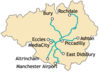 | |||||||||||||||||||||||||||||||
|---|---|---|---|---|---|---|---|---|---|---|---|---|---|---|---|---|---|---|---|---|---|---|---|---|---|---|---|---|---|---|---|---|
| Operations |
| |||||||||||||||||||||||||||||||
| History (Timeline) |
| |||||||||||||||||||||||||||||||
| Future |
| |||||||||||||||||||||||||||||||
| Proposed stops |
| |||||||||||||||||||||||||||||||