Wolfpen Ridge
| Wolfpen Ridge | |
|---|---|
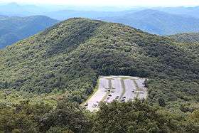 Wolfpen Ridge viewed from Brasstown Bald | |
| Highest point | |
| Elevation | 4,561 ft (1,390 m) |
| Coordinates | 34°51′49″N 83°48′31″W / 34.86361°N 83.80861°WCoordinates: 34°51′49″N 83°48′31″W / 34.86361°N 83.80861°W |
| Geography | |
| Location | Towns / Union counties, Georgia, U.S. |
| Parent range | Blue Ridge Mountains |
| Topo map | USGS Jacks Gap |
| Climbing | |
| First ascent | unknown |
| Easiest route | Hike |
Wolfpen Ridge is a ridge in the Blue Ridge Mountains in U.S. state of Georgia that runs south to north along the boundary between Towns and Union counties. Brasstown Bald, the highest point in Georgia, is located at the northern end of the ridge (elevation: 4,786 feet (1,459 m)). At the southern end of the ridge, there is an unnamed peak with an elevation of 4,561 feet, which makes it the fifth-highest point in Georgia.
See also
Sources
External links
This article is issued from Wikipedia - version of the 11/3/2016. The text is available under the Creative Commons Attribution/Share Alike but additional terms may apply for the media files.