Wolfe County, Kentucky
| Wolfe County, Kentucky | |
|---|---|
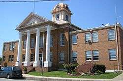 Wolfe County courthouse in Campton | |
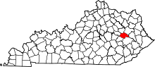 Location in the U.S. state of Kentucky | |
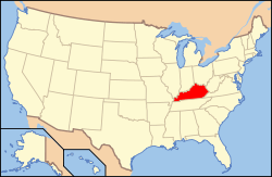 Kentucky's location in the U.S. | |
| Founded | 1860 |
| Named for | The Wolfe family out of Western North Carolina |
| Seat | Campton |
| Largest city | Campton |
| Area | |
| • Total | 223 sq mi (578 km2) |
| • Land | 222 sq mi (575 km2) |
| • Water | 0.6 sq mi (2 km2), 0.3% |
| Population | |
| • (2010) | 7,355 |
| • Density | 33/sq mi (13/km²) |
| Congressional district | 6th |
| Time zone | Eastern: UTC-5/-4 |
Wolfe County is a county located in the U.S. state of Kentucky. As of the 2010 census, the population was 7,355.[1] Its county seat is Campton.[2] The county is named for Nathaniel Wolfe.
History
Wolfe County was formed on March 5, 1860 from portions of Breathitt County, Morgan County, Owsley County and Powell County. It was named for Nathaniel Wolfe, a member of the legislative assembly.[3]
Campton, the county's seat was reportedly formed from camp town in Wolfe County. A small creek winding through Campton, Swift Creek, is named after Jonathan Swift of the legend of Swift's silver mine. Swift supposedly buried treasure in the area which has never been recovered.
Geography
According to the U.S. Census Bureau, the county has a total area of 223 square miles (580 km2), of which 222 square miles (570 km2) is land and 0.6 square miles (1.6 km2) (0.3%) is water.[4]
Adjacent counties
- Menifee County (north)
- Morgan County (northeast)
- Magoffin County (east)
- Breathitt County (southeast)
- Lee County (southwest)
- Powell County (northwest)
National protected area
- Daniel Boone National Forest (part)
State protected area
Demographics
| Historical population | |||
|---|---|---|---|
| Census | Pop. | %± | |
| 1870 | 3,603 | — | |
| 1880 | 5,638 | 56.5% | |
| 1890 | 7,180 | 27.4% | |
| 1900 | 8,764 | 22.1% | |
| 1910 | 9,864 | 12.6% | |
| 1920 | 8,783 | −11.0% | |
| 1930 | 8,425 | −4.1% | |
| 1940 | 9,997 | 18.7% | |
| 1950 | 7,615 | −23.8% | |
| 1960 | 6,534 | −14.2% | |
| 1970 | 5,669 | −13.2% | |
| 1980 | 6,698 | 18.2% | |
| 1990 | 6,503 | −2.9% | |
| 2000 | 7,065 | 8.6% | |
| 2010 | 7,355 | 4.1% | |
| Est. 2015 | 7,259 | [5] | −1.3% |
| U.S. Decennial Census[6] 1790-1960[7] 1900-1990[8] 1990-2000[9] 2010-2013[1] | |||
As of the census[10] of 2000, there were 7,065 people, 2,816 households, and 1,976 families residing in the county. The population density was 32 per square mile (12/km2). There were 3,264 housing units at an average density of 15 per square mile (5.8/km2). The racial makeup of the county was 99.24% White, 0.24% Black or African American, 0.08% Native American, 0.03% Asian, 0.03% Pacific Islander, 0.06% from other races, and 0.33% from two or more races. 0.51% of the population were Hispanic or Latino of any race.
There were 2,816 households out of which 33.60% had children under the age of 18 living with them, 52.30% were married couples living together, 12.50% had a female householder with no husband present, and 29.80% were non-families. 27.00% of all households were made up of individuals and 9.70% had someone living alone who was 65 years of age or older. The average household size was 2.45 and the average family size was 2.96.
In the county the population was spread out with 25.90% under the age of 18, 9.40% from 18 to 24, 28.50% from 25 to 44, 23.50% from 45 to 64, and 12.70% who were 65 years of age or older. The median age was 36 years. For every 100 females there were 98.50 males. For every 100 females age 18 and over, there were 96.10 males.
The median income for a household in the county was $19,310, and the median income for a family was $23,333. Males had a median income of $23,859 versus $18,952 for females. The per capita income for the county was $10,321. About 29.90% of families and 35.90% of the population were below the poverty line, including 50.20% of those under age 18 and 26.70% of those age 65 or over.
Politics
| Year | Republican | Democrat |
|---|---|---|
| 2016 | 68.46% 1,804 | 28.58% 753 |
| 2012 | 60.26% 1,542 | 38.14% 976 |
| 2008 | 47.44% 1,408 | 50.30% 1,493 |
| 2004 | 43.90% 1,385 | 55.28% 1,744 |
| 2000 | 52.25% 1,267 | 46.85% 1,136 |
Events
The annual Swift Silver Mine Festival is held on Labor Day weekend each year. It includes a parade and vendors in the downtown Campton area.
Communities
- Bear Pin
- Bethany
- Campton (county seat)
- Hazel Green
- Lee City
- Mary Flatt Road
- Olivia
- Pine Ridge
- Trent
Notable people
- Pete Center, who pitched for the Cleveland Indians in the 1940s.
- Folk artist Edgar Tolson; Ralph Rinzler of the Smithsonian Institution was impressed by Tolson's figures, and included them in the 1971 Festival of American Folklife.
- South Trimble, politician, born near Hazel Green
See also
- Hazel Green Academy
- National Register of Historic Places listings in Wolfe County, Kentucky
- Red River Gorge
References
- 1 2 "State & County QuickFacts". United States Census Bureau. Retrieved March 6, 2014.
- ↑ "Find a County". National Association of Counties. Retrieved 2011-06-07.
- ↑ The Register of the Kentucky State Historical Society, Volume 1. Kentucky State Historical Society. 1903. p. 37.
- ↑ "2010 Census Gazetteer Files". United States Census Bureau. August 22, 2012. Retrieved August 20, 2014.
- ↑ "County Totals Dataset: Population, Population Change and Estimated Components of Population Change: April 1, 2010 to July 1, 2015". Retrieved July 2, 2016.
- ↑ "U.S. Decennial Census". United States Census Bureau. Retrieved August 20, 2014.
- ↑ "Historical Census Browser". University of Virginia Library. Retrieved August 20, 2014.
- ↑ "Population of Counties by Decennial Census: 1900 to 1990". United States Census Bureau. Retrieved August 20, 2014.
- ↑ "Census 2000 PHC-T-4. Ranking Tables for Counties: 1990 and 2000" (PDF). United States Census Bureau. Retrieved August 20, 2014.
- ↑ "American FactFinder". United States Census Bureau. Retrieved 2008-01-31.
- ↑ "Dave Leip's Atlas of U.S. Presidential Elections". Retrieved 2016-04-28.
Municipalities and communities of Wolfe County, Kentucky, United States | ||
|---|---|---|
| City | | |
| CDP | ||
| Other unincorporated communities | ||

Coordinates: 37°44′N 83°29′W / 37.74°N 83.49°W