Wisconsin Rapids, Wisconsin
| Wisconsin Rapids, Wisconsin | |
|---|---|
| City | |
 Location of Wisconsin Rapids, Wisconsin | |
| Coordinates: 44°23′12″N 89°49′23″W / 44.38667°N 89.82306°WCoordinates: 44°23′12″N 89°49′23″W / 44.38667°N 89.82306°W | |
| Country | United States |
| State | Wisconsin |
| County | Wood |
| Government | |
| • Mayor | Zachary Vruwink [1] |
| Area[2] | |
| • City | 14.67 sq mi (38.00 km2) |
| • Land | 13.82 sq mi (35.79 km2) |
| • Water | 0.85 sq mi (2.20 km2) |
| Elevation | 1,027 ft (313 m) |
| Population (2010)[3] | |
| • City | 18,367 |
| • Estimate (2013[4]) | 18,039 |
| • Density | 1,329.0/sq mi (513.1/km2) |
| • Metro | 54,362 |
| Time zone | CST (UTC-6) |
| • Summer (DST) | CDT (UTC-5) |
| Area code(s) | 715 & 534 |
| FIPS code | 55-88200[5] |
| GNIS feature ID | 1576906[6] |
| Website | http://www.wirapids.org |


Wisconsin Rapids is a city in and the county seat of Wood County, Wisconsin, United States.[7] The population was 18,367 at the 2010 census.
According to the 2010 census, the Wisconsin Rapids micropolitan area was home to 54,362 people. The city also forms one of the core areas of the United States Census Bureau's Marshfield-Wisconsin Rapids Micropolitan Statistical Area, which includes all of Wood County (2000 population: 75,555).
Geography
Wisconsin Rapids is located at 44°23′12″N 89°49′23″W / 44.38667°N 89.82306°W (44.386805, -89.823078).[8]
According to the United States Census Bureau, the city has a total area of 14.67 square miles (38.00 km2), of which 13.82 square miles (35.79 km2) is land and 0.85 square miles (2.20 km2) is water.[2]
History
The American Indians called the area "Ahdawagam", meaning "Two-sided Rapids". Although Europeans began to settle this area in the 1830s, Wisconsin Rapids has been known by this name only since 1920. Prior to that, the community was divided by the Wisconsin River, with the west side incorporated as Centralia and the east side as Grand Rapids. The two cities merged in 1900, with the entire community taking the name Grand Rapids. The name was changed in 1920 to avoid mail and other goods from being misdirected to the much better known Grand Rapids, Michigan.[9]
Demographics
| Historical population | |||
|---|---|---|---|
| Census | Pop. | %± | |
| 1870 | 1,115 | — | |
| 1880 | 1,350 | 21.1% | |
| 1890 | 1,702 | 26.1% | |
| 1900 | 4,493 | 164.0% | |
| 1910 | 6,521 | 45.1% | |
| 1920 | 7,243 | 11.1% | |
| 1930 | 8,726 | 20.5% | |
| 1940 | 11,416 | 30.8% | |
| 1950 | 13,496 | 18.2% | |
| 1960 | 15,042 | 11.5% | |
| 1970 | 18,587 | 23.6% | |
| 1980 | 17,995 | −3.2% | |
| 1990 | 18,245 | 1.4% | |
| 2000 | 18,435 | 1.0% | |
| 2010 | 18,367 | −0.4% | |
| Est. 2015 | 17,897 | [10] | −2.6% |
2010 census
As of the census[3] of 2010, there were 18,367 people, 8,296 households, and 4,626 families residing in the city. The population density was 1,329.0 inhabitants per square mile (513.1/km2). There were 8,972 housing units at an average density of 649.2 per square mile (250.7/km2). The racial makeup of the city was 92.2% White, 0.7% African American, 1.0% Native American, 3.7% Asian, 0.9% from other races, and 1.5% from two or more races. Hispanic or Latino of any race were 2.9% of the population.
There were 8,296 households of which 27.1% had children under the age of 18 living with them, 39.1% were married couples living together, 11.9% had a female householder with no husband present, 4.8% had a male householder with no wife present, and 44.2% were non-families. 38.7% of all households were made up of individuals and 16.8% had someone living alone who was 65 years of age or older. The average household size was 2.17 and the average family size was 2.87.
The median age in the city was 41.1 years. 22.8% of residents were under the age of 18; 8.5% were between the ages of 18 and 24; 23.3% were from 25 to 44; 25.5% were from 45 to 64; and 19.8% were 65 years of age or older. The gender makeup of the city was 47.8% male and 52.2% female.
2000 census
As of the census[5] of 2000, there were 18,435 people, 7,970 households, and 4,782 families residing in the city. The population density was 1,390 people per square mile (536.8/km²). There were 8,426 housing units at an average density of 635.3 per square mile (245.3/km²). The racial makeup of the city was 94.04% White, 0.34% African American, 0.80% Native American, 3.46% Asian, 0.02% Pacific Islander, 0.37% from other races, and 0.97% from two or more races. Hispanic or Latino of any race were 1.31% of the population.
There were 7,970 households out of which 28.0% had children under the age of 18 living with them, 46.0% were married couples living together, 10.6% had a female householder with no husband present, and 40.0% were non-families. 34.8% of all households were made up of individuals and 16.0% had someone living alone who was 65 years of age or older. The average household size was 2.26 and the average family size was 2.93.
In the city the population was spread out with 24.7% under the age of 18, 8.5% from 18 to 24, 27.5% from 25 to 44, 19.8% from 45 to 64, and 19.4% who were 65 years of age or older. The median age was 38 years. For every 100 females there were 90.1 males. For every 100 females age 18 and over, there were 86.2 males.
The median income for a household in the city was $34,956, and the median income for a family was $43,594. Males had a median income of $36,098 versus $22,466 for females. The per capita income for the city was $17,723. About 7.0% of families and 9.1% of the population were below the poverty line, including 12.5% of those under age 18 and 7.2% of those age 65 or over.
Economy
Known for its papermaking manufacturing history, Wisconsin Rapids is also an important locale for the cranberry industry. Wisconsin Rapids is the corporate home of the international educational software company, Renaissance Learning, Inc. as well as other national and global companies.
In the past, Wisconsin Rapids was home to the corporate headquarters for Consolidated Papers, Inc, (Consolidated Paper Mills), which was acquired by the Finnish company Stora Enso in early 2000.[12] In 2007, NewPage Corporation acquired the paper production facility.[13] In 2015, Verso Corporation acquired the mill. Verso continues its presence in the area with a paper mill that houses two paper machines and a kraft pulp mill.
Airport
- KISW - South Wood County Airport
Education
Wisconsin Rapids is served by Wisconsin Rapids Public Schools. Lincoln High School is the local public high school, serving grades 10 through 12. Assumption High School is a private Catholic high school. River Cities High School is a charter school alternative to the local high schools. The city has two public junior high schools: East Junior High School (grades 8–9) and Wisconsin Rapids Area Middle School (grades 6–7). East and Wisconsin Rapids Area Middle School were separate schools for grades 7–9 until 2010 when the school district placed all students in grades 6–7 at one school and grades 8–9 at another.
Mid-State Technical College, which has a campus in the city, offers vocational diplomas, and Lakeland College offers qualifications in academic subjects.
Recreation
Wisconsin Rapids has several local parks, including Robinson Park, Gaynor Park, and Lyon Park. There is also a recently built skate park. The state water-skiing championships are held at Lake Wazeecha every year and the national BMX Bandit cycling championships are held at the Central Wisconsin BMX velodrome.
There are three museums, the South Wood County Historical Corporation Museum, the Alexander House, and the Wisconsin River Paper Making Museum, all of which are housed in historical family homes.
The Alexander House is a museum to the history of the Nekoosa Edwards Paper Company (NEPCO), and also hosts art exhibits. The building is the former home of the Alexander Family, which ran the Nekoosa Edwards Paper Company.
The South Wood County Historical Corporation Museum houses multiple exhibits covering the history of the South Wood County area. The building is the former Witter family home. The Witter family was a prominent family in Wisconsin Rapids, instrumental to the formation of the Consolidated Water Power and Paper Company, and involved in the founding of many other local historical businesses.
The Wisconsin River Papermaking Museum houses exhibits focused on papermaking, featuring permanent and traveling exhibits on papermaking. The museum houses the history of Consolidated Papers, with permanent exhibits on the history of the company's formation, the history of the home, built by Thomas E Nash in 1901, and home to the Stanton Mead family for 60 years. The Mead family ran Consolidated Water Power Company for almost the entirety of its 100+ year history.
All three museums are open Tuesdays and Thursdays from 1-4pm and are free and open to the public. The Wisconsin River Papermaking Museum and the Alexander House are open year round, while the South Wood County Historical Society museum closes in the winter season.
There is a municipal zoo (free to enter).
There is a prairie chicken sanctuary at the Buena Vista Wildlife Reservation, and every year the Prairie Chicken Festival is held. The Grand Affair Arts Festival takes place in September of each year. In summer of 2010, the Wisconsin Rapids Rafters of the collegiate summer Northwoods League, played their first season at Witter Field.[14]
Media
Print media
- Daily Tribune, daily newspaper founded 1920 from merger of Grand Rapids Leader (est. 1914) and Grand Rapids Tribune
- Buyers' Guide, weekly ad sheet with some editorial content
- Wisconsin Rapids City-Times daily online newspaper launched in October 2013
Television
- RCCA: River Cities public, educational, and government access (PEG) broadcast on cable tv
Radio
Although this is a list of radio stations based in the Wisconsin Rapids area, the signals of radio stations from much of Central Wisconsin are commonly received in the city.
- AM Radio stations
- WFHR 1320 kHz, News/Sports Talk Radio - Established November 1940
- FM Radio stations
- Y105.5. WLJY 105.5Mhz WLJY - '80s, '90s, and contemporary. Established as KZZA in 2003, latterly WRCW.
- Hot 96-7 96.7Mhz WHTQ Top 40 - Established as WYTE in 1985, latterly WLJY
- WIFC 95.5Mhz - CHR - Established 1969
- WDEZ 101.9Mhz Country & western - Established as WRIG in 1964
- Y106.5 106.5Mhz WYTE- Contemporary Country & Western - Established as WDLB in 1965
- WGLX 103.3Mhz WGLX-FM - Classic Rock - Established as WFHR-FM in 1946, latterly WWRW.
- WSPT 97.9Mhz WSPT-FM - Classic Hits - Established 1961.
- Wisconsin Public Radio 89.1 MHz WHAA - News, current affairs, and arts programming. Part of the Wisconsin Public Radio network, established locally 2007.
Notable people
- Ken Anderson, professional wrestler
- Mark E. Anderson, U.S. National Guard general
- Bonnie Bartlett, actress
- Bruno Block, MLB catcher
- Theodore W. Brazeau, Wisconsin legislator
- Arthur J. Crowns, Wisconsin legislator
- James Daly, actor
- George R. Gardner, Wisconsin legislator
- Orestes Garrison, Wisconsin legislator
- John A. Gaynor, Wisconsin legislator
- Harvey F. Gee, Wisconsin legislator
- Bill Granger, journalist and novelist
- George Hambrecht, Wisconsin legislator
- Jidenna, hip-hop musician
- Stephen E. Johnson, U.S. Navy admiral
- William Merriam, Wisconsin legislator
- Tom Metcalf, MLB pitcher
- Edith Nash, educator and poet
- Philleo Nash, professor and anthropologist
- Grim Natwick, animator and film director
- George Allen Neeves, Wisconsin legislator
- Casey Nelson, NHL player
- John Offerdahl, NFL player
- John M. Potter, Wisconsin legislator
- Bryan Reffner, NASCAR driver
- Don Rehfeldt, All-American college and NBA basketball player
- Donald E. Reiland, Wisconsin legislator
- Scott Scharff, NFL player
- Thomas B. Scott, Wisconsin legislator
- Arthur H. Treutel, Wisconsin legislator
- Dick Trickle, NASCAR driver
- Robert Uehling, Wisconsin legislator
- Byrde M. Vaughan, Wisconsin legislator
- Charles M. Webb, Wisconsin legislator
- William E. Wheelan, Wisconsin legislator
- Herman C. Wipperman, Wisconsin legislator
- Isaac P. Witter, Wisconsin legislator
- Joseph Wood, merchant, and Wisconsin legislator
References
- ↑ Wisconsin Rapids Staff Directory
- 1 2 "US Gazetteer files 2010". United States Census Bureau. Retrieved 2012-11-18.
- 1 2 "American FactFinder". United States Census Bureau. Retrieved 2012-11-18.
- ↑ "State & County QuickFacts - Wisconsin Rapids (city), Wisconsin". United States Census Bureau. Retrieved 2014-10-12.
- 1 2 "American FactFinder". United States Census Bureau. Retrieved 2008-01-31.
- ↑ "US Board on Geographic Names". United States Geological Survey. 2007-10-25. Retrieved 2008-01-31.
- ↑ "Find a County". National Association of Counties. Retrieved 2011-06-07.
- ↑ "US Gazetteer files: 2010, 2000, and 1990". United States Census Bureau. 2011-02-12. Retrieved 2011-04-23.
- ↑ http://www.wirapids.org
- ↑ "Annual Estimates of the Resident Population for Incorporated Places: April 1, 2010 to July 1, 2015". Retrieved July 2, 2016.
- ↑ "Census of Population and Housing". Census.gov. Retrieved June 4, 2015.
- ↑ "Stora Enso to Purchase Consolidated Papers". The Street. Retrieved March 26, 2016
- ↑ "NewPage to Acquire Stora Enso North America". PR Newswire. Retrieved August 9, 2016
- ↑ Wisconsin Rapids Tribune
External links
- City of Wisconsin Rapids, Wisconsin
- Wisconsin Rapids Chamber of Commerce
- Wisconsin Rapids Area Convention and Visitors Bureau
- Wisconsin Rapids City Times
- Wisconsin Rapids Public Schools
Municipalities and communities of Wood County, Wisconsin, United States | ||
|---|---|---|
| Cities | 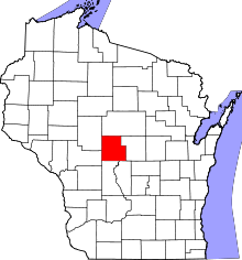 | |
| Villages | ||
| Towns | ||
| CDPs | ||
| Unincorporated communities | ||
| Indian reservation | ||
| Footnotes | ‡This populated place also has portions in an adjacent county or counties | |