Windham (CDP), New York
| Windham, New York | |
|---|---|
| CDP | |
 Windham, New York Location within the state of New York | |
| Coordinates: 42°18′42″N 74°14′50″W / 42.31167°N 74.24722°WCoordinates: 42°18′42″N 74°14′50″W / 42.31167°N 74.24722°W | |
| Country | United States |
| State | New York |
| County | Greene |
| Area | |
| • Total | 1.9 sq mi (4.9 km2) |
| • Land | 1.9 sq mi (4.9 km2) |
| • Water | 0.0 sq mi (0.0 km2) |
| Elevation | 1,516 ft (462 m) |
| Population (2010) | |
| • Total | 367 |
| Time zone | Eastern (EST) (UTC-5) |
| • Summer (DST) | EDT (UTC-4) |
| ZIP code | 12496 |
| Area code(s) | 518 |
| FIPS code | 36-82469[1] |
| GNIS feature ID | 0971463[2] |
Windham is a census-designated place (CDP) in Greene County, New York, United States. The population was 367 at the 2010 census.
The community of Windham is in the town of Windham, located on Route 23. It was formerly known by several other names" "Batavia," "Osbornville," and "Windham Center."
Geography
Windham is located at 42°18′41″N 74°14′49″W / 42.31139°N 74.24694°W (42.311591, -74.247116).[3]
According to the United States Census Bureau, the CDP has a total area of 1.9 square miles (4.9 km²).None of the area is covered with water.
The Batavia Creek flows past the village. The village is at the north boundary of the Catskill Park.
Demographics
As of the census[1] of 2000, there were 359 people, 172 households, and 97 families residing in the CDP. The population density was 191.4 per square mile (73.7/km²). There were 422 housing units at an average density of 225.0/sq mi (86.7/km²). The racial makeup of the CDP was 98.61% White and 1.39% Native American. Hispanic or Latino of any race were 1.11% of the population.
There were 172 households out of which 22.7% had children under the age of 18 living with them, 44.8% were married couples living together, 8.1% had a female householder with no husband present, and 43.6% were non-families. 41.3% of all households were made up of individuals and 19.2% had someone living alone who was 65 years of age or older. The average household size was 2.09 and the average family size was 2.81.
In the CDP the population was spread out with 19.5% under the age of 18, 4.7% from 18 to 24, 23.4% from 25 to 44, 24.0% from 45 to 64, and 28.4% who were 65 years of age or older. The median age was 47 years. For every 100 females there were 100.6 males. For every 100 females age 18 and over, there were 102.1 males.
The median income for a household in the CDP was $32,083, and the median income for a family was $44,250. Males had a median income of $35,625 versus $40,313 for females. The per capita income for the CDP was $23,320. About 6.1% of families and 10.5% of the population were below the poverty line, including 11.1% of those under age 18 and 13.6% of those age 65 or over.
References
- 1 2 "American FactFinder". United States Census Bureau. Retrieved 2008-01-31.
- ↑ "US Board on Geographic Names". United States Geological Survey. 2007-10-25. Retrieved 2008-01-31.
- ↑ "US Gazetteer files: 2010, 2000, and 1990". United States Census Bureau. 2011-02-12. Retrieved 2011-04-23.
External links
Municipalities and communities of Greene County, New York, United States | ||
|---|---|---|
| Towns | 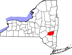 | |
| Villages | ||
| CDPs |
| |
| Other hamlets | ||