Wilmington (CDP), New York
| Wilmington, New York | |
|---|---|
| Census-designated place | |
 Wilmington | |
| Coordinates: 44°23′19″N 73°48′55″W / 44.38861°N 73.81528°WCoordinates: 44°23′19″N 73°48′55″W / 44.38861°N 73.81528°W | |
| Country | United States |
| State | New York |
| County | Essex |
| Town | Wilmington |
| Area | |
| • Total | 8.3 sq mi (21.6 km2) |
| • Land | 8.3 sq mi (21.4 km2) |
| • Water | 0.08 sq mi (0.2 km2) |
| Elevation | 1,020 ft (310 m) |
| Population (2010) | |
| • Total | 937 |
| • Density | 113/sq mi (43.8/km2) |
| Time zone | Eastern (EST) (UTC-5) |
| • Summer (DST) | EDT (UTC-4) |
| ZIP code | 12997 |
| FIPS code | 36-82304 |
Wilmington is a hamlet and census-designated place (CDP) in the town of Wilmington in Essex County, New York, United States. The population of the CDP was 937 at the 2010 census,[1] out of a total town population of 1,253.
Geography
The Wilmington CDP covers a large area in the central part of the town of Wilmington, including the hamlet of Wilmington but extending west to include the hamlet of North Pole, east as far as Hardy Road, and south as far as Fox Farm Road. The West Branch of the Ausable River flows from southwest to northeast through the center of the CDP.
New York State Route 86 runs through the center of the CDP, leading southwest 12 miles (19 km) to Lake Placid and east 5 miles (8 km) to Jay. New York State Route 431 leads west from NY 86 near the center of Wilmington 8 miles (13 km) nearly to the summit of Whiteface Mountain.
According to the United States Census Bureau, the Wilmington CDP has a total area of 8.3 square miles (21.6 km2), of which 8.3 square miles (21.4 km2) is land and 0.1 square miles (0.2 km2), or 1.05%, is water.[1]
References
- 1 2 "Geographic Identifiers: 2010 Demographic Profile Data (G001): Wilmington CDP, New York". U.S. Census Bureau, American Factfinder. Retrieved March 4, 2016.
Municipalities and communities of Essex County, New York, United States | ||
|---|---|---|
| Towns | 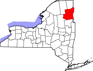 | |
| Villages | ||
| CDPs | ||
| Other hamlets | ||
| Footnotes | ‡This populated place also has portions in an adjacent county or counties | |