Williamston, North Carolina
| Williamston, North Carolina | |
|---|---|
| Town | |
|
Commercial area in Williamston | |
| Motto: "Easy Living with Hometown Values" | |
 Location of Williamston, North Carolina | |
| Coordinates: 35°51′5″N 77°3′45″W / 35.85139°N 77.06250°WCoordinates: 35°51′5″N 77°3′45″W / 35.85139°N 77.06250°W | |
| Country | United States |
| State | North Carolina |
| County | Martin |
| Area | |
| • Total | 3.7 sq mi (9.6 km2) |
| • Land | 3.7 sq mi (9.6 km2) |
| • Water | 0.0 sq mi (0.0 km2) |
| Elevation | 72 ft (22 m) |
| Population (2010) | |
| • Total | 5,511 |
| • Density | 1,581.3/sq mi (610.5/km2) |
| Time zone | Eastern (EST) (UTC-5) |
| • Summer (DST) | EDT (UTC-4) |
| ZIP code | 27892 |
| Area code(s) | 252 |
| FIPS code | 37-74220[1] |
| GNIS feature ID | 1023261[2] |
| Website | www.townofwilliamston.com |

Williamston is a town in Martin County, North Carolina, United States. The population was 5,511 at the 2010 census. It is the county seat of Martin County.[3] The closest major city is Greenville,[3] approx. 28 mi to the southwest.
Geography
Williamston is located at 35°51′5″N 77°3′45″W / 35.85139°N 77.06250°W (35.851454, -77.062588).[4]
According to the United States Census Bureau, the town has a total area of 3.7 square miles (9.6 km2), all of it land. However, it is on the Roanoke River.
Some major highways are U.S. 13, U.S. 17, and U.S. 64.
Demographics
| Historical population | |||
|---|---|---|---|
| Census | Pop. | %± | |
| 1860 | 616 | — | |
| 1870 | 520 | −15.6% | |
| 1880 | 482 | −7.3% | |
| 1890 | 751 | 55.8% | |
| 1900 | 912 | 21.4% | |
| 1910 | 1,574 | 72.6% | |
| 1920 | 1,800 | 14.4% | |
| 1930 | 2,781 | 54.5% | |
| 1940 | 3,966 | 42.6% | |
| 1950 | 4,975 | 25.4% | |
| 1960 | 6,924 | 39.2% | |
| 1970 | 6,570 | −5.1% | |
| 1980 | 6,159 | −6.3% | |
| 1990 | 5,503 | −10.7% | |
| 2000 | 5,843 | 6.2% | |
| 2010 | 5,511 | −5.7% | |
| Est. 2015 | 5,508 | [5] | −0.1% |
As of the census[1] of 2000, there were 5,844 people, 2,350 households, and 1,536 families residing in the town. The population density was 1,581.3 people per square mile (609.7/km²). There were 2,506 housing units at an average density of 678.2 per square mile (261.5/km²). The racial makeup of the town was 57.50% African American, 40.41% White, 0.29% Native American, 0.46% Asian, 0.09% Pacific Islander, 0.50% from other races, and 0.75% from two or more races. Hispanic or Latino of any race were 1.49% of the population.
There were 2,350 households out of which 31.3% had children under the age of 18 living with them, 35.4% were married couples living together, 26.5% had a female householder with no husband present, and 34.6% were non-families. 31.9% of all households were made up of individuals and 16.1% had someone living alone who was 65 years of age or older. The average household size was 2.38 and the average family size was 3.00.
In the town the population was spread out with 26.8% under the age of 18, 7.7% from 18 to 24, 23.2% from 25 to 44, 21.7% from 45 to 64, and 20.7% who were 65 years of age or older. The median age was 39 years. For every 100 females there were 72.7 males. For every 100 females age 18 and over, there were 65.7 males.
The median income for a household in the town was $22,925, and the median income for a family was $32,984. Males had a median income of $28,661 versus $20,337 for females. The per capita income for the town was $14,125. 29.0% of the population and 22.8% of families were below the poverty line. 40.5% of those under the age of 18 and 28.6% of those 65 and older are living below the poverty line.
Civil rights movement
Williamston was the focus of activity in the civil rights movement.[7] Beginning in June 1963, civil rights activists protested at City Hall for 29 consecutive days led by Golden Frinks.[7]
The Ku Klux Klan was very active in this part of the state during this time including a well-documented rally in Williamston on October 5, 1963 attended by mostly local residents but with several carloads of attendees traveling over 150 miles to attend.[8]
Education
Martin Community College
Notable residents of Williamston

References
- 1 2 "American FactFinder". United States Census Bureau. Retrieved 2008-01-31.
- ↑ "US Board on Geographic Names". United States Geological Survey. 2007-10-25. Retrieved 2008-01-31.
- 1 2 "Find a County". National Association of Counties. Retrieved 2011-06-07.
- ↑ "US Gazetteer files: 2010, 2000, and 1990". United States Census Bureau. 2011-02-12. Retrieved 2011-04-23.
- ↑ "Annual Estimates of the Resident Population for Incorporated Places: April 1, 2010 to July 1, 2015". Retrieved July 2, 2016.
- ↑ "Census of Population and Housing". Census.gov. Retrieved June 4, 2015.
- 1 2 Cunningham, David (2013). Klansville, U.S.A.: The Rise and Fall of the Civil Rights-Era Ku Klux Klan. Oxford University Press. p. 115. ISBN 978-0199752027.
- ↑ Cunningham, David (2013). Klansville, U.S.A.: The Rise and Fall of the Civil Rights-Era Ku Klux Klan. Oxford University Press. pp. 48–49. ISBN 978-0199752027.
External links
| Wikimedia Commons has media related to Williamston, North Carolina. |
Municipalities and communities of Martin County, North Carolina, United States | ||
|---|---|---|
| Towns | 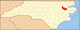 | |