Willaura
| Willaura Victoria | |
|---|---|
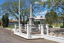 War memorial on the main street of town | |
 Willaura | |
| Coordinates | 37°32′S 142°44′E / 37.533°S 142.733°ECoordinates: 37°32′S 142°44′E / 37.533°S 142.733°E |
| Population | 585 (2011 census) |
| Postcode(s) | 3379 |
| Location | |
| LGA(s) | Rural City of Ararat |
| State electorate(s) | Lowan |
| Federal Division(s) | Wannon |
Willaura is a town in western Victoria, Australia in the Rural City of Ararat local government area, 231 kilometres (144 mi) west of the state capital, Melbourne. At the 2011 census, Willaura and surrounding area had a population of 585.
According to tradition, the town's name is derived from a question, specifically "Will Laura?"[1]
History
In September 1836 Major Thomas Mitchell travelled through the area on his return to Sydney from Portland. He crossed the Hopkins near the Edgarley Bridge, camped at Mount Stavely, journeyed through the salt lakes area, and then camped at Cockajemmy Lakes. He wrote in his journal that "...a land more favorable for Colonization could not be found..." and his trip effectively opened the district for European settlement. A cairn on the Wickliffe road commemorates his journey. The 1862 the Duffy Land Act made blocks available for free selection, and this was taken up enthusiastically around what was then known as Wickliffe Road. The railway had come through in 1877, and gold discoveries at Mafeking in June 1900 had bought many people to the area. In 1902 sixty tenant farmers were settled on 18,000 acres of Mount William Estate and in 1906 a further 37,000 acres was sold off to small farmers.
In 1902 part of Greenvale was sold as smaller town blocks, and the little settlement of Wickliffe Road, now called Willaura, had become a focal point for farming activities in the Shire. It was realized that crops, particularly wheat, did very well in the area and many farmers were keen to establish themselves. Willaura became an important receival centre for grain, and in 1910 was the second biggest in the western half of Victoria. There were a couple of disastrous fires in the town, one in 1912 and another in 1916, which wiped out many business houses. The town steadily progressed however, and in the 1940s gained momentum with the advent of Soldier Settlement. Parts of Edgarley, Narrapumelap and Burrumbeep were divided for Closer Settlement, and again farming activity boosted the district.[2]
Wickliffe Road Railway Station Post Office opened around January 1878 and was renamed Willaura in 1905.[3]
Today
The town shares an Australian rules football team with nearby Moyston, the Moyston-Willaura Pumas, competing in the Mininera & District Football League.[4] Golfers play at the course of the Willaura Golf Club.[5]
References
- ↑ Beatty, Bill (Aug 2, 1947). "There's drama & tragedy in place names". The Sydney Morning Herald. p. 8. Retrieved 18 October 2015.
- ↑ http://community-recreation.ararat.vic.gov.au/townships/index/town/10
- ↑ Premier Postal History, Post Office List, retrieved 11 April 2008
- ↑ "Moyston-Willaura Football & Netball Club". Retrieved 28 August 2007.
- ↑ Golf Select, Willaura, retrieved 11 May 2009
External links
![]() Media related to Willaura at Wikimedia Commons
Media related to Willaura at Wikimedia Commons