Wila Chullpa
| Wila Chullpa | |
|---|---|
 Wila Chullpa Location within Bolivia | |
| Highest point | |
| Elevation | 4,380 m (14,370 ft) [1] |
| Coordinates | 17°51′03″S 68°00′55″W / 17.85083°S 68.01528°WCoordinates: 17°51′03″S 68°00′55″W / 17.85083°S 68.01528°W |
| Geography | |
| Location | Bolivia, Oruro Department |
| Parent range | Andes |
Wila Chullpa (Aymara wila blood, blood-red,, chullpa an ancient funerary building,[2][3] "red chullpa") is a mountain in the Andes of Bolivia which reaches a height of approximately 4,380 m (14,370 ft). It is located in the Oruro Department, on the border of the Nor Carangas Province (which is identical to the Huayllamarca Municipality) and the San Pedro de Totora Province, northeast of the village of Huacanapi.[1][4]
References
- 1 2 Bolivian IGM map 1:50,000 Huacanapi 5940-II
- ↑ Radio San Gabriel, "Instituto Radiofonico de Promoción Aymara" (IRPA) 1993, Republicado por Instituto de las Lenguas y Literaturas Andinas-Amazónicas (ILLLA-A) 2011, Transcripción del Vocabulario de la Lengua Aymara, P. Ludovico Bertonio 1612 (Spanish-Aymara-Aymara-Spanish dictionary)
- ↑ "Diccionario Quechua - Aymara al español". katari.org. Retrieved April 11, 2016.
- ↑ "Huayllamarca". Retrieved April 11, 2016.
Capital: Oruro | ||
| Provinces | 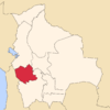 | |
| Municipalities (and seats) |
| |
This article is issued from Wikipedia - version of the 4/11/2016. The text is available under the Creative Commons Attribution/Share Alike but additional terms may apply for the media files.