Wila Ch'ankha
| Wila Ch'ankha | |
|---|---|
 Asanaki mountain range as seen from Machaqa Marka with Qurimina, Pepitu (4.478 m) and Wila Ch'ankha on the left and Iswaya Island (3.879 m) (lying in the Desaguadero River) in the middle of the picture. | |
| Highest point | |
| Elevation | 4,701 m (15,423 ft) [1] |
| Coordinates | 18°24′S 66°56′W / 18.400°S 66.933°WCoordinates: 18°24′S 66°56′W / 18.400°S 66.933°W |
| Geography | |
 Wila Ch'ankha Location in Bolivia | |
| Location | Bolivia, Oruro Department |
| Parent range | Andes |
Wila Ch'ankha (Aymara wila red, ch'ankha wool cord,[2] "red cord", Hispanicized spelling Wila Chanca) is a 4,701-metre-high (15,423 ft) mountain located in the Andes in Bolivia. It is situated in the Oruro Department, Poopó Province, Poopó Municipality, Poopó Canton, near the Desaguadero River and northeast of Poopó Lake.[3] The town of Poopó lies at the foot of the mountain, north of it.
References
- ↑ ii.uib.no "Cerro Wila Chanca" (GPS on the summit)
- ↑ www.katari.org Aymara-Spanish dictionary: Wila (s.) - Sangre. adj. Color rojo Ch'ankha (s.) - Cordon de lana.
- ↑ lib.utexas.edu Detailed map of the area
Capital: Oruro | ||
| Provinces | 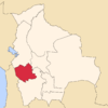 | |
| Municipalities (and seats) |
| |
This article is issued from Wikipedia - version of the 4/30/2016. The text is available under the Creative Commons Attribution/Share Alike but additional terms may apply for the media files.