Whitestown, New York
| Whitestown, New York | |
|---|---|
| Town | |
 Location in Oneida County and the state of New York. | |
| Coordinates: 43°7′23″N 75°18′33″W / 43.12306°N 75.30917°WCoordinates: 43°7′23″N 75°18′33″W / 43.12306°N 75.30917°W | |
| Country | United States |
| State | New York |
| County | Oneida |
| Government | |
| • Type | Town Council |
| • Town Supervisor | Shaun J Kaleta () |
| • Town Council |
Members' List
|
| Area | |
| • Total | 27.2 sq mi (70.4 km2) |
| • Land | 27.2 sq mi (70.4 km2) |
| • Water | 0.0 sq mi (0.0 km2) |
| Elevation | 453 ft (138 m) |
| Population (2010) | |
| • Total | 18,667 |
| • Density | 690/sq mi (270/km2) |
| Time zone | Eastern (EST) (UTC-5) |
| • Summer (DST) | EDT (UTC-4) |
| ZIP code | 13492 |
| Area code(s) | 315 |
| FIPS code | 36-81754[1] |
| GNIS feature ID | 0979638[2] |
Whitestown is a town in Oneida County, New York, USA. The population was 18,667 at the 2010 census. The name is derived from Judge Hugh White, an early settler.
The Town of Whitestown is immediately west of Utica, New York. The New York State Thruway (Interstate 90) passes across the town.
History
The town, part of the Sadaquada Patent, was settled in 1784. The Town of Whitestown was formed in 1788, before the creation of Oneida County, with a size of 12 million acres (49,000 km²). Whitestown was founded by Hugh White after he scouted the land in 1784 by way of traveling the Mohawk River. On June 5, 1784, White and his family came upon the mouth of the Sauquoit Creek and settled in the forests that would become Whitestown. White was also the forerunner for the creation of Oneida County, NY in the 1790s.[3][4]
It is known as the "Mother of Towns" because of the many towns and counties formed from its expanse. The Town of Paris and the Town of Steuben were formed from Whitestown in 1792. The Town of Cazenovia was formed in 1793. The Town of Augusta was formed in 1798. Utica was formed in 1817. The Town of New Hartford was formed from Whitestown in 1827.
Geography
According to the United States Census Bureau, the town has a total area of 27.2 square miles (70 km2), of which, 27.2 square miles (70 km2) of it is land and 0.04% is water.
The town is west of the City of Utica and the north border is defined by the Mohawk River.
Oriskany Creek flows northward through the town to the Mohawk River.
Demographics
| Historical population | |||
|---|---|---|---|
| Census | Pop. | %± | |
| 1800 | 4,212 | — | |
| 1810 | 4,912 | 16.6% | |
| 1820 | 5,219 | 6.3% | |
| 1830 | 4,419 | −15.3% | |
| 1840 | 5,156 | 16.7% | |
| 1850 | 5,820 | 12.9% | |
| 1860 | 4,367 | −25.0% | |
| 1870 | 4,339 | −0.6% | |
| 1880 | 4,498 | 3.7% | |
| 1890 | 5,155 | 14.6% | |
| 1900 | 6,235 | 21.0% | |
| 1910 | 7,798 | 25.1% | |
| 1920 | 10,183 | 30.6% | |
| 1930 | 11,818 | 16.1% | |
| 1940 | 11,580 | −2.0% | |
| 1950 | 12,686 | 9.6% | |
| 1960 | 19,185 | 51.2% | |
| 1970 | 21,382 | 11.5% | |
| 1980 | 20,150 | −5.8% | |
| 1990 | 18,985 | −5.8% | |
| 2000 | 18,635 | −1.8% | |
| 2010 | 18,667 | 0.2% | |
| Est. 2014 | 18,610 | [5] | −0.3% |
As of the census[1] of 2000, there were 18,635 people, 7,544 households, and 5,024 families residing in the town. The population density was 685.2 people per square mile (264.5/km²). There were 7,945 housing units at an average density of 292.1 per square mile (112.8/km²). The racial makeup of the town was 97.27% White, 1.18% African American, 0.09% Native American, 0.48% Asian, 0.01% Pacific Islander, 0.28% from other races, and 0.69% from two or more races. Hispanic or Latino of any race were 1.32% of the population.
There were 7,544 households out of which 28.8% had children under the age of 18 living with them, 52.1% were married couples living together, 11.2% had a female householder with no husband present, and 33.4% were non-families. 29.3% of all households were made up of individuals and 14.8% had someone living alone who was 65 years of age or older. The average household size was 2.39 and the average family size was 2.96.
In the town the population was spread out with 22.8% under the age of 18, 7.3% from 18 to 24, 27.4% from 25 to 44, 23.9% from 45 to 64, and 18.5% who were 65 years of age or older. The median age was 40 years. For every 100 females there were 93.2 males. For every 100 females age 18 and over, there were 90.0 males.
The median income for a household in the town was $40,084, and the median income for a family was $49,798. Males had a median income of $36,553 versus $24,942 for females. The per capita income for the town was $19,507. About 7.0% of families and 9.1% of the population were below the poverty line, including 14.7% of those under age 18 and 9.6% of those age 65 or over.
Places of Interest
- Mohawk Airlines, until its dissolution, had its headquarters on the grounds of Oneida County Airport in Whitestown.[7][8]
- Summit Park, A theme park located in Oriskany, New York. It had rides, circuses, and animals; but once people had greater means to travel to other theme parks, like Sylvan Beach; the park closed in 1926.[9]
Communities and locations in Whitestown
Villages of Whitestown
Below are the villages and hamlets of Whitestown.[10]
- Oriskany – The Village of Oriskany is near the north town line.
- New York Mills – The Village of New York Mills is southeast of Yorkville, adjacent to Utica.
- Whitesboro – The Village Whitesboro is in the eastern part of the town, south of the Thruway.
- Yorkville – The Village of Yorkville, located on Route 5A, lies between Utica and Whitesboro.
- Walesville – A hamlet in the southwest part of the town.
- Coleman Mills – A hamlet south of Oriskany and north of the Thruway.
- Dunham Manor – A location south of Whitesboro.
- Glenhaven – A location by the south town line.
- Herthum Heights – A location northwest of Whitesboro.
- Sunset Manor – A location northwest of Whitesboro.
References
- 1 2 "American FactFinder". United States Census Bureau. Retrieved 2008-01-31.
- ↑ "US Board on Geographic Names". United States Geological Survey. 2007-10-25. Retrieved 2008-01-31.
- ↑ "Oneida County Historical Society".
- ↑ ELLIS, DAVID MALDWYN (1 January 1984). "Whitestown: From Yankee Outpost to Cradle of Reform". New York History. 65 (1): 32–59. doi:10.2307/23174769 (inactive 2016-08-23). JSTOR 23174769 – via JSTOR.
- ↑ "Annual Estimates of the Resident Population for Incorporated Places: April 1, 2010 to July 1, 2014". Retrieved June 4, 2015.
- ↑ "Census of Population and Housing". Census.gov. Retrieved June 4, 2015.
- ↑ "World Airline Directory." Flight International. 6 May 1971. 637.
- ↑ "Zoning Map." Town of Whitestown. Retrieved on January 21, 2010.
- ↑ "Oneida County Historical Society".
- ↑ "History of Whitestown, NY".
External links
Municipalities and communities of Oneida County, New York, United States | ||
|---|---|---|
| Cities | 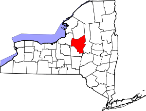 | |
| Towns | ||
| Villages | ||
| CDPs | ||
| Hamlets | ||