Whitehall Dyke
| Whitehall Dyke | |
|---|---|
| Basin | |
| Main source | Harbledown |
| River mouth | Great Stour, Thanington Without near Canterbury |
| Physical characteristics | |
| Length | 5.6 km (3.5 mi) |
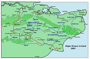
The Great Stour and other Rivers of Kent
Whitehall Dyke is a tributary of the Great Stour river in Kent, England.
The stream runs from its source near Harbledown, 5.6 kilometres, to the Great Stour at Thanington Without near Canterbury.[1]
The overall condition of the water body was rated as moderate in 2009, but declined poor overall in 2014.[2]
References
- ↑ The Environment Agency
- ↑ "Environment Agency - Catchment Data Explorer". environment.data.gov.uk. Retrieved 2016-02-24.
Coordinates: 51°16′39″N 1°04′10″E / 51.2774°N 1.0695°E
This article is issued from Wikipedia - version of the 6/19/2016. The text is available under the Creative Commons Attribution/Share Alike but additional terms may apply for the media files.