Whitecairns
| Whitecairns | |
 The Old Shop, Whitecairns |
|
 Whitecairns |
|
| OS grid reference | NJ922182 |
|---|---|
| Council area | Aberdeenshire |
| Lieutenancy area | Aberdeenshire |
| Country | Scotland |
| Sovereign state | United Kingdom |
| Post town | ABERDEEN |
| Postcode district | AB23 |
| Dialling code | 01358 |
| Police | Scottish |
| Fire | Scottish |
| Ambulance | Scottish |
| EU Parliament | Scotland |
| UK Parliament | Gordon |
| Scottish Parliament | Aberdeenshire East |
Coordinates: 57°15′18″N 2°07′48″W / 57.255°N 2.130°W
Whitecairns is a village in the Formartine area of Aberdeenshire, Scotland,[1] lying 3.6 kilometres (2.2 mi) north of Potterton and 9.7 kilometres (6.0 mi) south of Pitmedden on the B999 road.
Transport
Regular bus services link Whitecairns with Potterton and Aberdeen to the south, and with Pitmedden and Tarves to the north.[2]
Decoy airfield
During the Second World War, Harestone Moss, close to Whitecairns was set up as a decoy site for RAF Dyce airfield. This was to trick the Luftwaffe into thinking that this was Dyce airfield at night.

The decoy was bombed on several occasions, two craters are still present today.
- 3 Aug 1940
- 3 Nov 1940
- 5 Dec 1940
- 18 July 1941
This decoy site had a bunker that housed a generator used to power the dummy airfield lights.[3]
References
- ↑ Whitecairns local information website
- ↑ Public Transport, Aberdeenshire Council
- ↑ RCAHMS. "Easter Craigie, Decoy Control Bunker, Generator Plant (110723)". Canmore. Retrieved 3 June 2012.
"Civil Defence Incidents". Aberdeen City Council. Retrieved 13 June 2012.
| Wikimedia Commons has media related to Whitecairns, Aberdeenshire. |
Settlements and places of interest in Formartine, Aberdeenshire | ||
|---|---|---|
| Primary settlements | 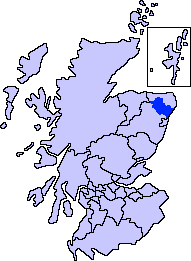 | |
| Other settlements | ||
| Places of interest | ||
Areas and primary settlements in Aberdeenshire (see also: Aberdeen City) | ||
|---|---|---|
| in Banff and Buchan |  | |
| in Buchan | ||
| in Formartine | ||
| in Garioch | ||
| in Kincardine and Mearns | ||
| in Marr | ||