White Pigeon, Michigan
| White Pigeon, Michigan | |
|---|---|
| Village | |
|
Aerial Photo of White Piegon facing South East | |
 Location of White Pigeon, Michigan | |
| Coordinates: 41°47′51″N 85°38′35″W / 41.79750°N 85.64306°W | |
| Country | United States |
| State | Michigan |
| County | St. Joseph |
| Area[1] | |
| • Total | 1.41 sq mi (3.65 km2) |
| • Land | 1.39 sq mi (3.60 km2) |
| • Water | 0.02 sq mi (0.05 km2) |
| Elevation | 817 ft (249 m) |
| Population (2010)[2] | |
| • Total | 1,522 |
| • Estimate (2012[3]) | 1,511 |
| • Density | 1,095.0/sq mi (422.8/km2) |
| Time zone | Eastern (EST) (UTC-5) |
| • Summer (DST) | EDT (UTC-4) |
| FIPS code | 26-86920[4] |
| GNIS feature ID | 1625017[5] |

White Pigeon is a village in St. Joseph County in the U.S. state of Michigan. The population was 1,522 at the 2010 census. The village is located within White Pigeon Township.
Geography
According to the United States Census Bureau, the village has a total area of 1.41 square miles (3.65 km2), of which 1.39 square miles (3.60 km2) is land and 0.02 square miles (0.05 km2) is water.[1] The White Pigeon River flows through the south end of town, emptying into the St. Joseph River.
Major highways
History
White Pigeon was incorporated in 1837.[6][7] Downtown White Pigeon boasts an historic building listed on the National Register of Historic Places, the United States Land Office, which is the oldest surviving U.S. Land office in the state of Michigan.[8] Out of this office the U.S. government sold land in Michigan for $1.25 an acre in the 1830s to settlers of Western Michigan.
The town was named after the Potawatomi Indian Chief Wahbememe, which means Chief White Pigeon. According to legend, while he was at the gathering of the chiefs in Detroit, Wahbememe heard plans to attack the settlement which is now White Pigeon. The Chief was a friend to the white settlers and didn't want to see harm come to them so he set out on foot and ran almost 150 miles to the settlement to warn the people. After running that long distance and giving his warning, he collapsed and soon died from exhaustion. His remains are buried in the town, and the site is now part of the National Register of Historic Places.[9][10]
Demographics
| Historical population | |||
|---|---|---|---|
| Census | Pop. | %± | |
| 1860 | 959 | — | |
| 1870 | 922 | −3.9% | |
| 1880 | 1,021 | 10.7% | |
| 1890 | 961 | −5.9% | |
| 1900 | 705 | −26.6% | |
| 1910 | 667 | −5.4% | |
| 1920 | 887 | 33.0% | |
| 1930 | 966 | 8.9% | |
| 1940 | 1,017 | 5.3% | |
| 1950 | 1,113 | 9.4% | |
| 1960 | 1,399 | 25.7% | |
| 1970 | 1,455 | 4.0% | |
| 1980 | 1,478 | 1.6% | |
| 1990 | 1,458 | −1.4% | |
| 2000 | 1,627 | 11.6% | |
| 2010 | 1,522 | −6.5% | |
| Est. 2015 | 1,514 | [11] | −0.5% |
2010 census
As of the census[2] of 2010, there were 1,522 people, 621 households, and 383 families residing in the village. The population density was 1,095.0 inhabitants per square mile (422.8/km2). There were 724 housing units at an average density of 520.9 per square mile (201.1/km2). The racial makeup of the village was 93.3% White, 0.3% African American, 0.9% Native American, 0.5% Asian, 2.6% from other races, and 2.4% from two or more races. Hispanic or Latino of any race were 5.2% of the population.
There were 621 households of which 34.5% had children under the age of 18 living with them, 40.4% were married couples living together, 14.0% had a female householder with no husband present, 7.2% had a male householder with no wife present, and 38.3% were non-families. 29.3% of all households were made up of individuals and 12.2% had someone living alone who was 65 years of age or older. The average household size was 2.45 and the average family size was 3.02.
The median age in the village was 37.1 years. 27.1% of residents were under the age of 18; 7.3% were between the ages of 18 and 24; 24.9% were from 25 to 44; 25.5% were from 45 to 64; and 15.2% were 65 years of age or older. The gender makeup of the village was 47.0% male and 53.0% female.
2000 census
As of the census[4] of 2000, there were 1,627 people, 602 households, and 431 families residing in the village. The population density was 1,157.8 per square mile (445.5/km²). There were 640 housing units at an average density of 455.4 per square mile (175.3/km²). The racial makeup of the village was 94.59% White, 0.18% African American, 1.11% Native American, 0.55% Asian, 0.06% Pacific Islander, 2.03% from other races, and 1.48% from two or more races. Hispanic or Latino of any race were 2.58% of the population.
There were 602 households out of which 35.4% had children under the age of 18 living with them, 51.2% were married couples living together, 15.4% had a female householder with no husband present, and 28.4% were non-families. 21.8% of all households were made up of individuals and 6.8% had someone living alone who was 65 years of age or older. The average household size was 2.70 and the average family size was 3.13.
In the village the population was spread out with 29.1% under the age of 18, 9.6% from 18 to 24, 29.6% from 25 to 44, 21.5% from 45 to 64, and 10.2% who were 65 years of age or older. The median age was 33 years. For every 100 females there were 85.3 males. For every 100 females age 18 and over, there were 85.2 males.
The median income for a household in the village was $41,292, and the median income for a family was $43,182. Males had a median income of $32,470 versus $21,327 for females. The per capita income for the village was $16,895. About 10.5% of families and 13.1% of the population were below the poverty line, including 20.1% of those under age 18 and 1.8% of those age 65 or over.
Transportation
White Pigeon is served by the Michigan Southern Railroad (which has its main yard complex in town) and the Grand Elk Railroad to the west of town.
Notable people
- John S. Barry, fourth Governor of Michigan, lived in White Pigeon.
- Orris Pratt, member of the Wisconsin State Assembly, was born in White Pigeon.
- Samuel Pratt, member of the Wisconsin State Assembly and the Wisconsin State Senate, lived in White Pigeon.
References
- 1 2 "US Gazetteer files 2010". United States Census Bureau. Retrieved 2012-11-25.
- 1 2 "American FactFinder". United States Census Bureau. Retrieved 2012-11-25.
- ↑ "Population Estimates". United States Census Bureau. Retrieved 2013-06-03.
- 1 2 "American FactFinder". United States Census Bureau. Retrieved 2008-01-31.
- ↑ "US Board on Geographic Names". United States Geological Survey. 2007-10-25. Retrieved 2008-01-31.
- ↑ InfoMi - White Pigeon
- ↑ St. Joseph County history Archived May 9, 2008, at the Wayback Machine.
- ↑ Michigan Markers
- ↑
- ↑
- ↑ "Annual Estimates of the Resident Population for Incorporated Places: April 1, 2010 to July 1, 2015". Retrieved July 2, 2016.
- ↑ "Census of Population and Housing". Census.gov. Retrieved June 4, 2015.
Municipalities and communities of St. Joseph County, Michigan, United States | ||
|---|---|---|
| Cities | 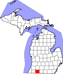 | |
| Villages | ||
| Townships | ||
| Unincorporated communities | ||
Coordinates: 41°47′53″N 85°38′36″W / 41.79806°N 85.64333°W