White Patch, Queensland
| White Patch Queensland | |||||||||||||
|---|---|---|---|---|---|---|---|---|---|---|---|---|---|
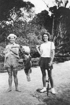 Large Rock Cod caught at White Patch, 1936 | |||||||||||||
 White Patch | |||||||||||||
| Coordinates | 27°01′51″S 153°07′32″E / 27.03083°S 153.12556°ECoordinates: 27°01′51″S 153°07′32″E / 27.03083°S 153.12556°E | ||||||||||||
| Population | 112 (2011)[1] | ||||||||||||
| Postcode(s) | 4507 | ||||||||||||
| LGA(s) | Moreton Bay Region | ||||||||||||
| State electorate(s) | Pumicestone | ||||||||||||
| Federal Division(s) | Longman | ||||||||||||
| |||||||||||||
White Patch is a coastal locality of the Moreton Bay Region in Queensland, Australia.[2]
Geography
White Patch is on the western side of Bribie Island, adjacent to the Pumicestone Passage which forms its western boundary. Wright Creek passes through the southern part of the locality into Pumicestone Passage. The western (coastal) side of the locality is residential. The eastern side (centre of Bribie Island) is undeveloped; some of it is part of the Bribie Island National Park.
History
Land sales at White Patch occurred as early as 1887.[3]
In November 1948, fishermen at White Patch claimed to have seen a sea serpent. It was described as being brown or yellow "like a banana", 18 to 24 feet (5.5 to 7.3 m) long with large eyes and was accompanied by smaller serpents (possibly its young). It was said to hiss and squeak.[4] In December 1948, Eric Decker, the Member of the Queensland Legislative Assembly for Sandgate, caught such a "serpent" while on holidays at Bribie Island. Mr Mack, curator at the Queensland Museum, said the description was consistent with a common sea snake in Moreton Bay.[5]
Demographics
In the 2011 census, White Patch recorded a population of 112 people, 50% female and 50% male.[1]
The median age of the White Patch population was 53 years, 16 years above the national median of 37.[1]
68.4% of people living in White Patch were born in Australia. The other top responses for country of birth were England 14%, New Zealand 4.4%, Germany 3.5%, Netherlands 3.5%, Sweden 2.6%.[1]
92.2% of people spoke only English at home; the next most common languages were 2.6% French, 2.6% Swedish.[1]
Attractions
A talking monument tells the story of the landing of Matthew Flinders on Bribie Island in July 1799.[6]
References
- 1 2 3 4 5 Australian Bureau of Statistics (31 October 2012). "White Patch (State Suburb)". 2011 Census QuickStats. Retrieved 29 May 2014.
- ↑ "White Patch (entry 45498)". Queensland Place Names. Queensland Government. Retrieved 29 May 2014.
- ↑ "FIFTY YEARS AGO.". The Courier-Mail. Brisbane: National Library of Australia. 5 May 1937. p. 16. Retrieved 30 May 2014.
- ↑ "Sea 'horror' at Toorbul.". The Courier-Mail. Brisbane: National Library of Australia. 27 November 1948. p. 1. Retrieved 30 May 2014.
- ↑ "SERPENT' CATCH: NOW BELIEVED SEA SNAKE.". The Courier-Mail. Brisbane: National Library of Australia. 14 December 1948. p. 1. Retrieved 30 May 2014.
- ↑ "Visiting Bribie Island". Bribie Island Chamber of Commerce Inc. Retrieved 30 May 2014.