Wheaton, Missouri
| Wheaton, Missouri | |
|---|---|
| City | |
 Location of Wheaton, Missouri | |
| Coordinates: 36°45′44″N 94°3′18″W / 36.76222°N 94.05500°WCoordinates: 36°45′44″N 94°3′18″W / 36.76222°N 94.05500°W | |
| Country | United States |
| State | Missouri |
| County | Barry |
| Township | Wheaton |
| Area[1] | |
| • Total | 0.51 sq mi (1.32 km2) |
| • Land | 0.51 sq mi (1.32 km2) |
| • Water | 0 sq mi (0 km2) |
| Elevation | 1,381 ft (421 m) |
| Population (2010)[2] | |
| • Total | 696 |
| • Estimate (2012[3]) | 695 |
| • Density | 1,364.7/sq mi (526.9/km2) |
| Time zone | Central (CST) (UTC-6) |
| • Summer (DST) | CDT (UTC-5) |
| ZIP code | 64874 |
| Area code(s) | 417 |
| FIPS code | 29-79126[4] |
| GNIS feature ID | 0728684[5] |
Wheaton is a city in Wheaton Township, Barry County, Missouri, United States. The population was 696 at the 2010 census.
History
The Wheaton Missouri and North Arkansas Railroad Depot was added to the National Register of Historic Places in 2000.[6]
Geography
Wheaton is located at 36°45′44″N 94°3′18″W / 36.76222°N 94.05500°W (36.762339, -94.055121).[7]
According to the United States Census Bureau, the city has a total area of 0.51 square miles (1.32 km2), all land.[1]
The community is located on Route 86, south of U.S. Route 60.
Demographics
| Historical population | |||
|---|---|---|---|
| Census | Pop. | %± | |
| 1920 | 374 | — | |
| 1930 | 359 | −4.0% | |
| 1940 | 393 | 9.5% | |
| 1950 | 394 | 0.3% | |
| 1960 | 341 | −13.5% | |
| 1970 | 360 | 5.6% | |
| 1980 | 548 | 52.2% | |
| 1990 | 637 | 16.2% | |
| 2000 | 721 | 13.2% | |
| 2010 | 696 | −3.5% | |
| Est. 2015 | 699 | [8] | 0.4% |
2010 census
As of the census[2] of 2010, there were 696 people, 274 households, and 175 families residing in the city. The population density was 1,364.7 inhabitants per square mile (526.9/km2). There were 333 housing units at an average density of 652.9 per square mile (252.1/km2). The racial makeup of the city was 89.8% White, 0.1% African American, 0.7% Native American, 1.4% Asian, 5.2% from other races, and 2.7% from two or more races. Hispanic or Latino of any race were 7.5% of the population.
There were 274 households of which 35.8% had children under the age of 18 living with them, 45.6% were married couples living together, 15.3% had a female householder with no husband present, 2.9% had a male householder with no wife present, and 36.1% were non-families. 32.8% of all households were made up of individuals and 15.7% had someone living alone who was 65 years of age or older. The average household size was 2.54 and the average family size was 3.17.
The median age in the city was 35.8 years. 29.5% of residents were under the age of 18; 8.1% were between the ages of 18 and 24; 23.9% were from 25 to 44; 24.7% were from 45 to 64; and 13.6% were 65 years of age or older. The gender makeup of the city was 46.1% male and 53.9% female.
2000 census
As of the census[4] of 2000, there were 721 people, 285 households, and 196 families residing in the city. The population density was 1,420.3 people per square mile (545.8/km²). There were 318 housing units at an average density of 626.4 per square mile (240.7/km²). The racial makeup of the city was 92.37% White, 0.14% African American, 0.83% Native American, 4.58% from other races, and 2.08% from two or more races. Hispanic or Latino of any race were 8.74% of the population.
There were 285 households out of which 36.8% had children under the age of 18 living with them, 54.4% were married couples living together, 10.5% had a female householder with no husband present, and 30.9% were non-families. 27.4% of all households were made up of individuals and 18.2% had someone living alone who was 65 years of age or older. The average household size was 2.53 and the average family size was 3.05.
In the city the population was spread out with 28.8% under the age of 18, 12.1% from 18 to 24, 25.7% from 25 to 44, 16.9% from 45 to 64, and 16.5% who were 65 years of age or older. The median age was 32 years. For every 100 females there were 87.8 males. For every 100 females age 18 and over, there were 85.2 males.
The median income for a household in the city was $21,354, and the median income for a family was $26,058. Males had a median income of $22,750 versus $16,827 for females. The per capita income for the city was $11,124. About 18.2% of families and 20.8% of the population were below the poverty line, including 25.4% of those under age 18 and 20.5% of those age 65 or over.
External links
- Historic maps of Wheaton in the Sanborn Maps of Missouri Collection at the University of Missouri
References
- 1 2 "US Gazetteer files 2010". United States Census Bureau. Retrieved 2012-07-08.
- 1 2 "American FactFinder". United States Census Bureau. Retrieved 2012-07-08.
- ↑ "Population Estimates". United States Census Bureau. Retrieved 2013-05-30.
- 1 2 "American FactFinder". United States Census Bureau. Retrieved 2008-01-31.
- ↑ "US Board on Geographic Names". United States Geological Survey. 2007-10-25. Retrieved 2008-01-31.
- ↑ National Park Service (2010-07-09). "National Register Information System". National Register of Historic Places. National Park Service.
- ↑ "US Gazetteer files: 2010, 2000, and 1990". United States Census Bureau. 2011-02-12. Retrieved 2011-04-23.
- ↑ "Annual Estimates of the Resident Population for Incorporated Places: April 1, 2010 to July 1, 2015". Retrieved July 2, 2016.
- ↑ "Census of Population and Housing". Census.gov. Retrieved June 4, 2015.
Municipalities and communities of Barry County, Missouri, United States | ||
|---|---|---|
| Cities | 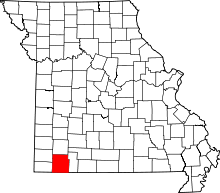 | |
| Villages | ||
| Townships | ||
| CDPs | ||
| Unincorporated communities | ||
| Ghost towns | ||
| Footnotes | ‡This populated place also has portions in an adjacent county or counties | |